
Ag Weather News
Forecaster-written weather analysis for agriculture — severe weather outlooks and seasonal insights.

June to July Transition
Let's talk near term first. The tropics are telegraphing several key features - MJO pushing hard into the Pacific (Phase 7-8-1), a large typhoon

Storm Cluster, A Couple Supercells on the Tex-Mex Border | Tue, May 26th, 2026
A few intense severe storms are possible across the Rio Grande river valley and the Texas-Mexico border late this afternoon and evening. A cluster of

Summer Forecast from the Climate Prediction Center
The new CPC forecast for June-August was released today and my initial assessment is that they followed the NMME (National Multi-Model Ensemble)

Recapping Last Weeks Storms
The past week was very active for severe weather across the Plains and Midwest, with a multi-day outbreak of severe storms spanning May 14-19. Take a

Northeast Pacific Temps Matter
You will hear A LOT of talk (especially from us) about the upcoming El Niño and its potential to be the strongest we've seen in decades

Another Severe Weather Outbreak Today | Mon, May 18th, 2026
A large cluster of thunderstorms continues this morning from western Illinois into Missouri and far eastern Kansas, fueled by strong warm and moist

Significant Severe Storms + Dangerous Fire Weather | Sun, May 17th, 2026
Another active day of dangerous weather is expected across the Plains and Upper Midwest today, with a regional outbreak of severe thunderstorms in

Broad Zone of Severe Storm Potential | Sat, May 16th, 2026
There is a broad zone of severe thunderstorm potential this Saturday afternoon and evening from the High Plains into the Midwest and Ohio Valley.

Clustered Severe Storms in Iowa (and surrounding states) Friday PM
Today kicks off a multi-day period of organized severe storms from the Plains into the Midwest. Widespread, significant severe weather may not occur
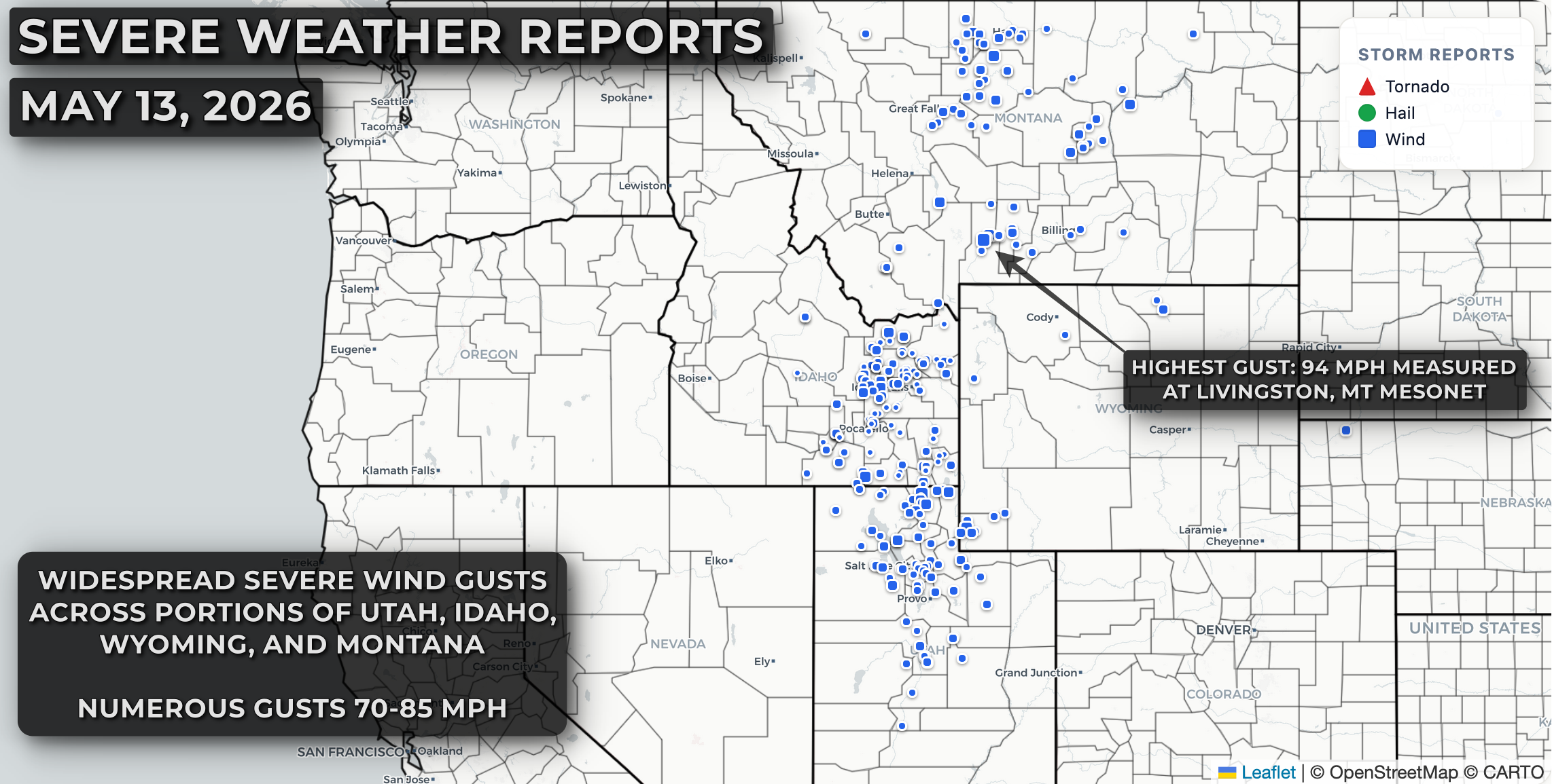
Widespread Severe Wind Event in the Northwest
A potent upper-level storm system lifting into the Pacific Northwest on Wednesday tapped into strong-heating and steep lapse rates to kick off
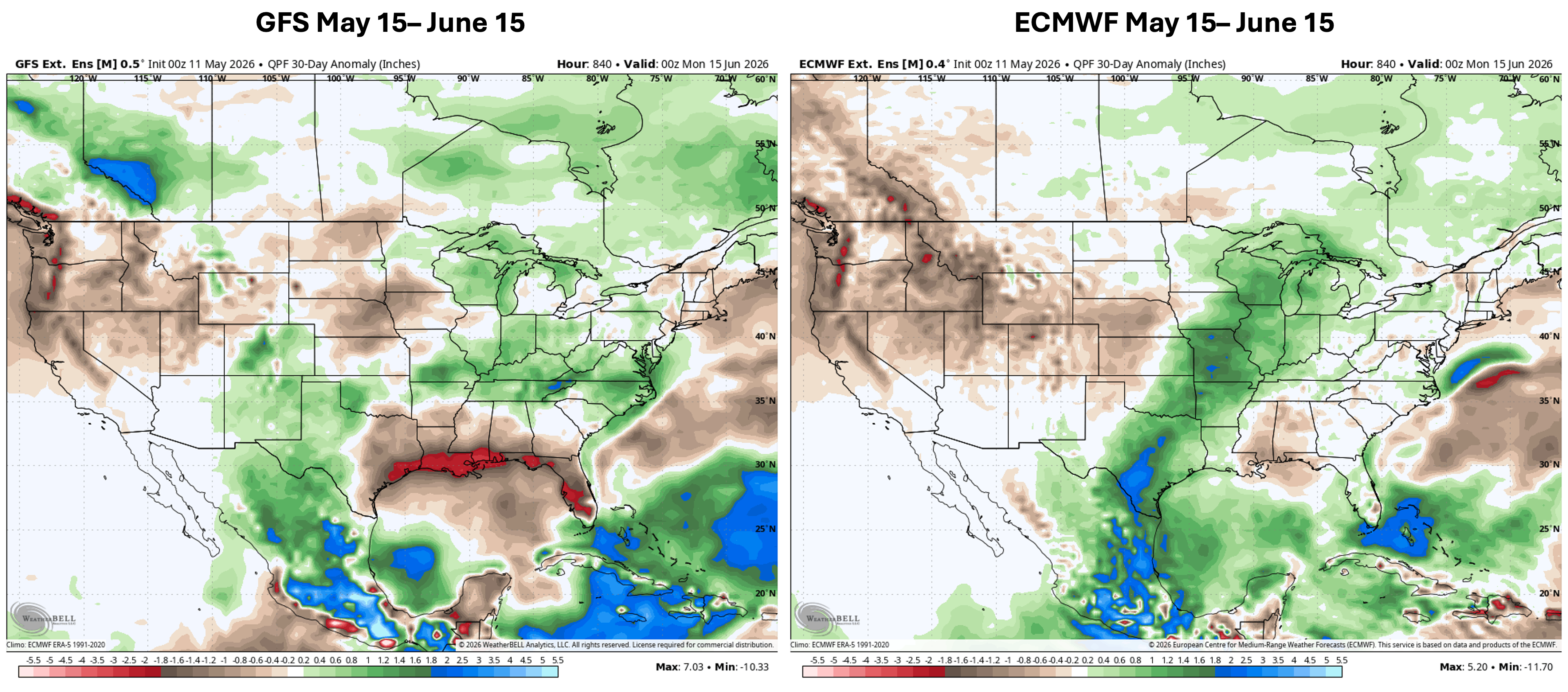
May 15 - June 15 ECMWF v. GFS
The latest updates from the ECMWF and GFS Extended Forecasts for May 15 to June 15 show very little agreement. There has been an issue over the last

Big Windy Tuesday From Plains to Midwest
An intense area of low pressure moving through the Great Lakes on Tuesday will drag a cold front southeastward from the northern Plains and Upper
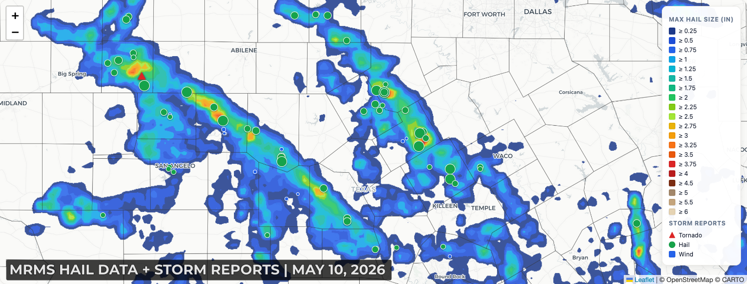
Texas Hail on Mother's Day
Mother's Day brought significant severe thunderstorms to portions of central Texas, with several intense supercells producing hailstones 2"
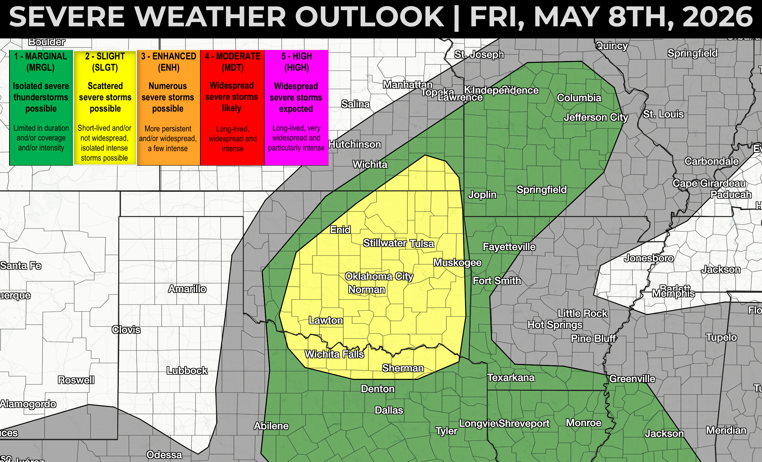
A Few Supercells Possible in OK-KS-TX This Evening
Moisture will be the primary limiting factor with today's severe storm risk across southeast Kansas, Oklahoma, and north Texas, but steep lapse

2 Summer models are in...
Long-range forecast models continue to increase the probability of an historic El Niño event over the next 6-8 months. The difficulty with this is

Isolated Hail + Wind Threat from Oklahoma to Missouri on Friday
A couple of strong storms are possible on Friday afternoon and evening from southwest Oklahoma into mid Missouri, including a couple of supercells
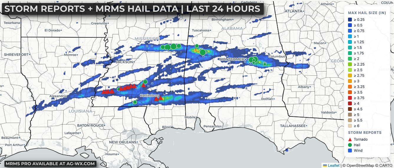
Recapping Wednesday's Severe Weather in the Southeast
Several long-lived supercells produced at least a couple of significant tornadoes and lots of hail as they tracked across Louisiana, Mississippi, and

Classic Southeast Severe Storm and Tornado Risk Later Today
Widespread cloud cover is in place this morning across much of the region, and that will play a big role in how the day evolves. Within a corridor

East-Based El Niño (another look)
There is a very useful tool you can find at https://www.data.jma.go.jp/tcc/tcc/products/clisys/enso_statistics/index.html that puts together

Highly Conditional Risk for Significant Severe Storms in AR, TX
There is a highly uncertain, but potentially dangerous risk for severe thunderstorms across portions of Arkansas and Texas late this afternoon into