
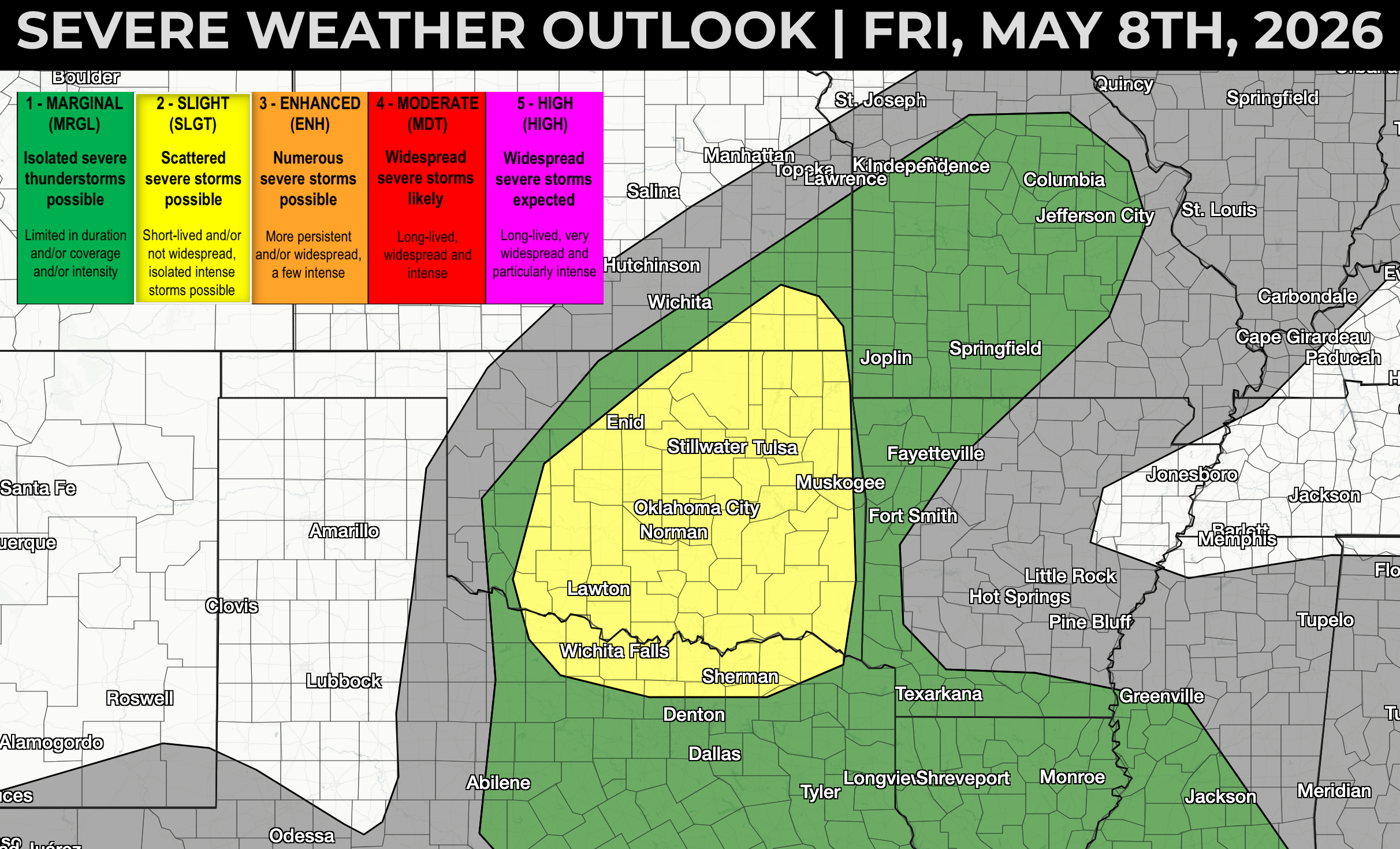
Moisture will be the primary limiting factor with today's severe storm risk across southeast Kansas, Oklahoma, and north Texas, but steep lapse rates and sufficient moisture ahead of a shortwave trough and cold front should be enough to ignite at least a couple of supercell thunderstorms producing severe hail and damaging wind gusts.
The best overlap of an environment supportive of severe storms and a strong trigger for thunderstorm development is forecast across north-central Oklahoma toward the Kansas / Oklahoma border during the mid-afternoon hours, shifting southeast with time. This suggests the best time for a more intense supercell thunderstorm or two will probably be found around the I-35 corridor from the Wichita KS vicinity south toward Oklahoma City OK between 4-8 PM CT.

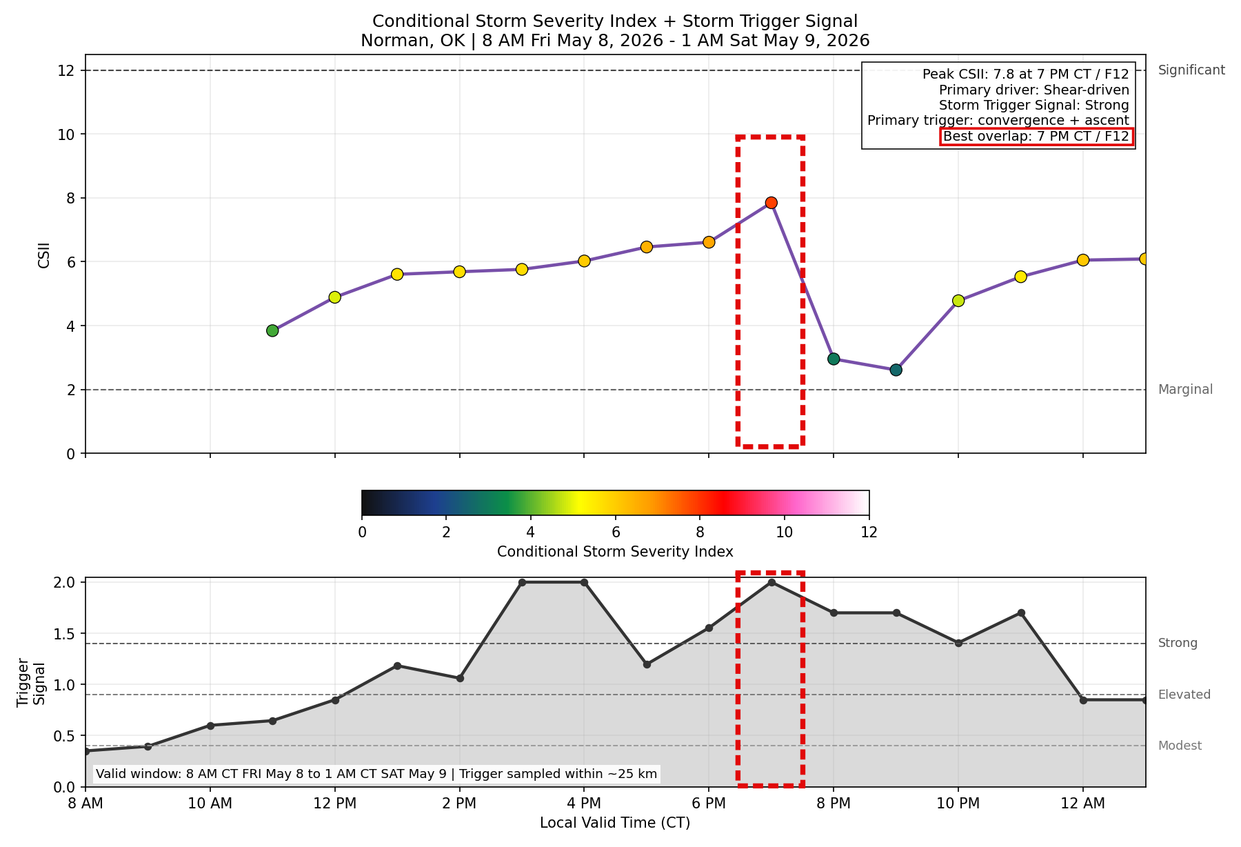
This chart shows the Conditional Storm Severity Index and Storm Trigger Index over time for the Oklahoma City, OK area, showing the best overlap of an environment supportive of severe weather and a trigger to support storm development at 7 PM on Friday evening - keep an eye on the OKC metro from around 6-8 PM based on morning forecast guidance.
You can see the forecast location of the shortwave trough axis (black dashed line) during the late afternoon, with thunderstorms developing ahead of the cold front beneath of broad region of faster 500 mb jet stream flow, noted by the darker blue shading and wind barbs.

Damaging winds and hail should be the primary risks this afternoon with any severe storms developing across this region, but an isolated tornado can't be entirely ruled out. Storms may evolve into one or two clusters that track southeast across the Ozarks into eastern Oklahoma and northeast Texas early tonight with a fading risk for severe impacts over time.