
Hurricane Isaias is a strong hurricane as of Friday morning, expected to peak at Category 2-3 strength before making landfall Friday evening very near Pensacola, Florida.
A life-threatening storm surge is expected from the mouth of the Mississippi River to Suwannee, FL. Damaging hurricane force winds are expected over portions of the Florida Panhandle, southern Alabama, and southern Mississippi. Tropical storm force winds may cause scattered damage over much of central and northern Alabama, extreme eastern Mississippi, and portions of northern and western Georgia.
Additionally, heavy rainfall and a few tornadoes are also likely across the Florida Panhandle, southern Alabama, and southern Georgia Friday afternoon – Friday night, with these risks expanding across much of the Southeast U.S. and Carolinas on Saturday.
Here's a look at some of the latest data as of Friday morning...
The latest forecast cone of uncertainty from the National Hurricane Center shows a landfall very near Pensacola, FL on Friday evening, with the remnants of Isaias continuing northward into Tennessee and Kentucky by Sunday. Note, this is a forecast for the CENTER of Isaias' circulation, not the extent of impacts.
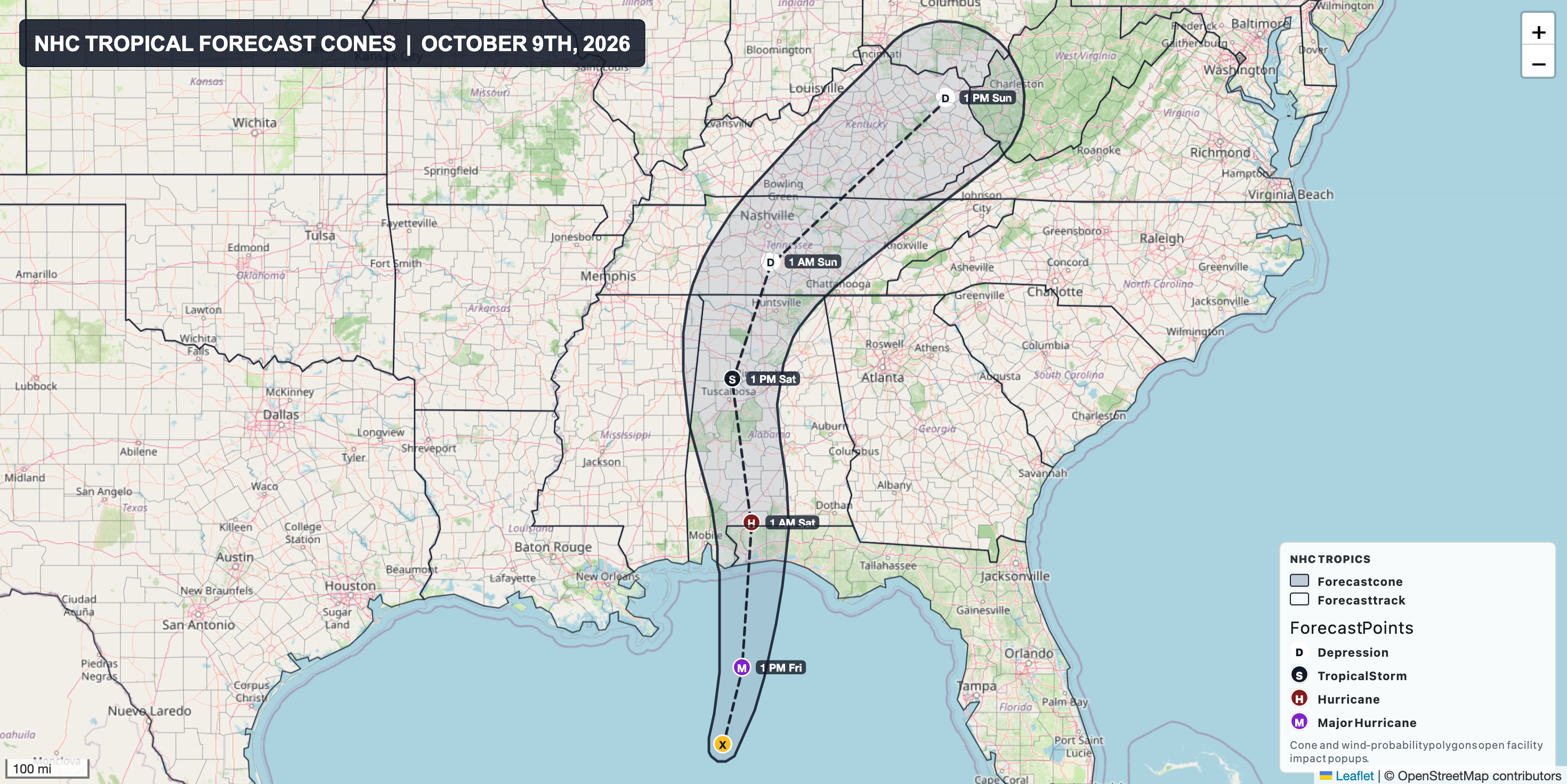
At 7 PM ET on Friday the center of Isaias will approach the coast of Florida, very near Pensacola. Heavy rain and high winds will already moving inland, along with an elevated risk for tornadoes in the outer bands across the Florida Panhandle into far southern Georgia and Alabama.

Elevated to enhanced risk for tornadoes across the Florida Panhandle and far southern Alabama and Georgia through Saturday morning:

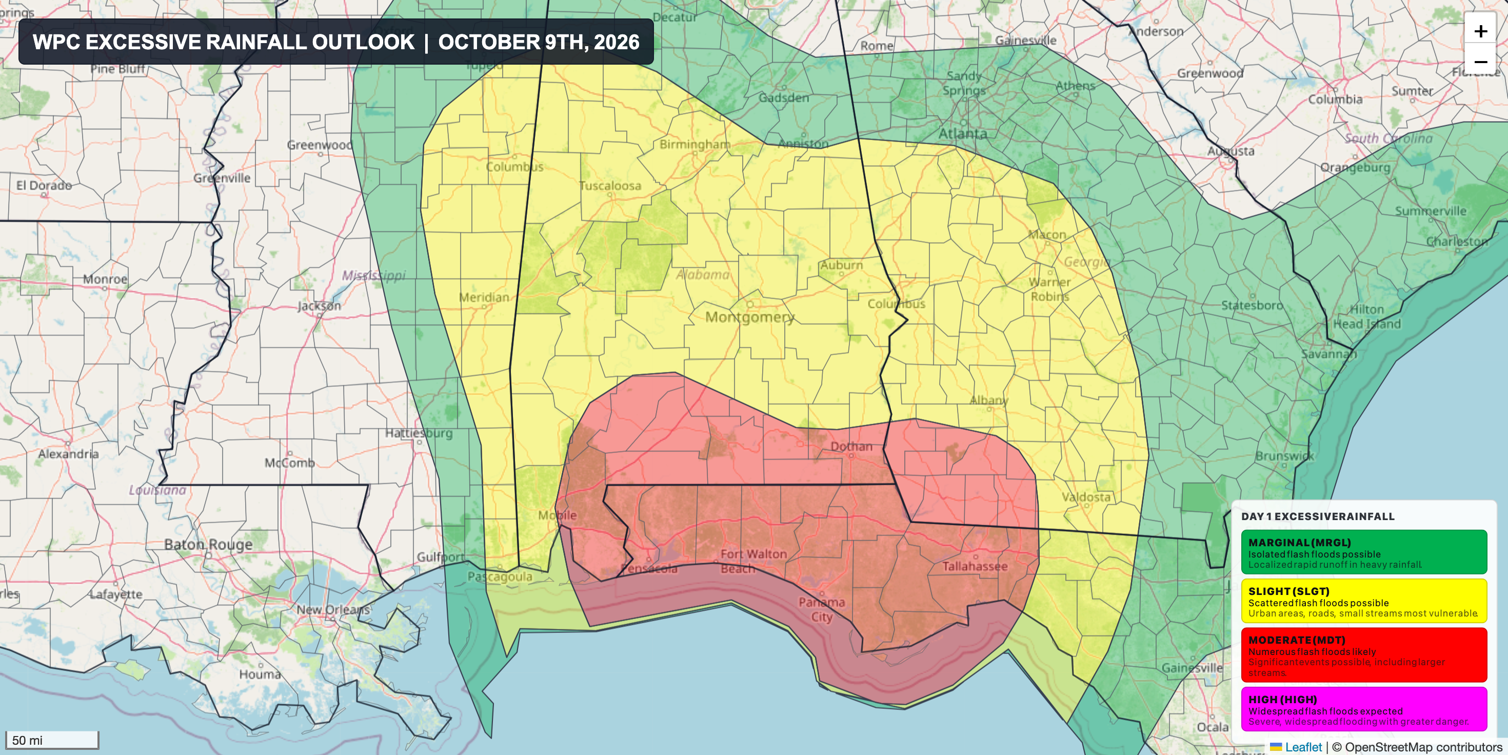
Level 3 of 4 moderate risk for excessive rainfall and flash flooding through Saturday morning:
Maximum forecast wind gusts from the RRFS:

Forecast rainfall totals from WPC/NOAA:

Explore more tropical data here: https://agweather.com/v3/tropical/