

Another active day of dangerous weather is expected across the Plains and Upper Midwest today, with a regional outbreak of severe thunderstorms in the Missouri Valley and extremely critical fire weather conditions likely in the Southern High Plains.
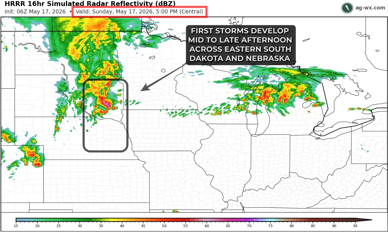
Much of the morning and early afternoon will be quiet across the risk area. Scattered to widespread storms are expected to develop ahead of a cold front and surface low from eastern South Dakota into eastern Nebraska by around 3-4 PM on Sunday. Storms may initially take on supercell form with an early risk for a couple of tornadoes, before the more likely scenario of rapid upscale growth into a bowing storm cluster early this evening.
A fast-moving QLCS, or bowing storm cluster is likely to evolve from Sioux Falls, SD to Omaha, NE with embedded supercells potentially producing tornadoes embedded within the line, along with numerous damaging straight-line wind gusts over 70 mph, with a few gusts 80-90 mph possible in southeast South Dakota, northeast Nebraska, western Iowa, and southern Minnesota from late Sunday evening into the early overnight.
Further south and west, a couple of widely isolated supercells may develop along Interstate 70 in northern Kansas, and down the Interstate 35 corridor from Topeka to Wichita. These storms are less certain in their development and existence, but may pose a risk of a couple tornadoes, hail over 2.5” in diameter, and 70 mph wind gusts.


Critical to locally extremely critical fire weather conditions are expected this afternoon from New Mexico into the Texas Panhandle and portions of southwestern Kansas. A sharpening dryline and strengthening west-southwesterly winds will combine with an extremely dry air mass to create dangerous wildfire conditions across the region.

Widespread sustained winds of 25 to 30 mph are expected, with relative humidity values falling as low as 5 to 15 percent during peak heating this afternoon. The driest and most dangerous conditions are expected across much of New Mexico and near the Texas Panhandle/western Oklahoma border region.
Vegetation across the region remains highly susceptible to rapid fire spread, and any wildfire that develops could become difficult to control quickly. Even though winds may remain just below the most extreme warning criteria in some areas, critically dry fuels and the potential for existing smoldering fire starts to re-intensify will support a volatile fire environment.
Ag operations across the region should avoid activities capable of producing sparks or open flames this afternoon and evening. Outdoor burning is strongly discouraged, and equipment use in dry grasslands should be monitored closely due to the elevated wildfire risk.