
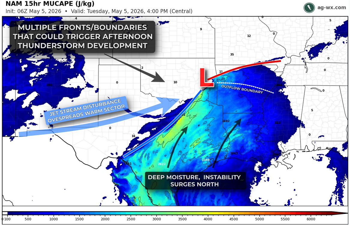
There is a highly uncertain, but potentially dangerous risk for severe thunderstorms across portions of Arkansas and Texas late this afternoon into the overnight (Tue, May 5th). Early this morning, a cluster of showers and thunderstorms moved across central and northeast Arkansas, leaving behind an outflow boundary, a dividing line between cooler, rain-cooled air and the warmer, more unstable air to the south. As we head through the late morning and into the afternoon, that boundary, along with a nearby cold front and dryline extending into Texas, will serve as the primary focus for new storm development.

As temperatures climb into the low 80s and moisture increases, the atmosphere will become moderately unstable. The challenge today is not whether the environment can support severe thunderstorms, but whether storms will actually develop. Large-scale forcing is somewhat limited, and lingering cloud cover and a cap could keep storm development limited and/or delayed into the overnight. That means many areas may stay dry, but any storm that does form will have the potential to intensify quickly and produce significant severe weather.
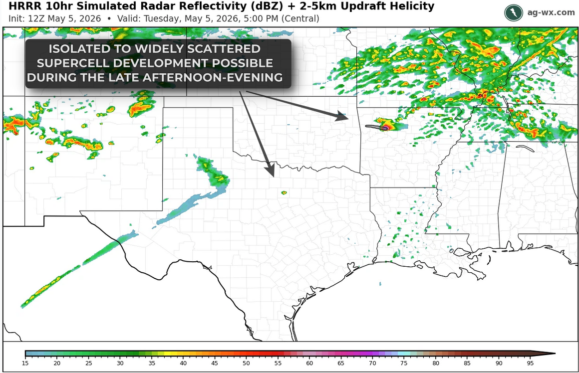
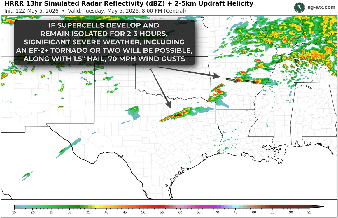
The most likely window for storm development will be from mid-afternoon into the evening. During this time, isolated to scattered thunderstorms may develop along the boundaries across Arkansas and into north Texas. Given the strong wind shear in place, any sustained storm is likely to become a supercell capable of producing large to very large hail, with hail over 1.5 inches in diameter possible early in the storm’s life cycle. Significant severe weather, including a couple of strong tornadoes are most likely across central and eastern Arkansas where low-level winds are more favorable, especially if a couple of storms can remain isolated and discrete for several hours.
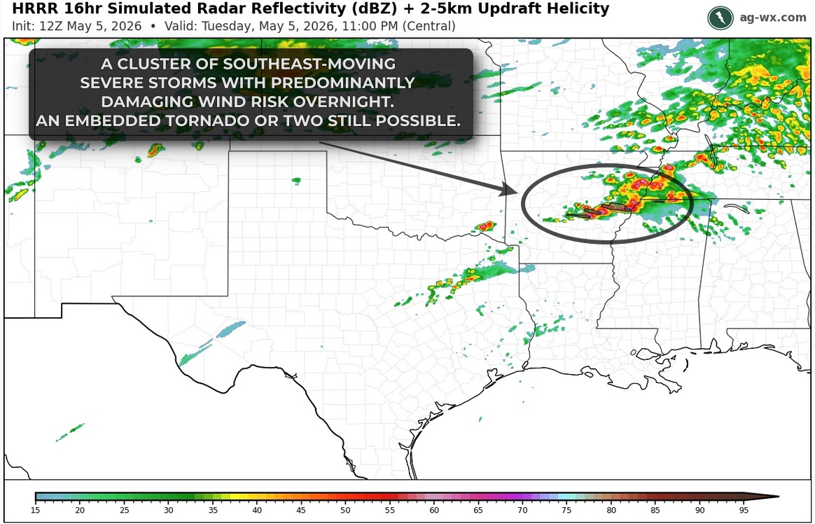
As we move later into the evening, storms may begin to merge into clusters, at which point the primary threat would transition toward damaging straight-line winds, though an embedded tornado would remain possible.
This is a conditional setup, but one that carries the potential for significant impacts in any location that sees a storm develop. Consider it less of a rearrange-the-day event, and more of a keep-it-in-mind-through-the-day scenario.