Mother's Day brought significant severe thunderstorms to portions of central Texas, with several intense supercells producing hailstones 2" to 4" in diameter before evolving into a southward propagating MCS (storm cluster) that produced damaging winds into the overnight hours.
Below is a wide view of MRMS radar estimated hail data with storm reports overlaid on top, followed by several zoomed in sectors in some of the more significant corridors of big hail.
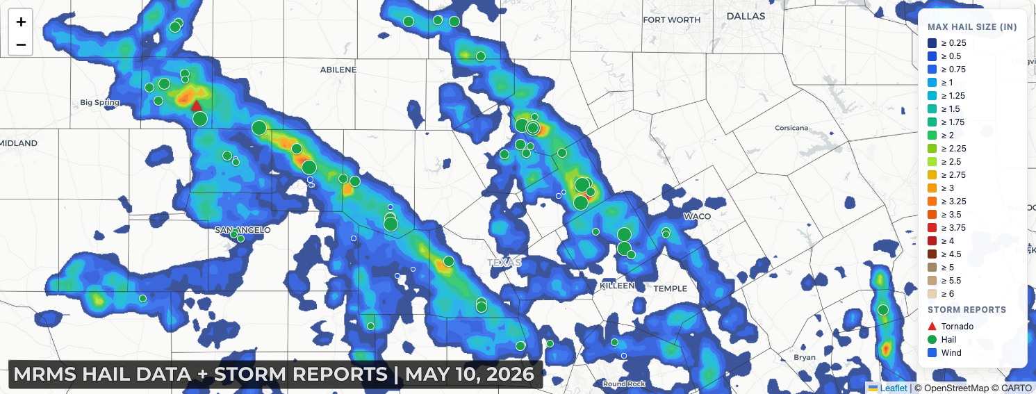
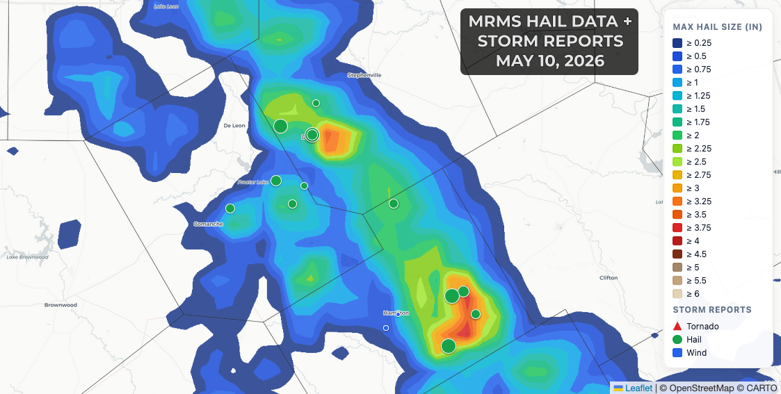
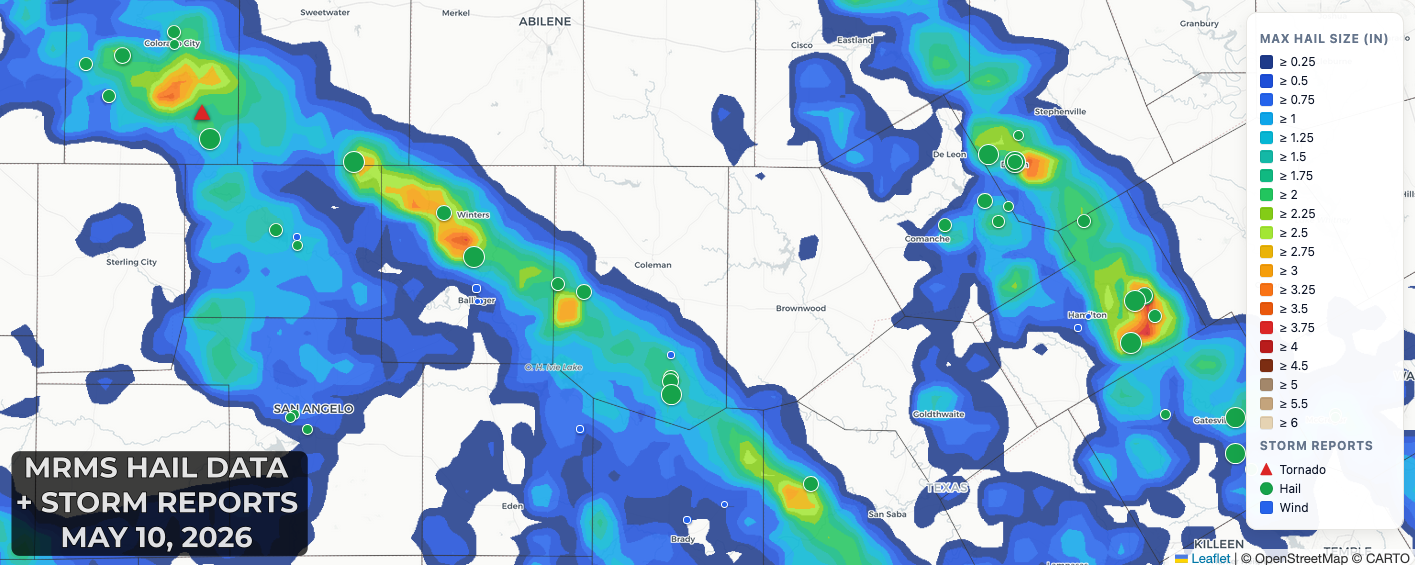
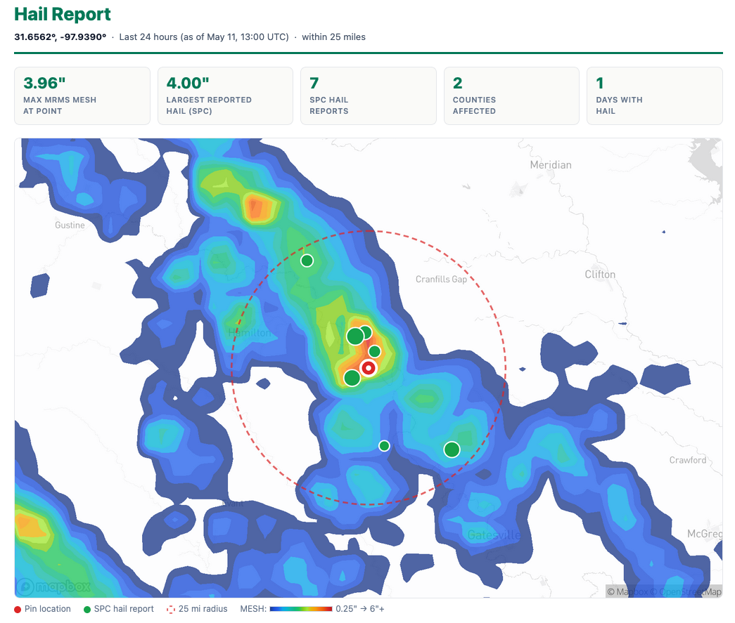
You can use our MRMS Pro tool to generate a hail report by clicking anywhere on the map.

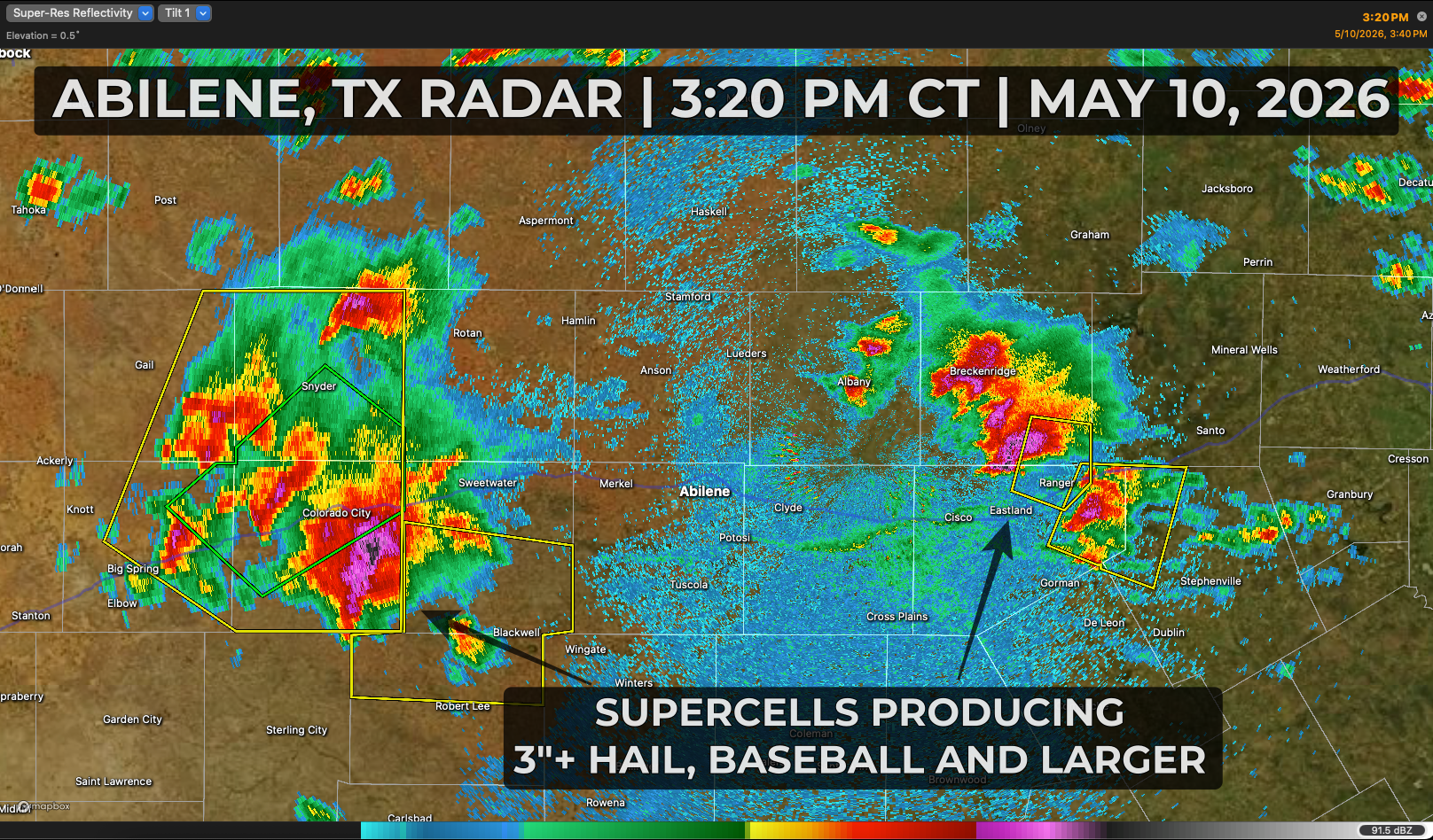
Here is a snapshot from the Abilene, Texas radar at 3:20 PM CT on May 10th, 2026 showing two clusters of supercells producing significant hail baseball sized and bigger.
Early supercells that were initially more isolated continued to grow upscale with their intense outflow consolidating into a southward propagating storm cluster that pushes south toward the Mexico border on Monday morning. Here's a "sandwich" (visible and infrared) satellite animation from Sunday afternoon into the overnight hours. Check out the gravity waves, seen as rippled emanating away from the center of the most intense updrafts - these were VERY intense thunderstorms!