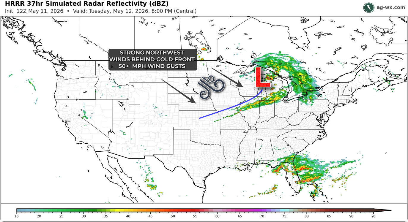
An intense area of low pressure moving through the Great Lakes on Tuesday will drag a cold front southeastward from the northern Plains and Upper Midwest into the Ohio Valley. Ahead of the front, strong southwesterly winds will draw warm and increasingly moist air northward into the Central Plains and Ohio Valley, from Kansas to Indiana.

While the current background jet stream pattern featuring frequent frontal passages and repeated intrusions of cool, dry air will limit moisture return and overall instability, strong forcing along the front should still allow showers and thunderstorms to develop.
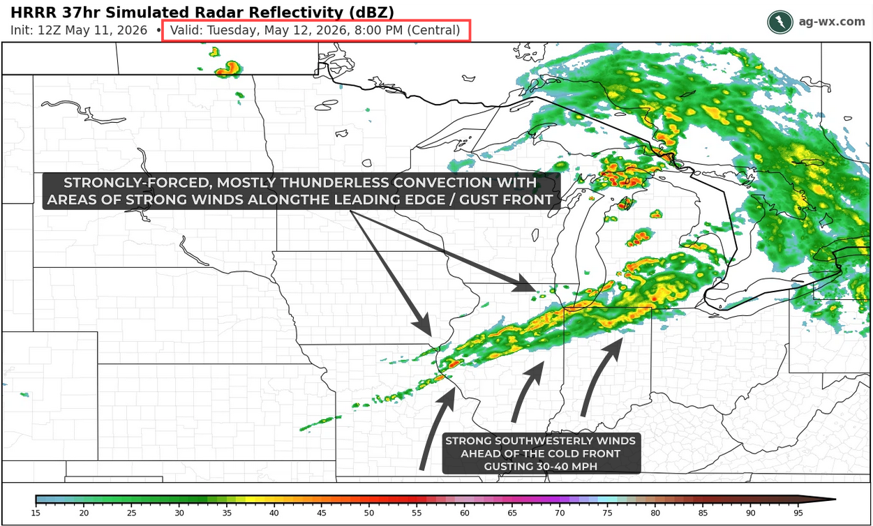
By late afternoon, a strongly forced line of showers and thunderstorms is expected to extend from northern Illinois and southern Wisconsin into northwest Indiana southwestward into Missouri and eastern Kansas. Steep lapse rates, modest instability, and strong forcing may allow a few storms to become severe, capable of producing hail up to 1 inch in diameter and wind gusts near 60 mph.
The more likely scenario, however, is a widespread corridor of mainly sub-severe wind gusts along the leading edge of the outflow-reinforced cold front. Radar imagery will likely show a broad area of showers and thunderstorms with a narrow line along the leading edge marking the sharp wind shift, where northwesterly wind gusts of 40–55 mph may occur.
Behind the cold front, strong gradient winds are expected to develop across the Northern Plains and Upper Midwest, with northwesterly gusts exceeding 50 mph at times.