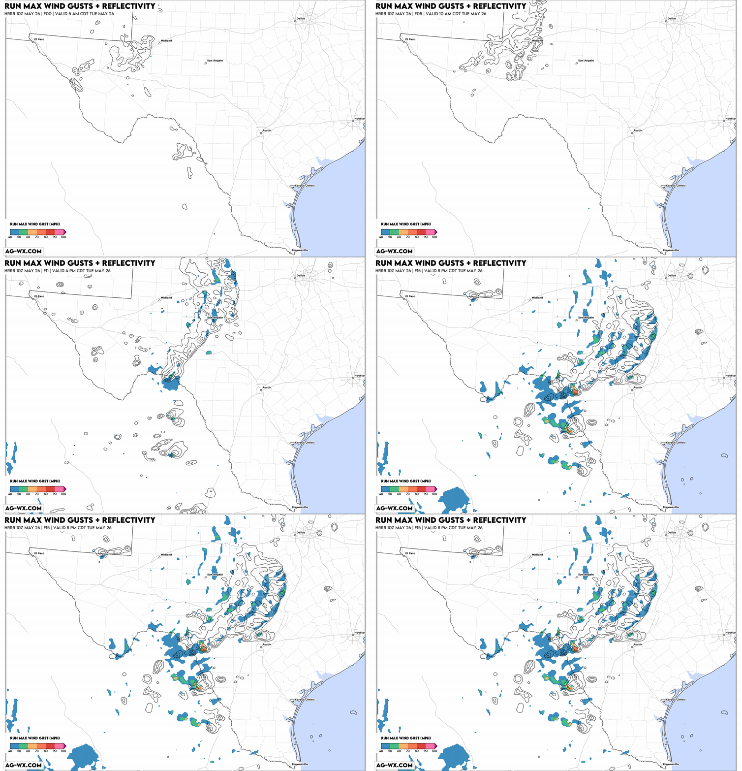
A few intense severe storms are possible across the Rio Grande river valley and the Texas-Mexico border late this afternoon and evening.
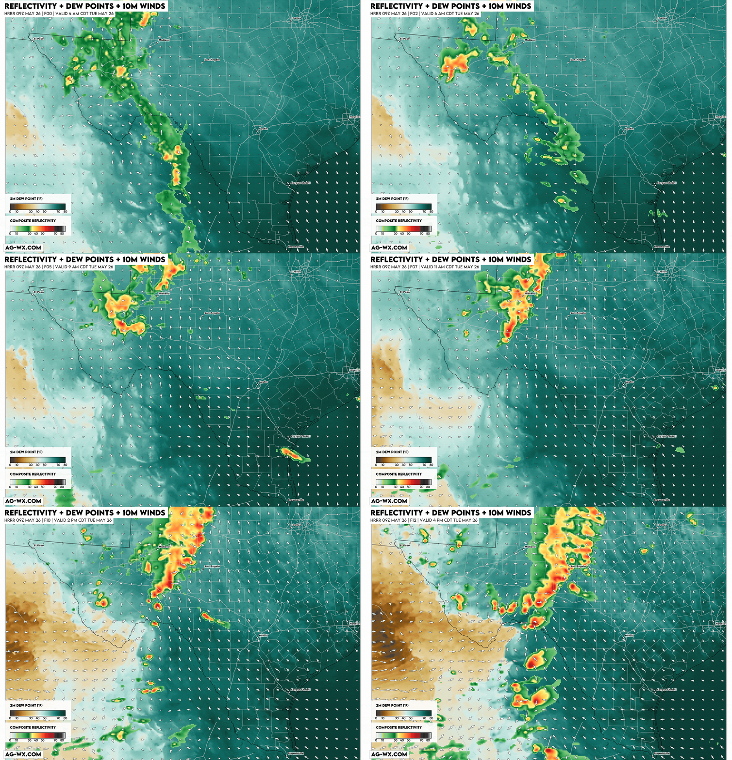
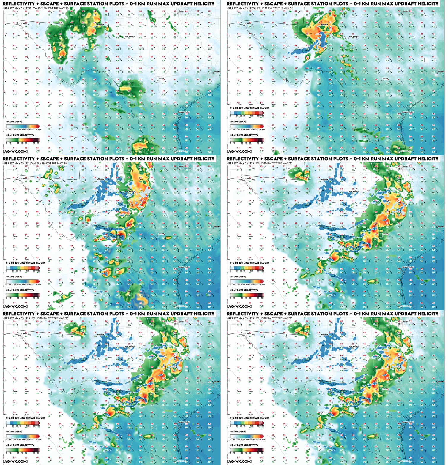
A cluster of severe-warned thunderstorms is already ongoing as of 9 AM CT on Tuesday morning from Big Spring to Fort Stockton in southwest Texas. These storms may continue to produce strong to severe wind gusts 50-65 mph and sporadic hail up to 1". The bigger story evolves to the south-southeast later this afternoon and evening.
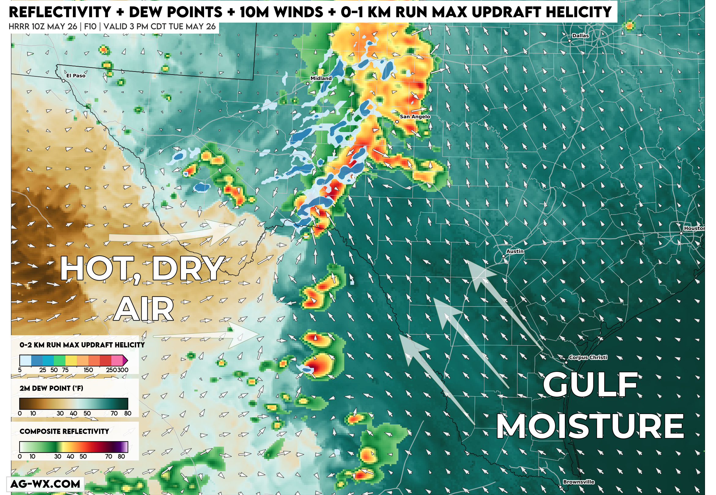
A subtle sub-tropical jet disturbance will overspread the Rio Grande valley this afternoon, with a weak surface low drawing deep moisture up from the Gulf. At the same time, a stout elevated mixed layer will be advected in from the west with a sharpening dryline from the Del Rio, Teas vicinity southward into Coahuila, Mexico.

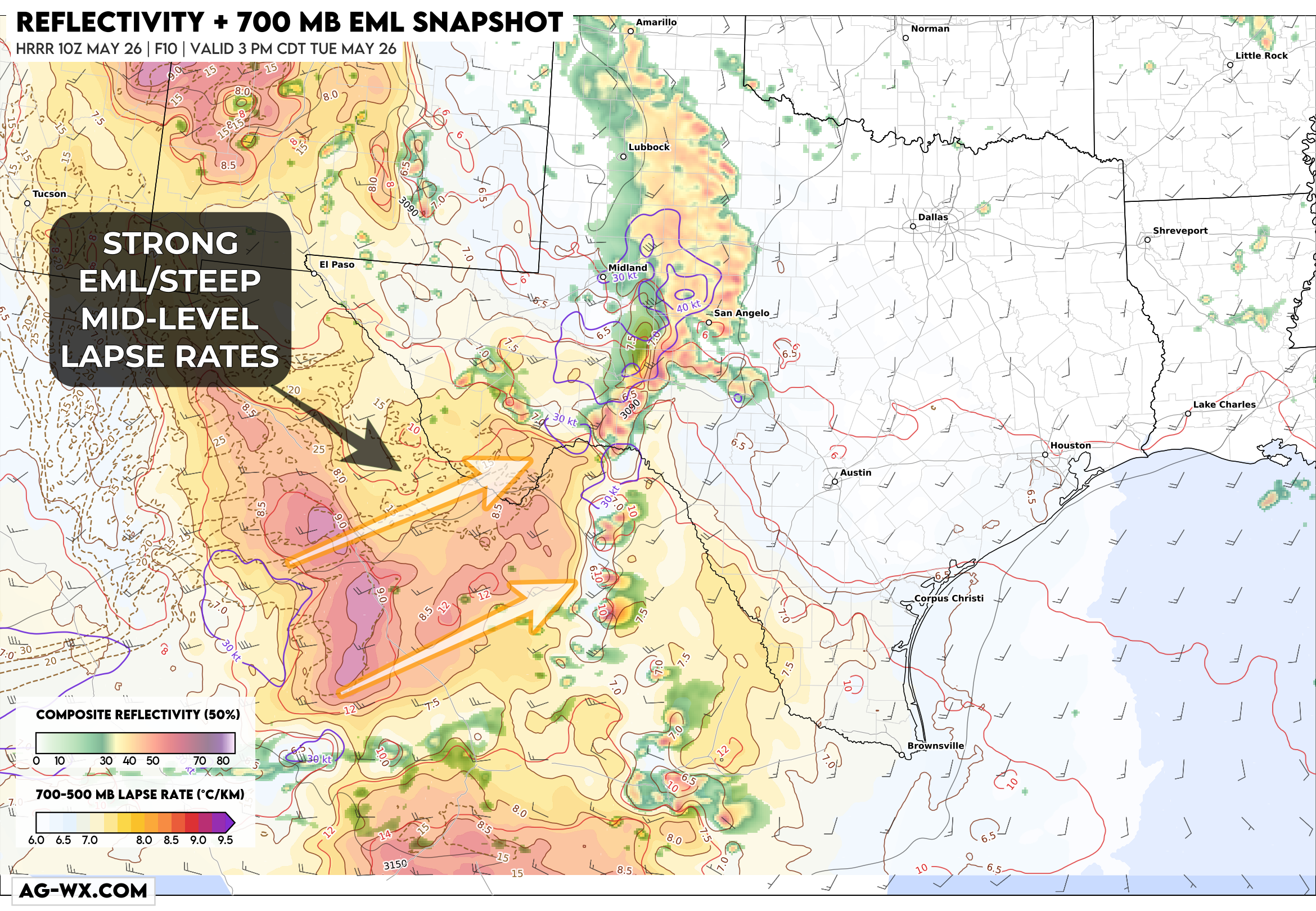
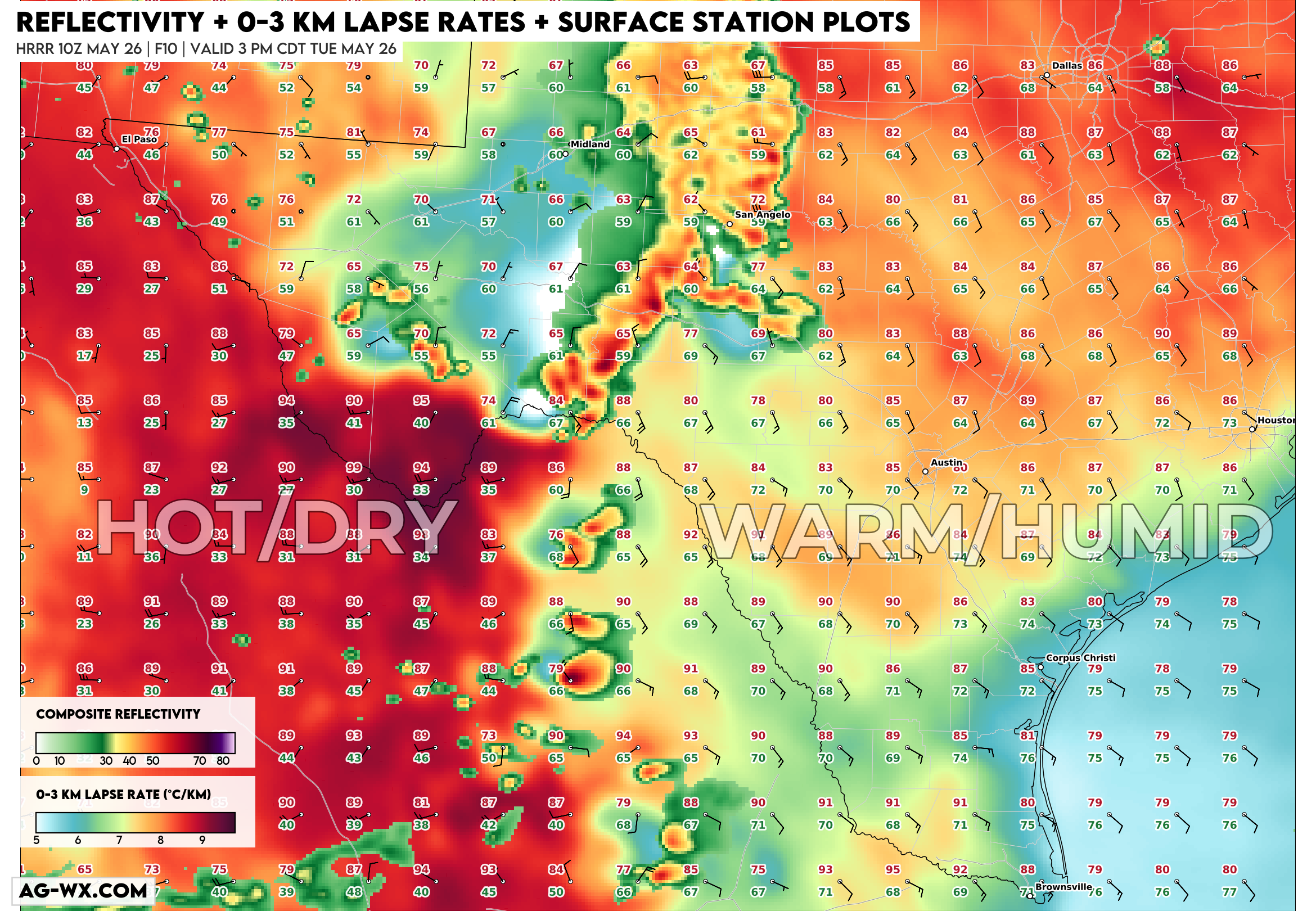
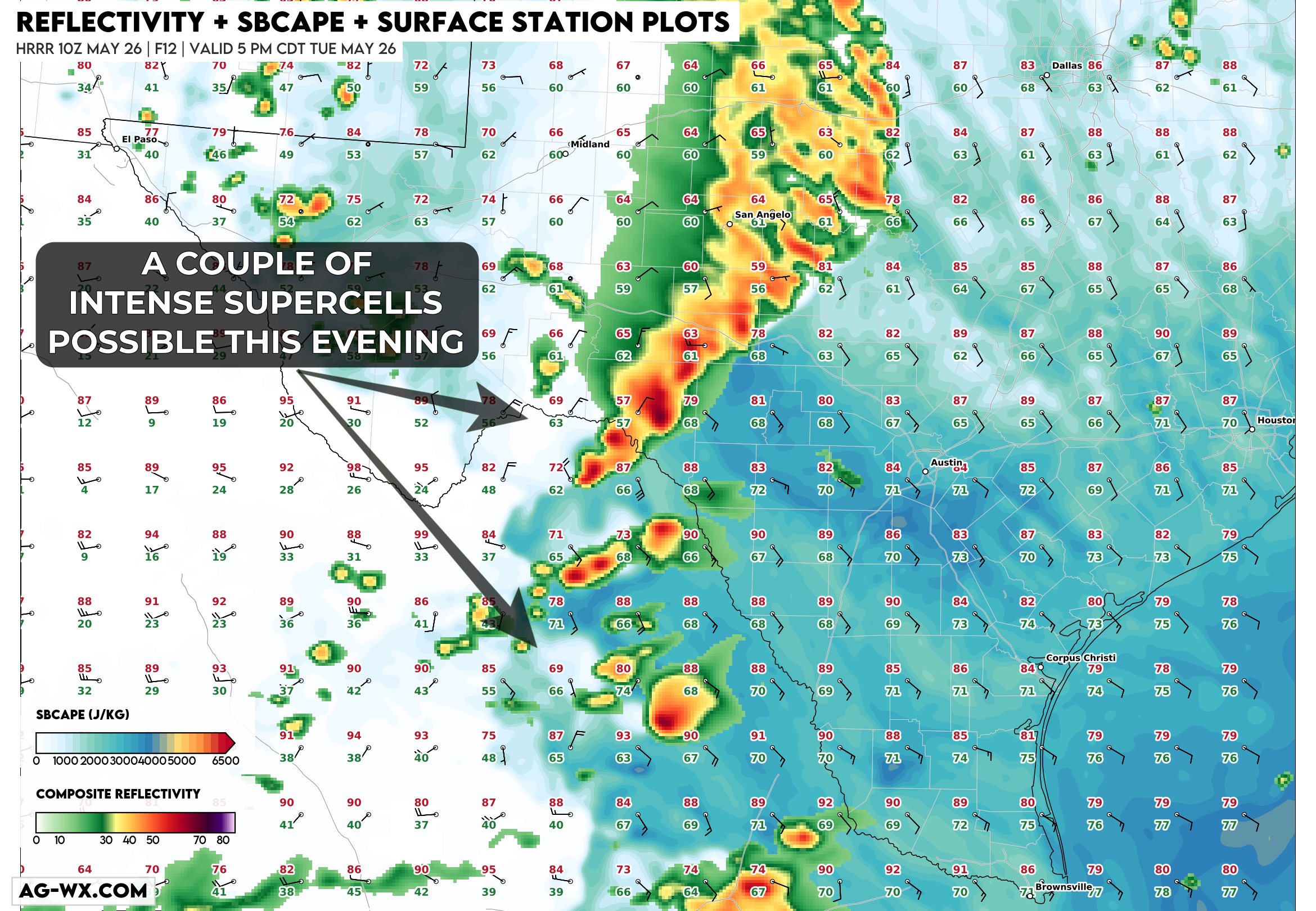
By mid-afternoon, strong instability on the order of 2500-3500 j/kg with dew points in the low 70s should be pushing up against the dryline near the Rio Grande.
All of this leads to an environment supportive of significant severe weather, illustrated by the Conditional Storm Intensity Index, which attemps to say "if a storm formed, how intense could it become?":
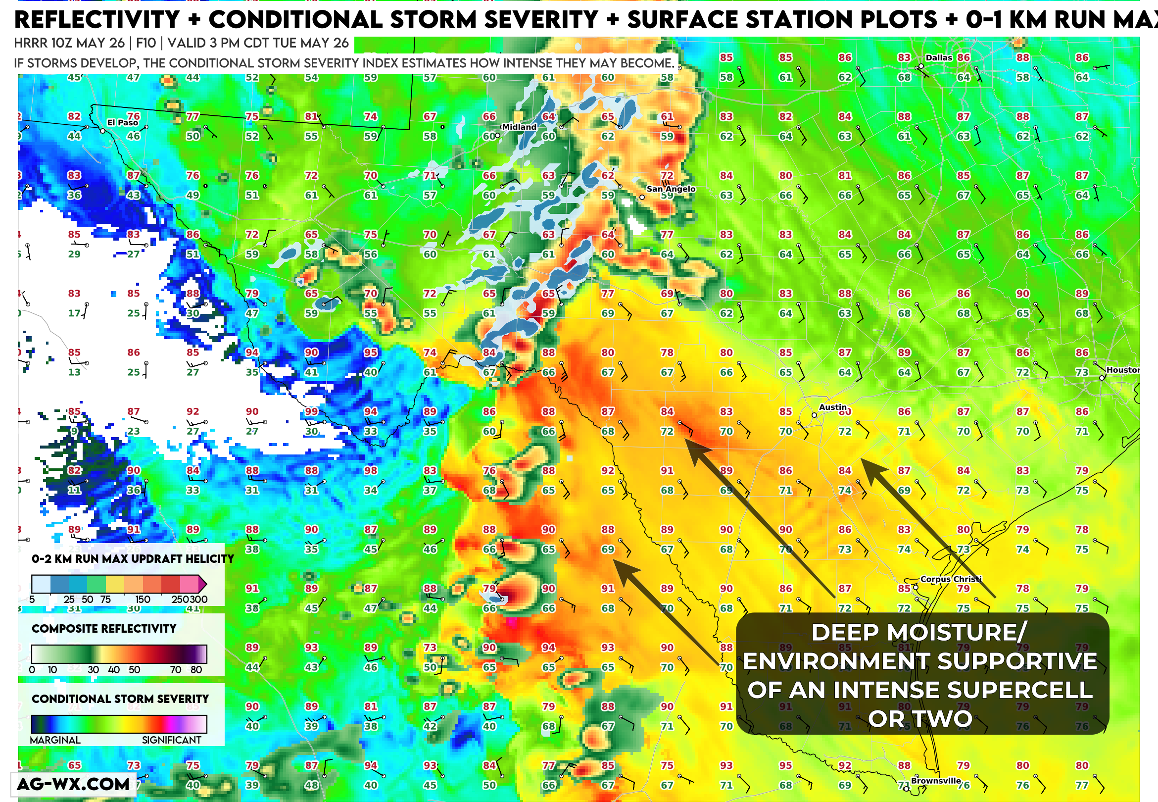
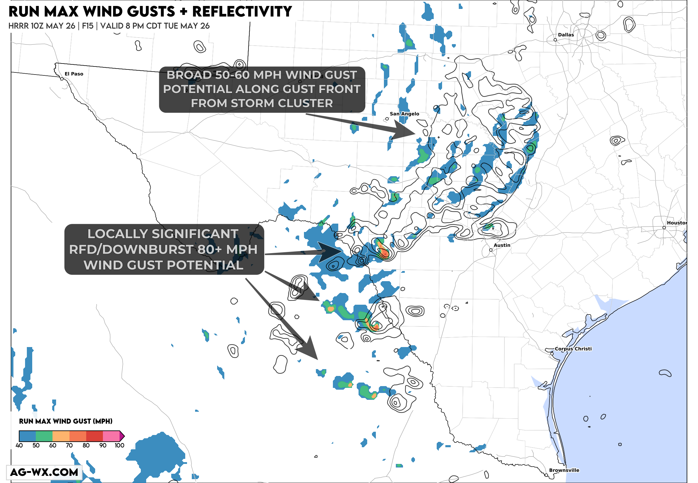
Scattered supercells should develop along the dryline, generally on the Mexico side of the river with giant hail over 4" and significant downburst winds over 80 mph possible. To the north, an outflow dominant cluster of storms will likely continue to produce severe winds 50-65 mph along the Highway 10 corridor toward the San Angelo-Austin corridor by late evening.
Here's an animation of instability + simulated radar with rotation tracks through the late evening:
This map shows composite reflectivity as black contour lines, showing the location of storm clusters/supercells, with shaded colors showing areas of strong to severe wind gusts. You can pick out the broader 50-65 mph wind gust potential along the gust front from San Angelo to Austin, with more significant 80+ mph wind gusts associated with RFD and strong downbursts. A couple of tornadoes would absolutely be on the table here, but I think that potential sticks to the Mexico side of the river.