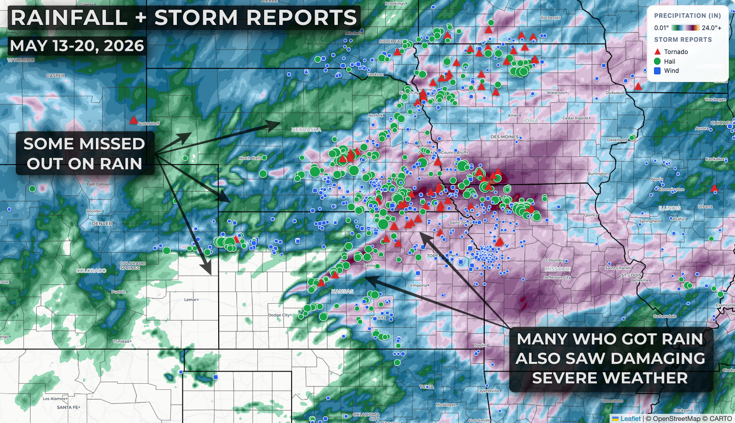
The past week was very active for severe weather across the Plains and Midwest, with a multi-day outbreak of severe storms spanning May 14-19.
Take a look at the last 7 days of storm reports:

You can almost make out two "zones" of severe weather. Across portions of Nebraska, Kansas, Iowa, South Dakota, Minnesota, and Missouri multiple days of significant severe weather occurred with many reports of hail over 2 inches in diameter, straight-line wind gusts over 80 mph, and a few tornadoes. Further east across the Midwest and Ohio Valley several days of rain and thunderstorms occurred, but the magnitude of severe impacts was much lower with a smattering of 60 mph wind gusts and mostly 1" or smaller hail.
This has been an exceptionally difficult spring for folks in Nebraska and Kansas. Looking back at the last week of rainfall with storm reports overlaid you can see that it was almost split evenly between drought-stricken areas missing out on rain, and areas that saw soaking rains that were accompanied by damaging severe weather impacts. Farmers in some areas are being forced to replant corn and soybean crops due to hail damage last week, while others are seeing emergence issues due to extreme early season weather conditions.