
EDIT: 3:55 PM Wednesday
Looks like a few supercells are beginning to evolve across Louisiana and Mississippi this afternoon. We may see several tornadic storms evolve around 5-7 PM CT.
Here's an update from the NWS/Storm Prediction Center:

You can follow along with the new high-res radar explorer - watch as storms begin to organize and move east across the risk area. This is the view a little before 4 PM CT.

Widespread cloud cover is in place this morning across much of the region, and that will play a big role in how the day evolves. Within a corridor from south-central Mississippi into central Alabama, there are signs that some filtered sunshine may break through. That would allow temperatures to warm and instability to build just enough to support severe thunderstorms later today.
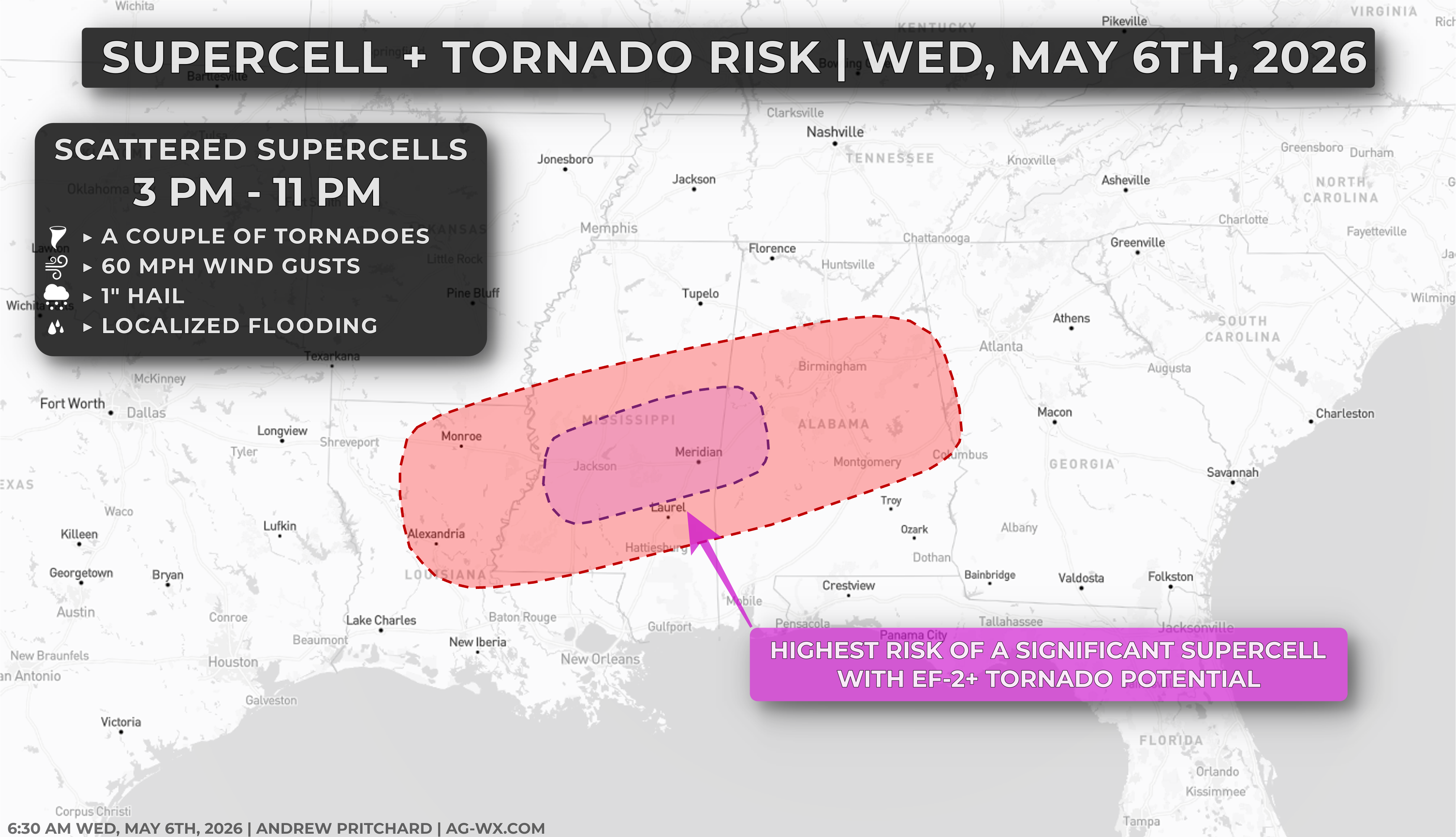
If that pocket of warming and destabilization materializes, scattered thunderstorms may develop by mid to late afternoon in the open warm sector, rather than along a well-defined boundary. Any storms that form in this environment will have the potential to become supercells. While wind shear won’t immediately be favorable for tornadoes, winds just above the surface are expected to strengthen into the evening, which will increase wind shear and enhance the potential for organized, rotating storms.
This means any sustained storm could quickly become severe, with the risk of all hazards. Large hail and damaging winds will be the predominant risks, especially early in the evolution this afternoon. Still, the setup also supports a tornado risk, especially during the evening and early overnight hours. This includes the potential for a few stronger tornadoes if storms can remain discrete and organized, especially in pink the highlighted region on the map above. The overall uncertainty today revolves around how much instability can develop given the morning cloud cover, which will leave some lingering questions about where, and how many supercells develop.
As we move into the late evening, any storms that do form may begin to merge into clusters and track southeast into southern Alabama and eventually into parts of Georgia. As this happens, the primary threat may transition toward damaging straight-line winds, although isolated tornadoes could still occur within the line.