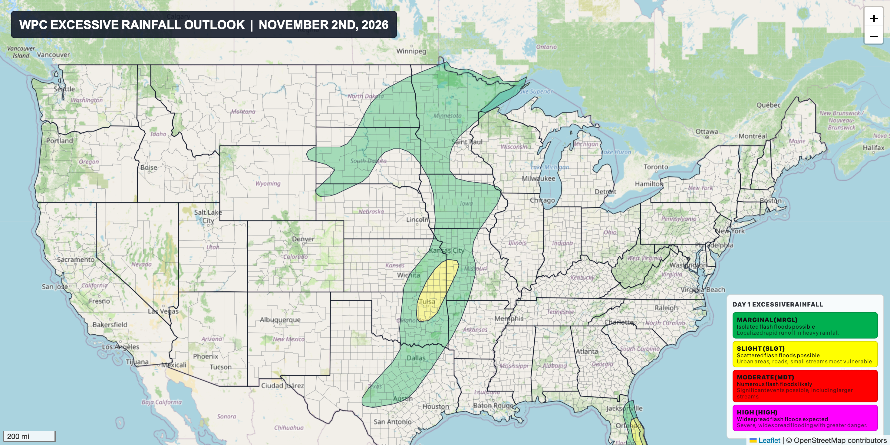
After what feels like an eternity, we've got southwest flow and a significant area of low pressure impacting the Plains today, shifting east into the Mississippi Valley on Tuesday. High pressure has dominated areas east of the Rockies over the past several weeks, and this storm system is expected to bring badly needed rainfall to portions of the Central and Southern U.S.
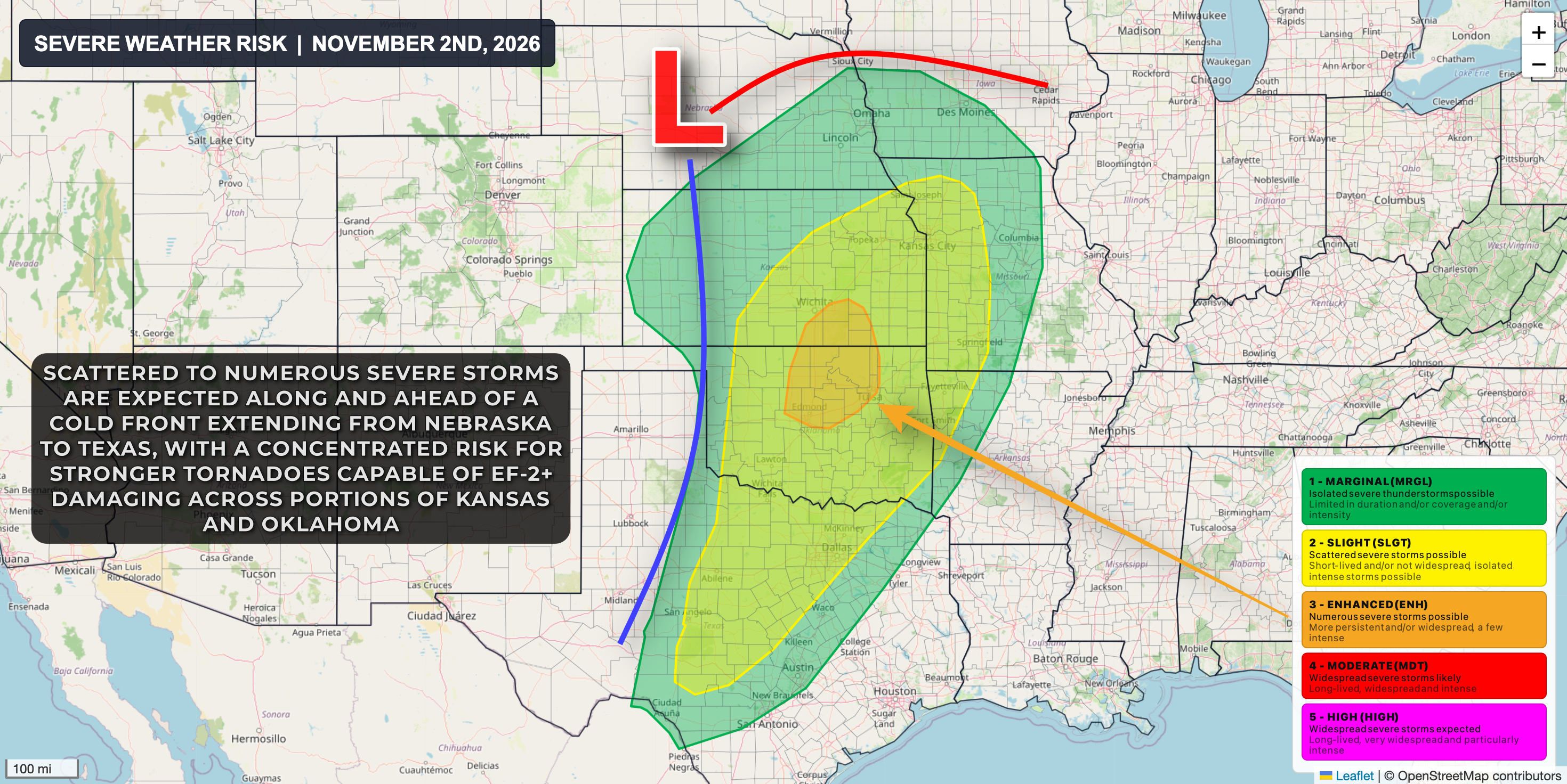
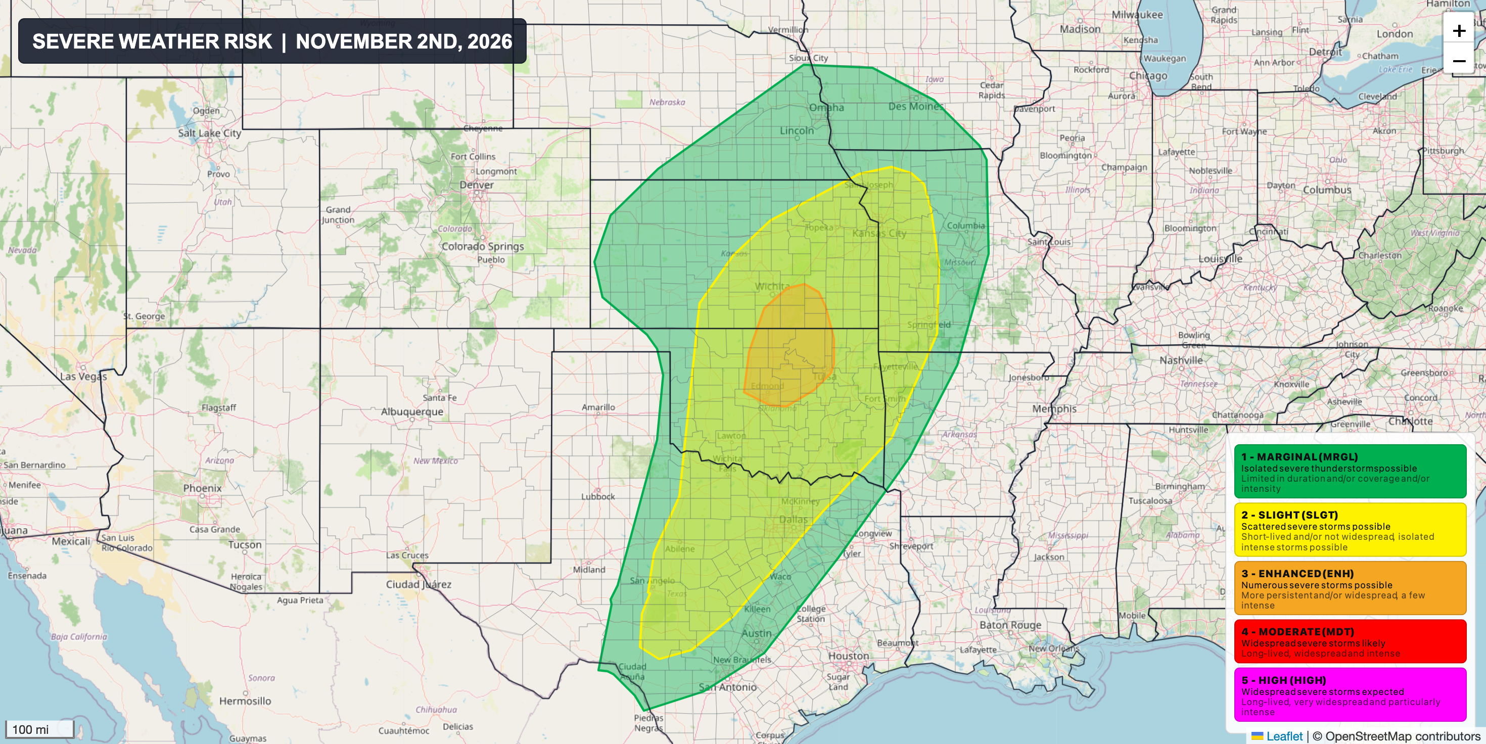
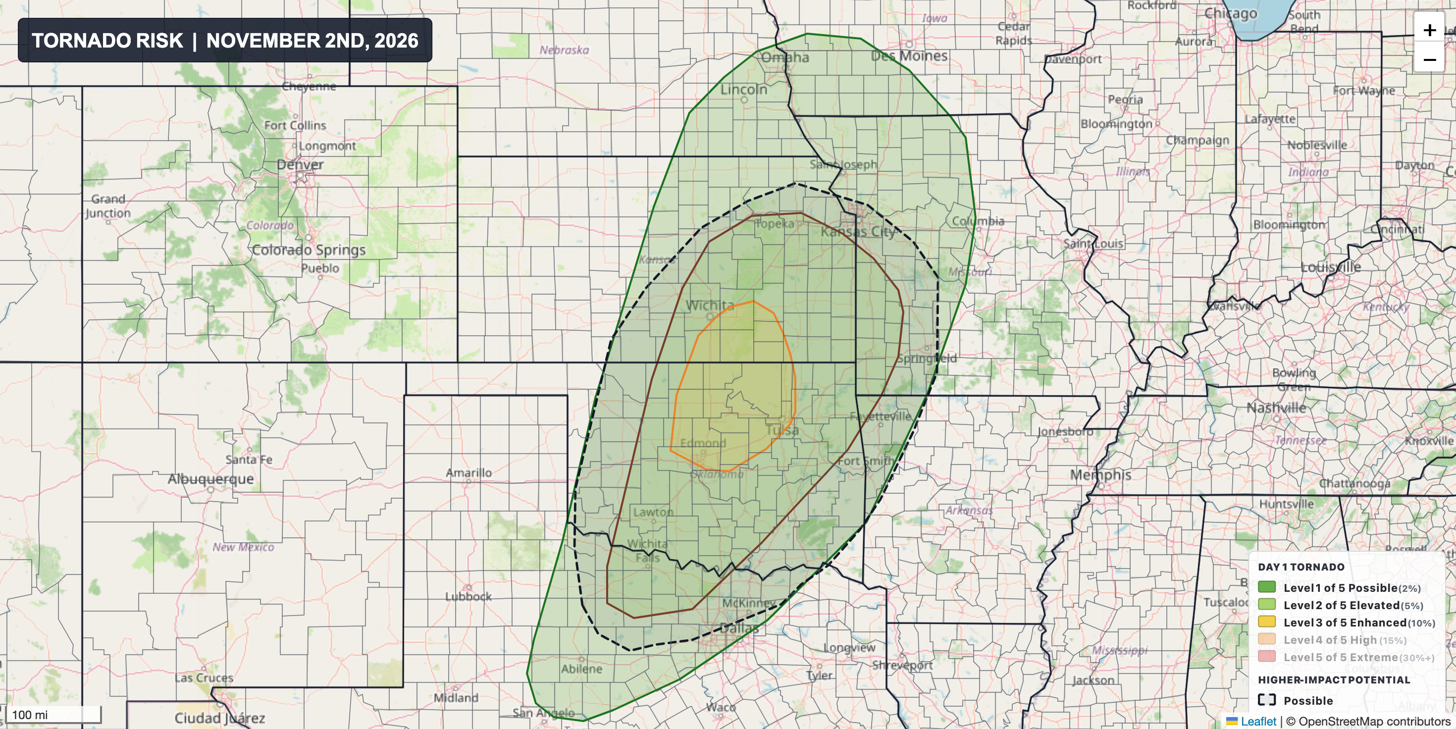
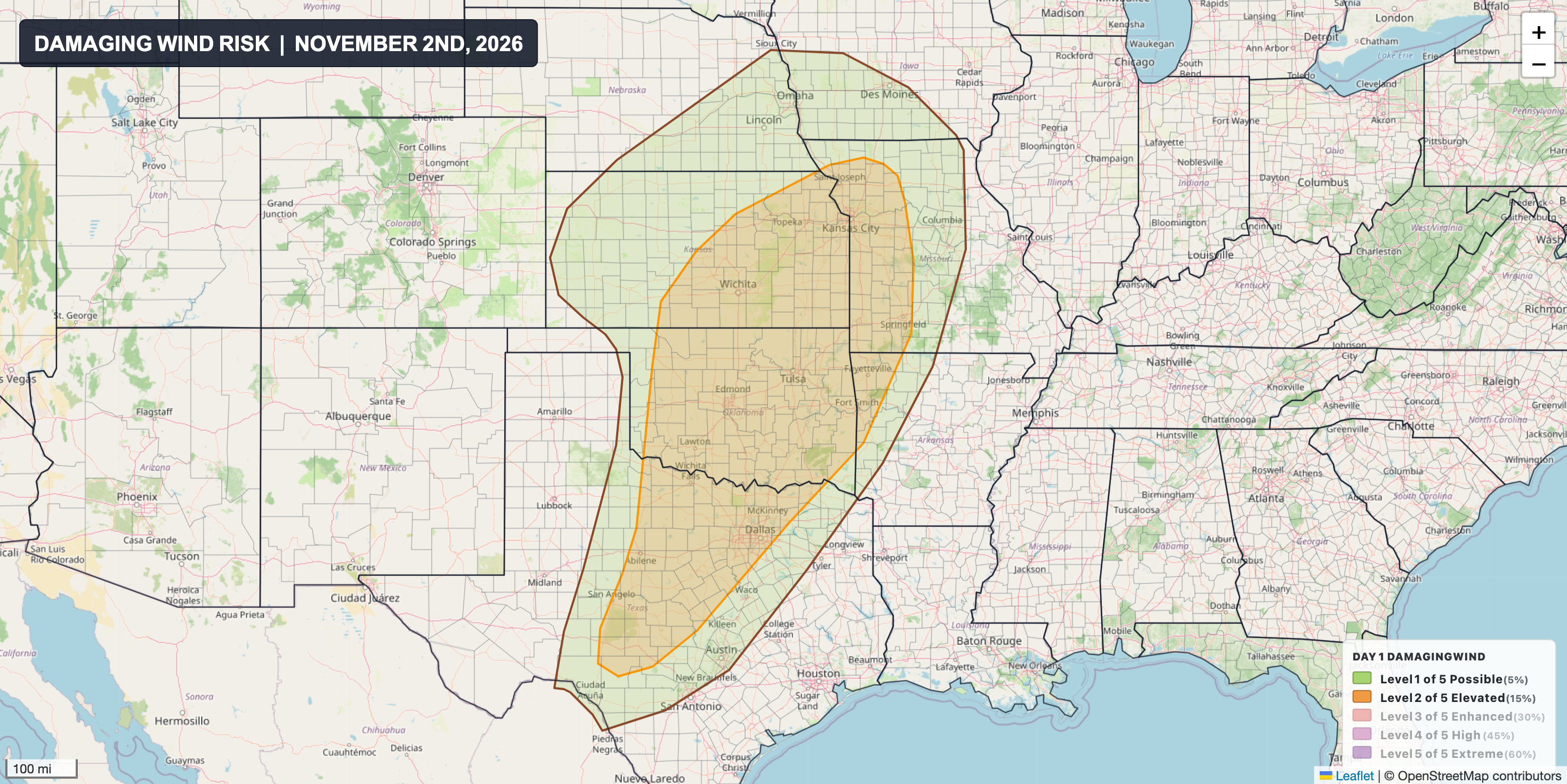
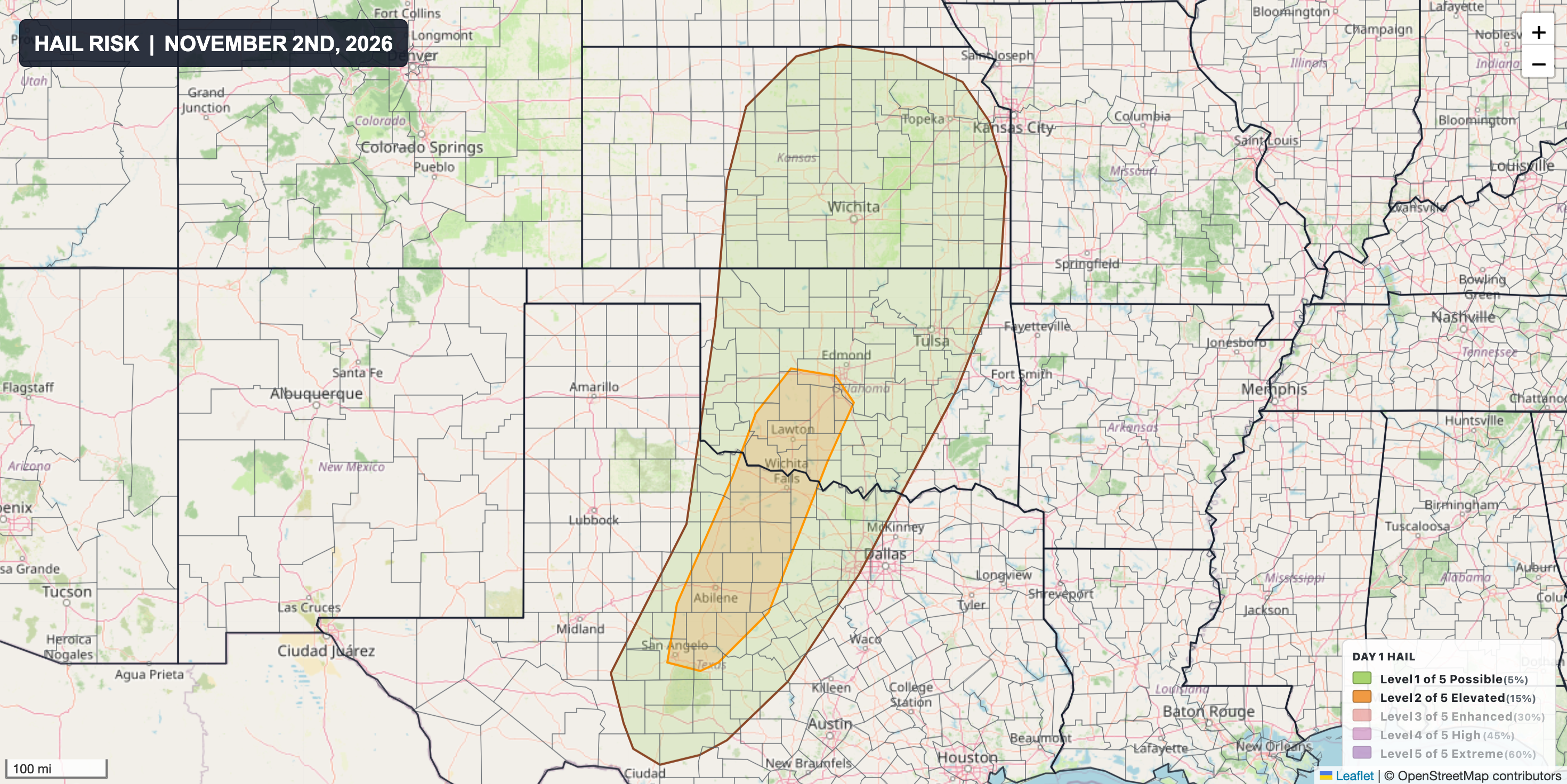
A strongly sheared warm sector ahead of a cold front extending from Nebraska to Texas will support scattered to numerous severe thunderstorms along the front from Monday afternoon into the evening hours. A few tornadoes, damaging wind gusts over 70 mph, and hail over 2" in diameter will be possible with the strongest storms.
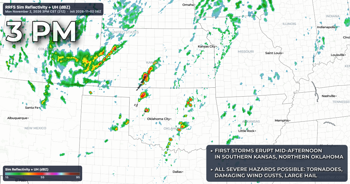
Much of the day will be quiet across the risk area, albeit quite blustery with southerly winds gusting over 30 mph at times. By mid-afternoon, storms should begin to erupt from central Kansas into western Oklahoma, with storms becoming widespread this evening from southern Nebraska into Texas. All severe hazards will be possible with severe storms across the entire risk area, but there is a concentrated corridor from central and eastern Kansas into Oklahoma that will see the best combination of ingredients supporting an elevated risk for tornadoes, including a few significant tornadoes with EF-2+ damage potential.
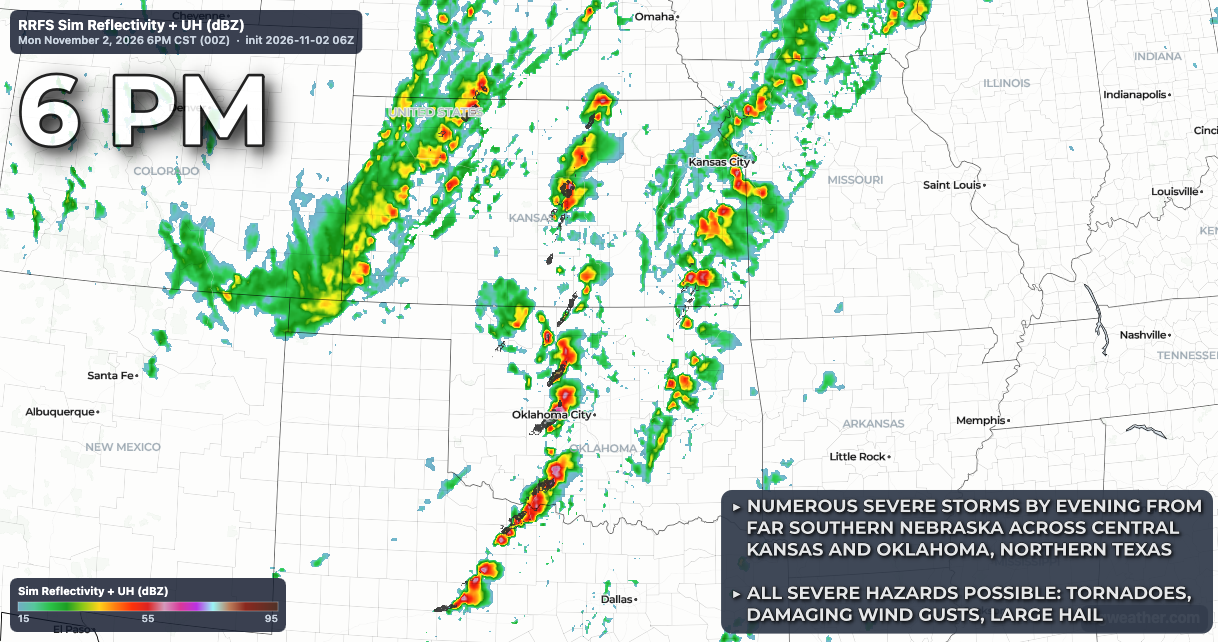
During the overnight hours the severe risk across the northern tier of the risk area from southern Nebraska into northwest Kansas should begin to fade, though embedded tornadoes and damaging wind gusts may continue to accompany stronger cells within a fast-moving squall line tracking across eastern Kansas, southwest Missouri, eastern Oklahoma and far western Arkansas into northeast Texas into early Tuesday morning.
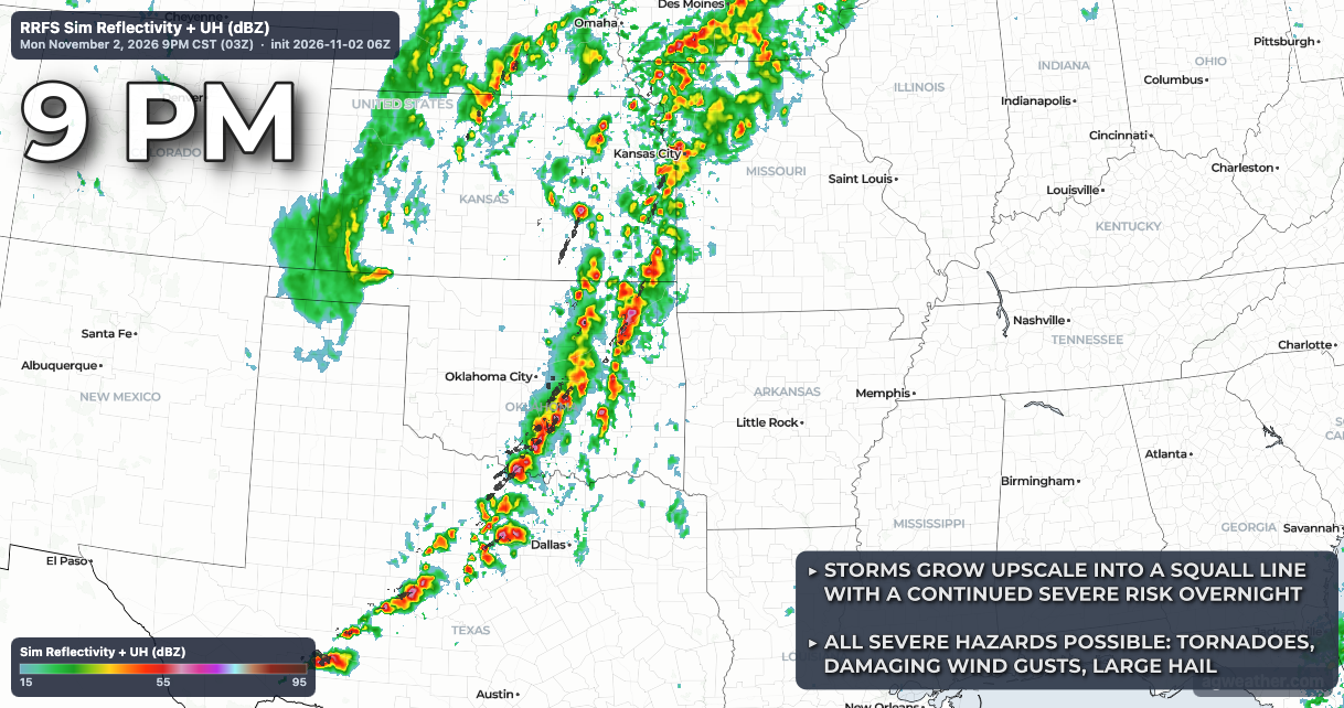
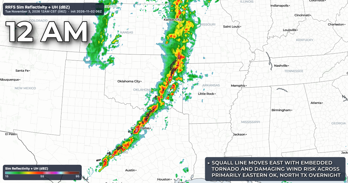
Severe Risk Visualized: