
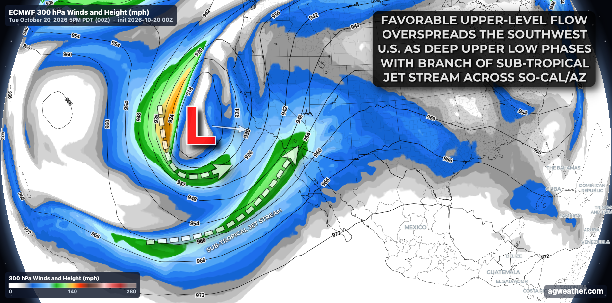
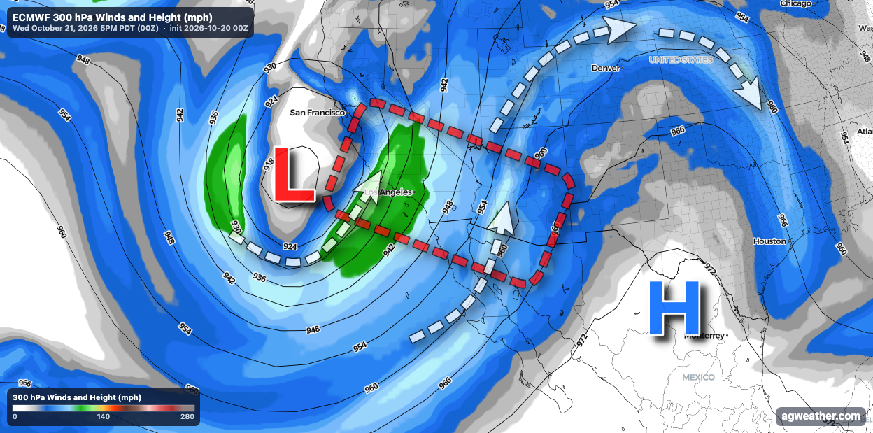
A deep upper-level low pressure system will make a slow journey south along the West Coast, phasing with a branch of enhanced flow from the sub-tropical jet stream to create a favorable environment for multiple days of thunderstorms and potential severe weather impacts across portions of the Southwest U.S.
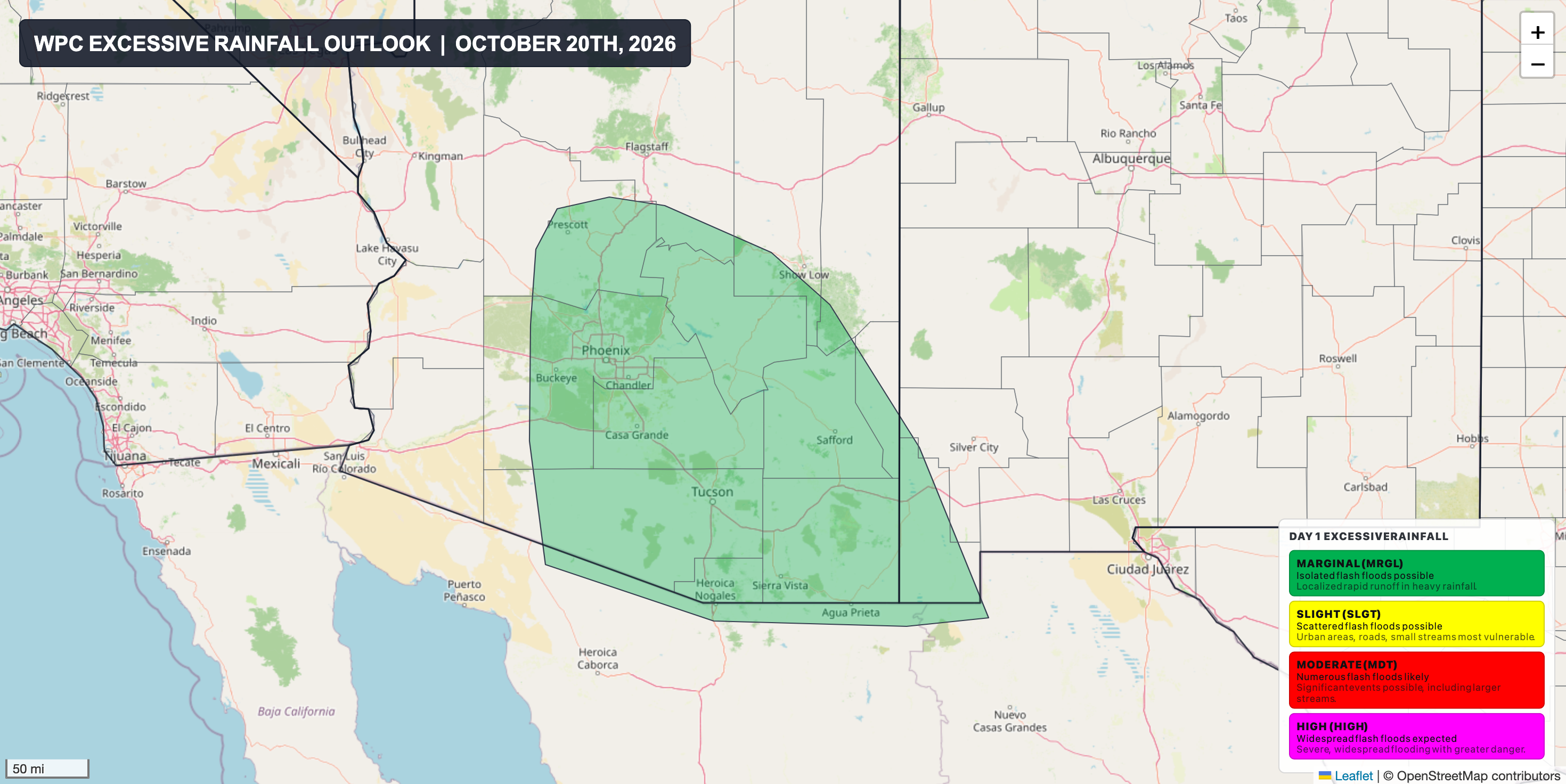
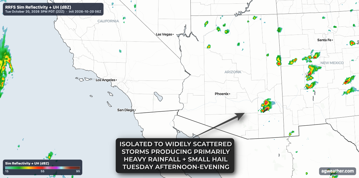
Today's risk is rather meager with a couple of stronger storms producing locally heavy rainfall across central and southern Arizona.
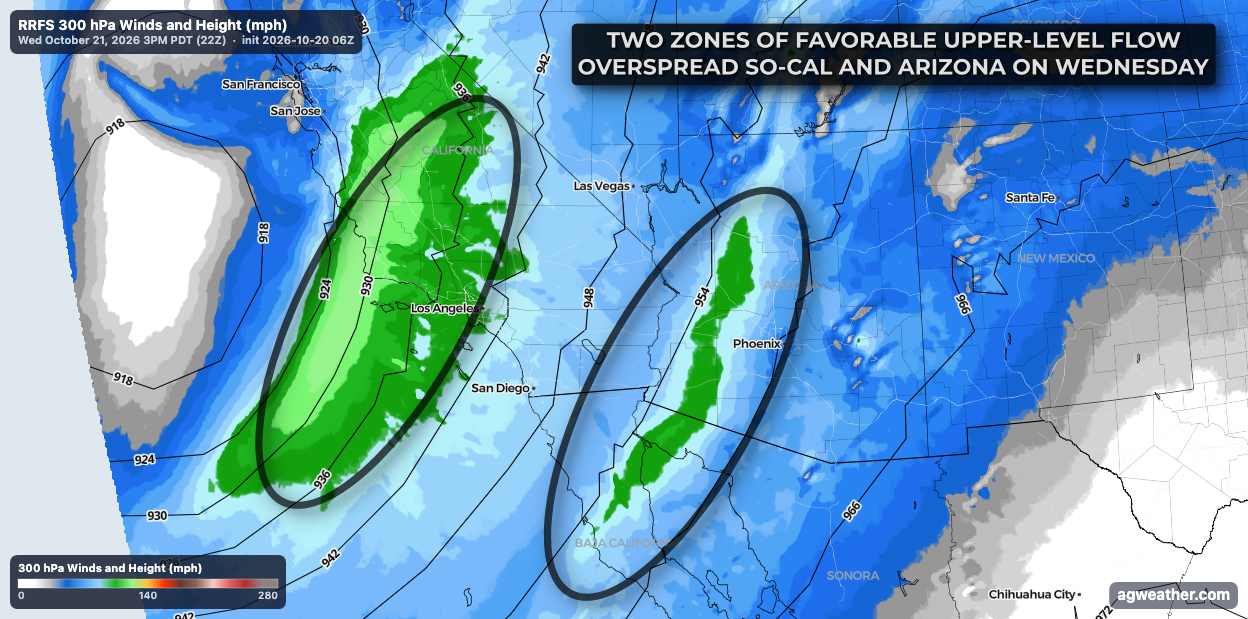
On Wednesday, as the upper-level trough slides down the coast, it phases with the sub-tropical jet stream and two zones of favorable flow overspread southern California and Arizona.
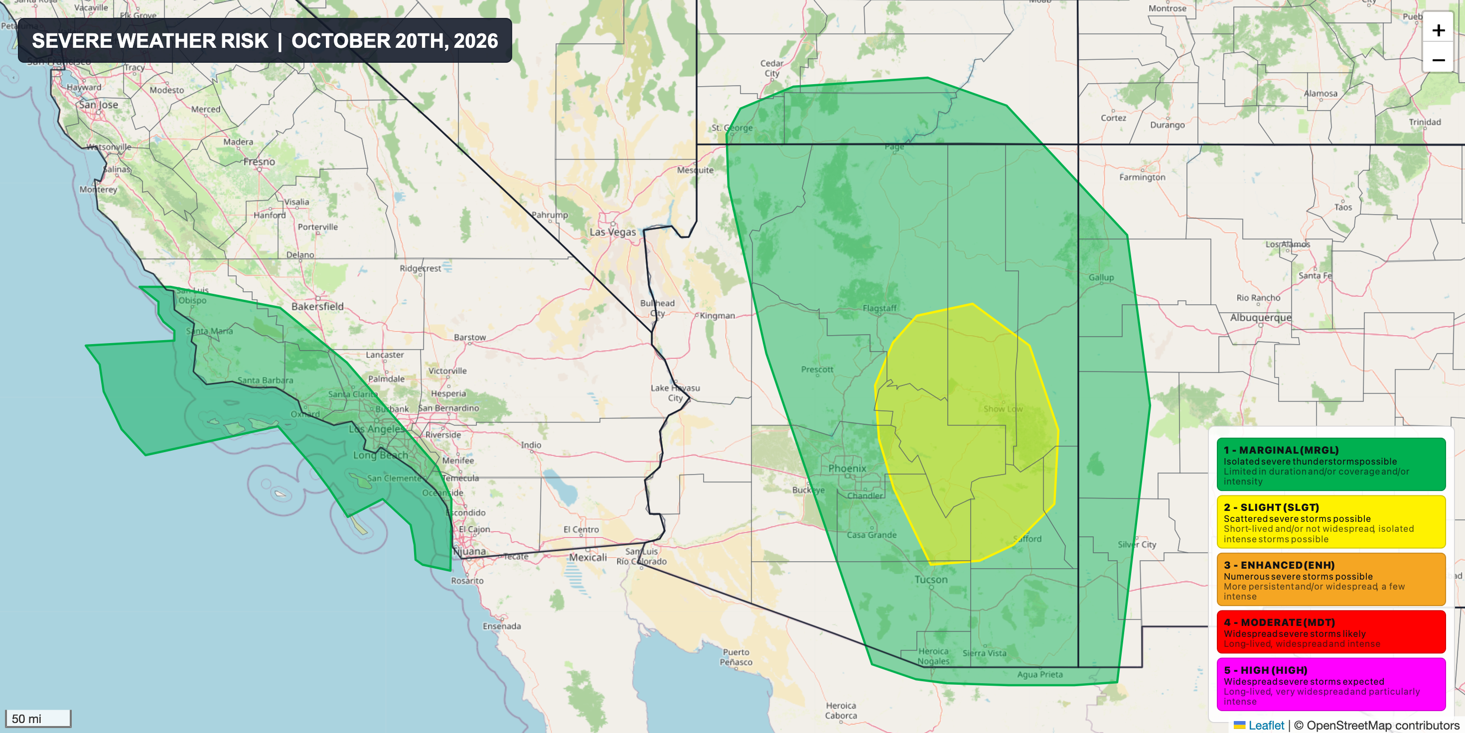
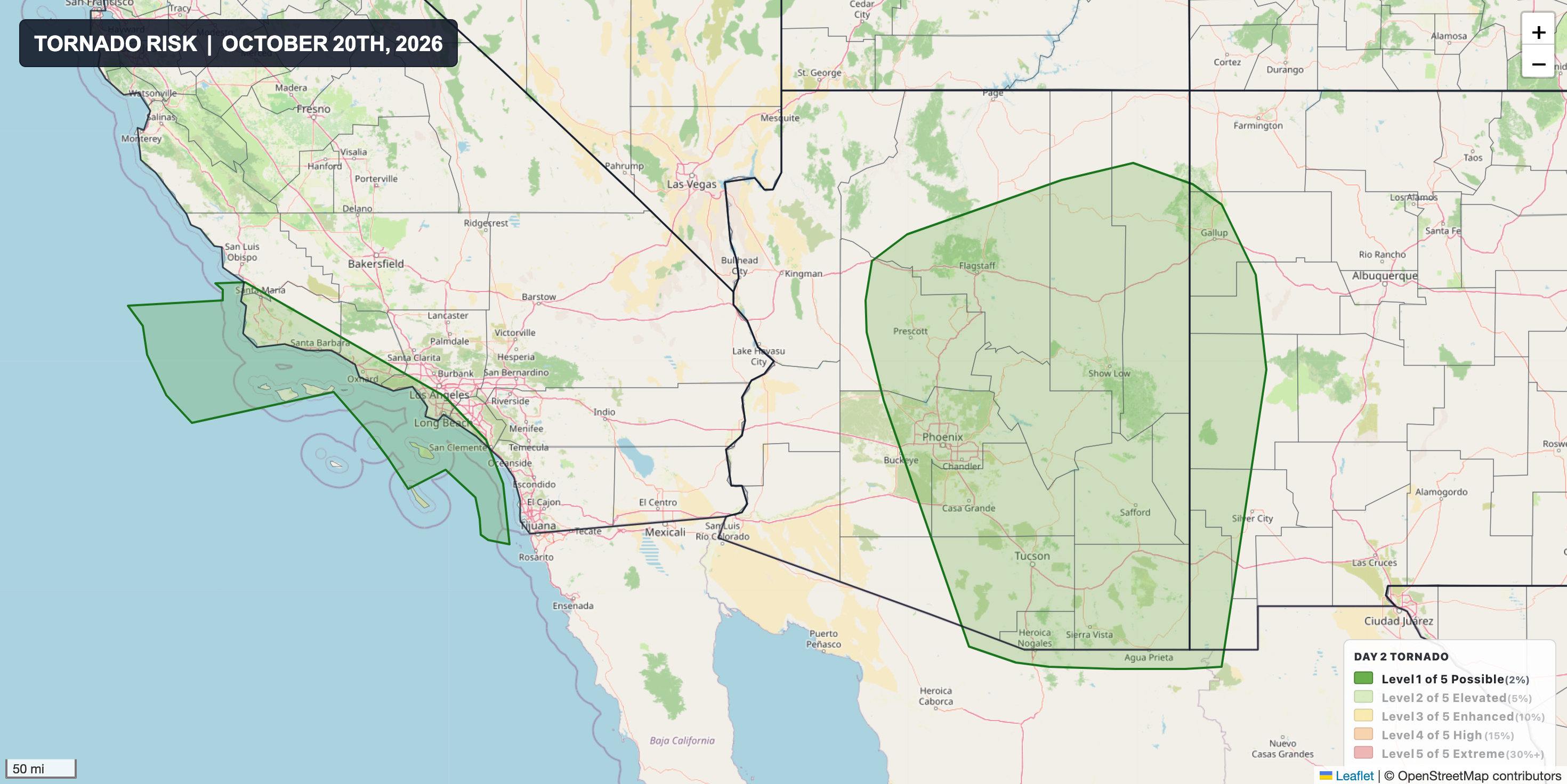
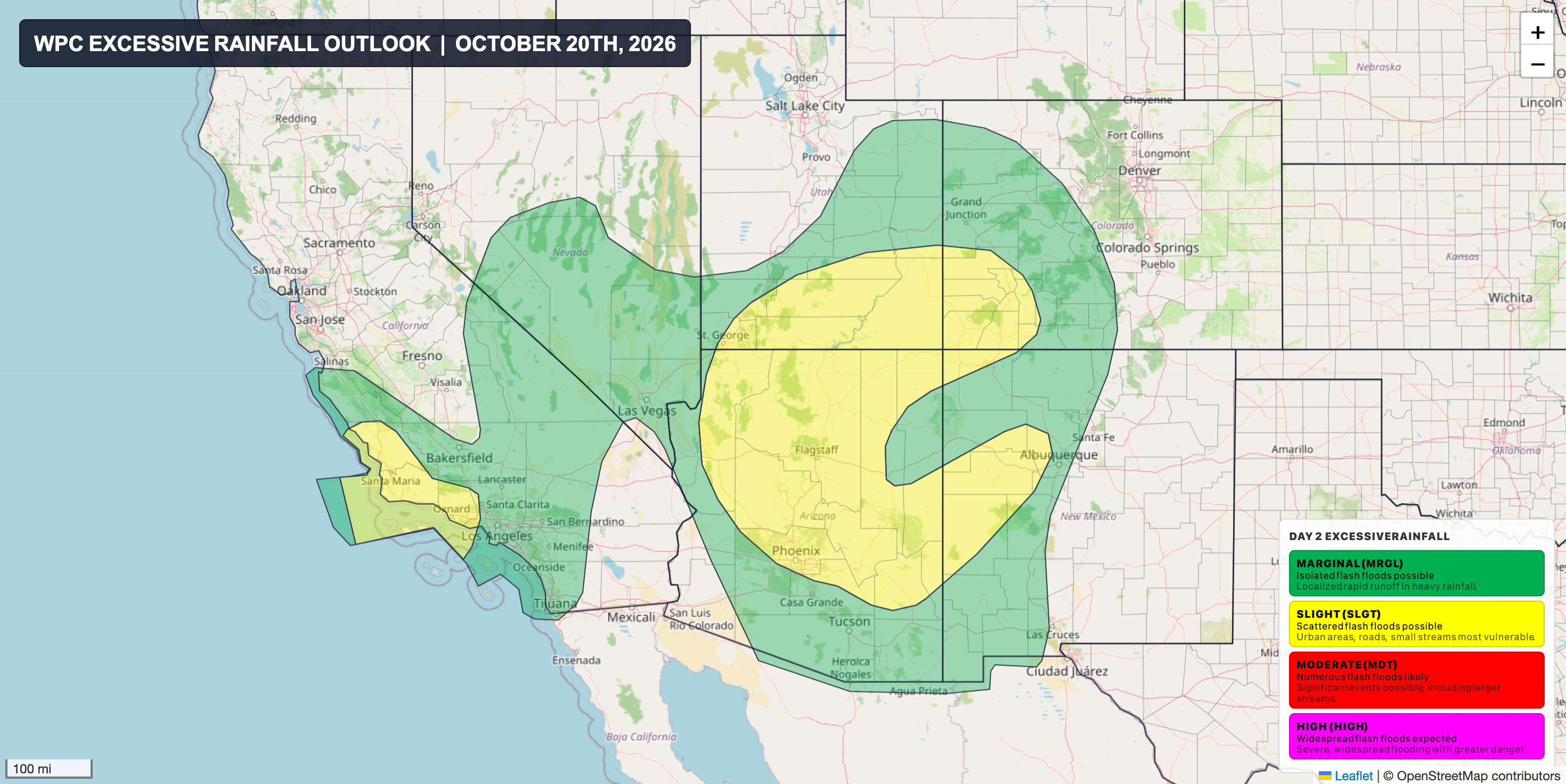
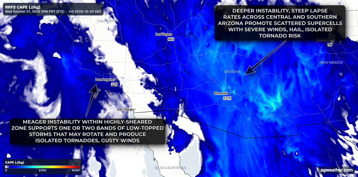
Instability will be stronger across central and southern Arizona compared to the environment across southern California. This should support a more robust risk for scattered intense thunderstorms including a few supercells across the Arizona risk area on Wednesday afternoon. Severe hail and winds, along with a couple of tornadoes are possible from this activity, along with locally heavy rainfall and flash flooding. Some high-resolution guidance even supports a continued risk for renewed severe thunderstorm development across portions of Arizona well into the night and perhaps early Thursday morning.
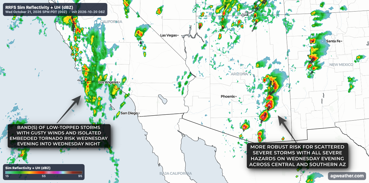
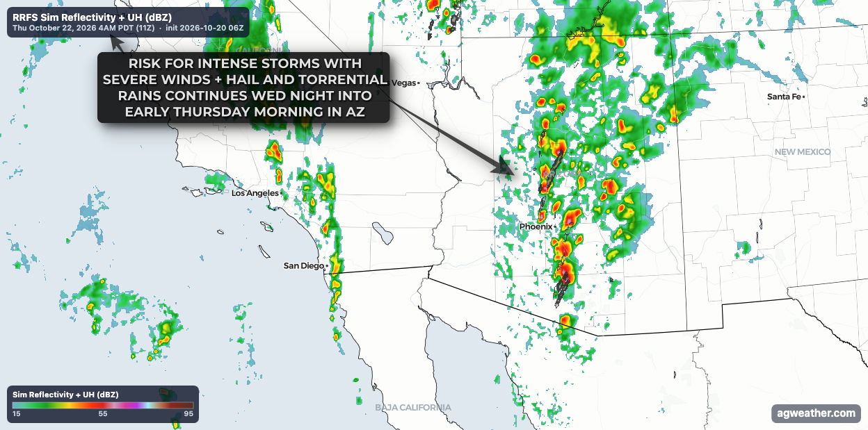
Across southern California the risk is a little lower and a little later, with one or two bands of low-topped showers and thunderstorms approaching the region late Wednesday evening into the overnight hours. The primary risk here would be gusty winds and an embedded tornado or two with any stronger cell that can develop, primarily driven by high wind shear and a little instability near the surface.
With high pressure dominating the interior, we'll continue to see the Southwest U.S. hold down the highest chances for severe storms and heavy rains into the weekend.