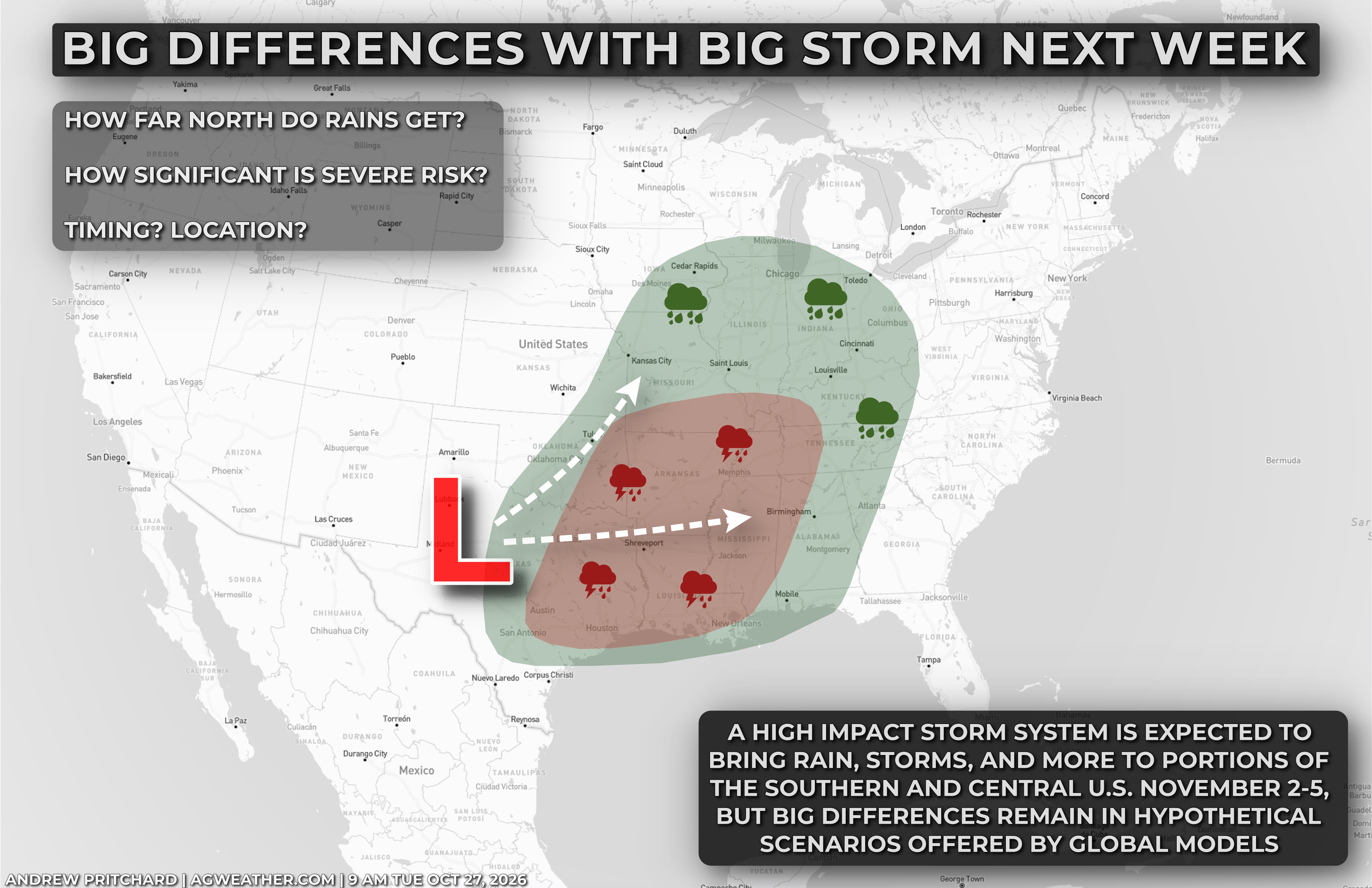
We're still a week out which is an eternity in the world of high-impact weather forecasting, but attention is already growing around a potential early week storm system that is expected to bring the first meaningful rains in quite some time to portions of the Southern U.S. with at least some potential for severe storms across portions of the Plains, Midwest, and South.
That's a mouthful, all to say we could see a big area of low pressure bring rain, thunderstorms, and more, to a broad geographic area that hasn't seen much over the last month or more thanks to persistent high pressure and mild, dry conditions.
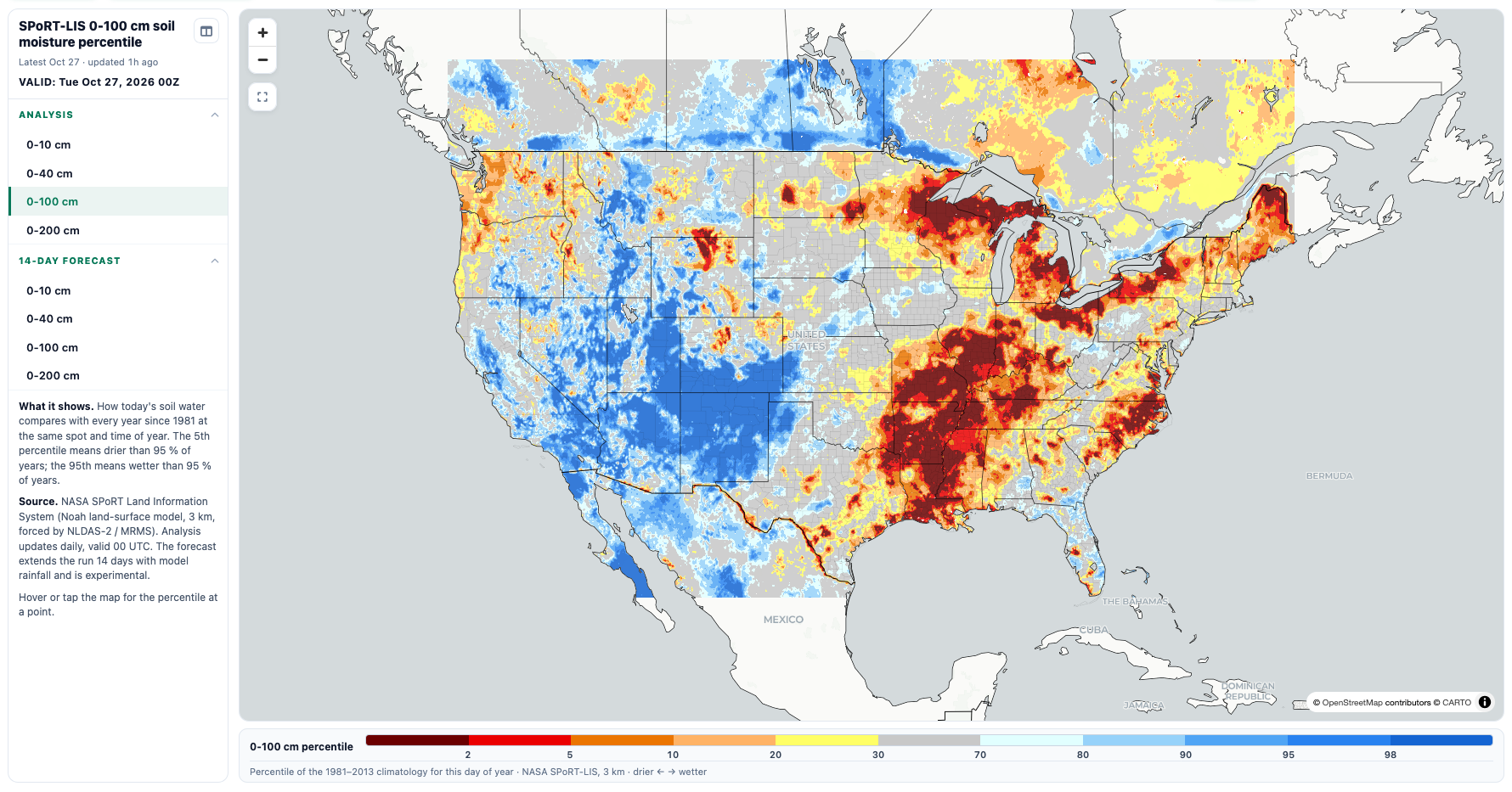
Here's a current look at soil moisture values - note the large area of dryness from the Gulf Coast to the Ohio Valley:
At a week out, it's no surprise that there are major discrepancies between model solutions around the storm system being watched around November 2-5. It can be a fun exercise to go in and look at the differing hypothetical trough ejections and how they result in different warm sectors, severe weather risks, and precipitation swaths.
Let's make some comparisons from the 0z Tues, Oct 27 model suite - note, I'm not suggesting either model solution is correct - these will change, flip flop, evolve, etc in coming days.
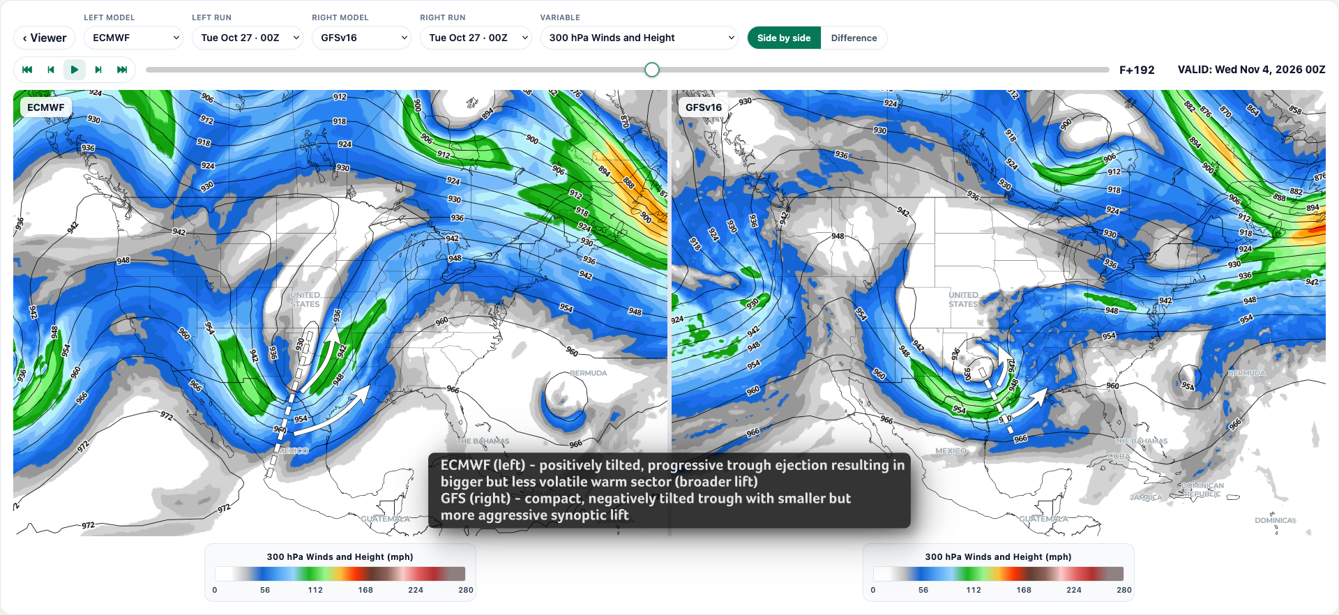
Verbatim, the overnight ECMWF run has a broader, positively tilted trough ejection vs the GFS and its more compact, negatively tilted trough. Synoptically, the ECMWF would foster a larger, but weaker area of upper-level divergence and associated lift from the Gulf Coast into the Ohio Valley, while the GFS would support a smaller, but more aggressive region of lift across the Gulf Coast and Mid-South.
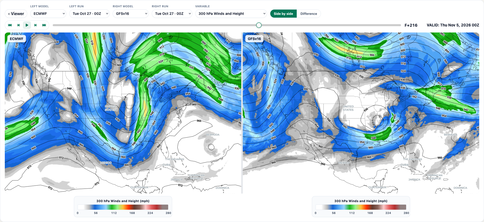
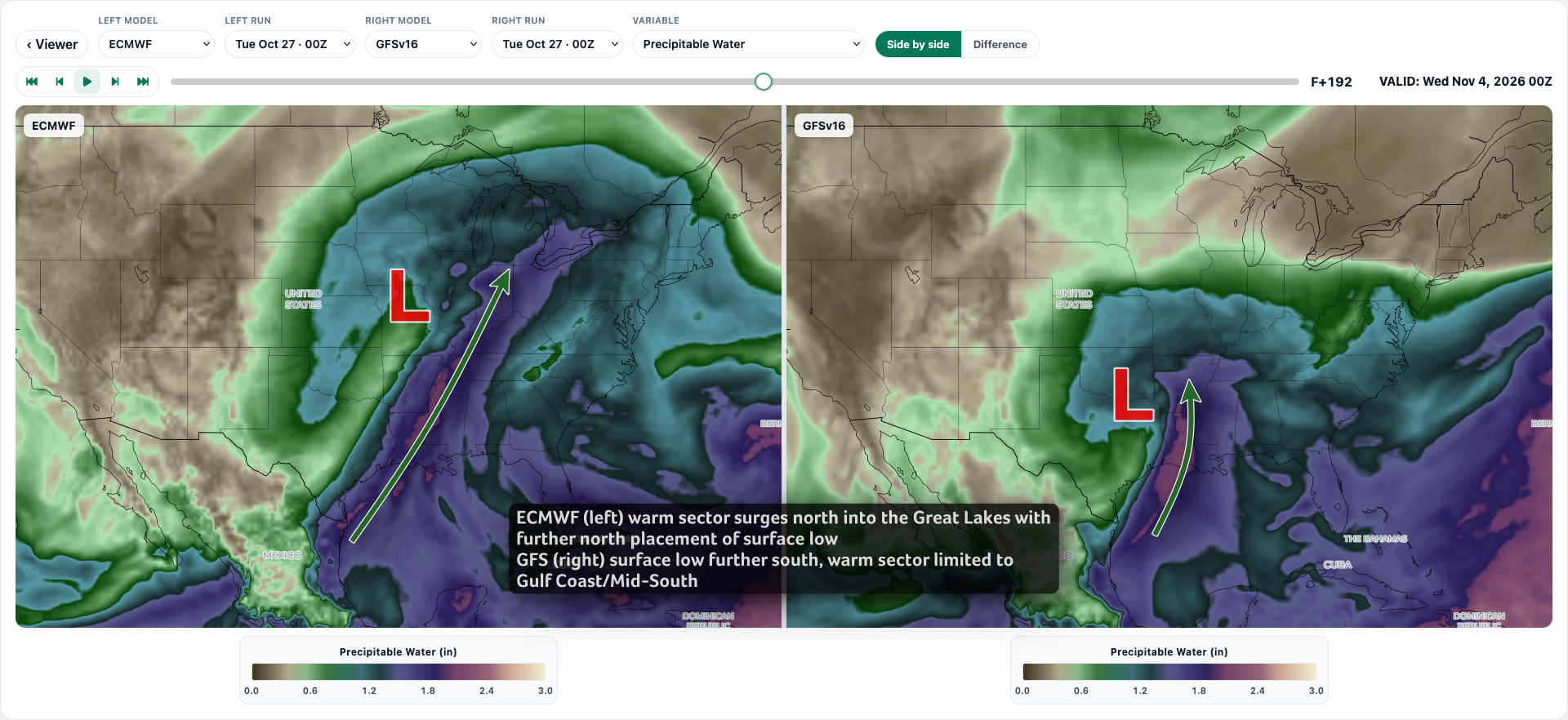
The more progressive, positively tilted ECMWF hypothetical-trough opens the warm sector northward into the Great Lakes with a smaller warm sector beneath the more compact, negatively tilted GFS hypothetical-trough.
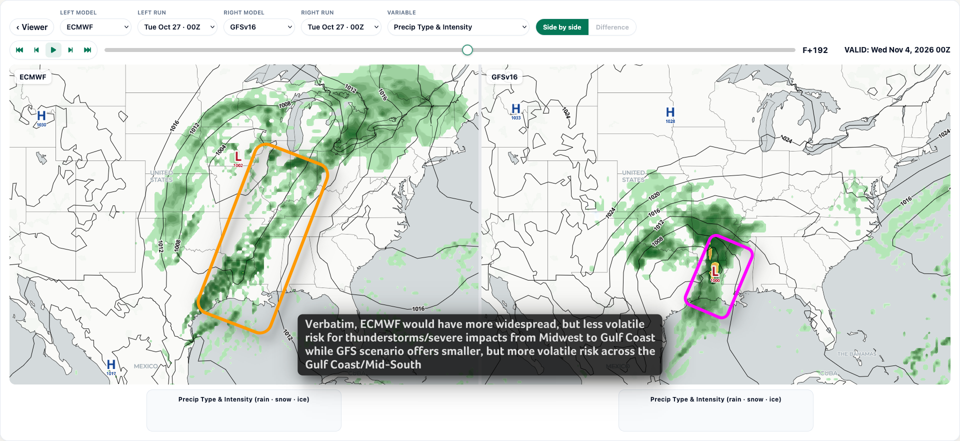
If both scenarios played out exactly as modeled today, the ECMWF would likely foster a broader, lower risk for severe storms - think large marginal to slight risk day with a broad area of showers and storms, perhaps a squall line with severe impacts while the GFS supports a more volatile, localized high-impact zone - think enhanced risk or higher with supercells and tornadoes possible.
When it comes to total precipitation accumulation, the broader, positively tilted trough ejection advertised by the ECMWF would bring beneficial rains to a larger swath of the Gulf Coast into the Midwest and Great Lakes with a limited, southern track for the heavest rains with the compact, negatively tilted GFS.
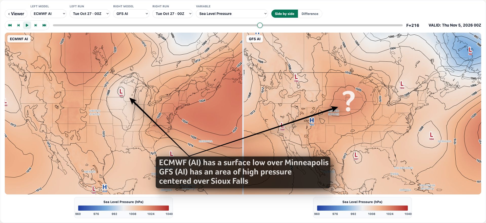
To drive home the point that there's a long way to go yet, check out the ECMWF AI and GFS AI runs from overnight: