
An active weather day is unfolding across the Midwest, with multiple rounds of thunderstorms expected from Missouri into Iowa, Illinois, Indiana, and southern Michigan. Several corridors of severe thunderstorms are expected, with damaging winds and a few tornadoes possible.
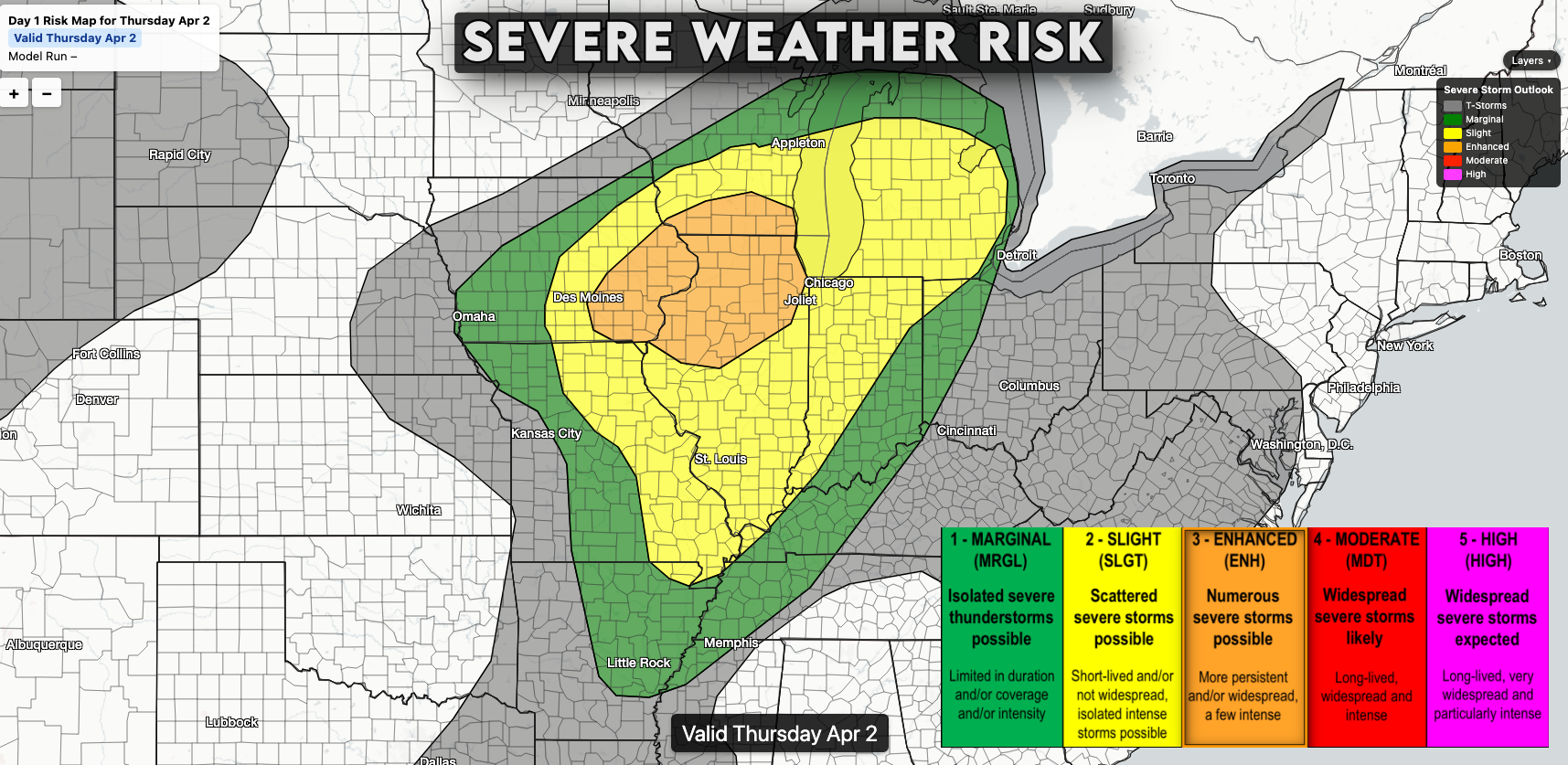
An area of rain and embedded thunderstorms is already lifting northeast out of Missouri into Illinois this morning. While much of this activity is below severe levels right now, there is potential for some re-intensification through late morning into the afternoon as the atmosphere becomes a bit more unstable.
If that happens, a few storms could produce isolated damaging wind gusts or even a brief tornado as these storms lift northeast across Illinois into Indiana.
The more significant severe weather risk is expected to develop later today into this evening.
As a strong storm system lifts northeast out of the Plains, conditions will become increasingly favorable for severe storms—especially from eastern Iowa into northern Illinois and southern Wisconsin, within a zone of strong instability and favorable wind shear.
Storms are expected to develop in eastern Iowa by late afternoon and evening, initially as more isolated or semi-discrete storms. During this phase, storms could become supercells capable of producing tornadoes, including the potential for a few stronger tornadoes, along with damaging winds as they track northeast into Illinois and southern Wisconsin.

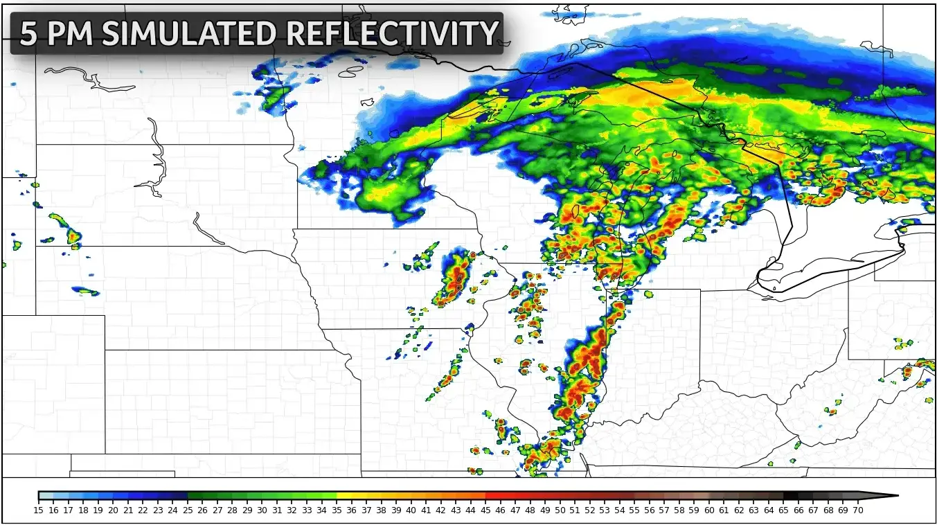
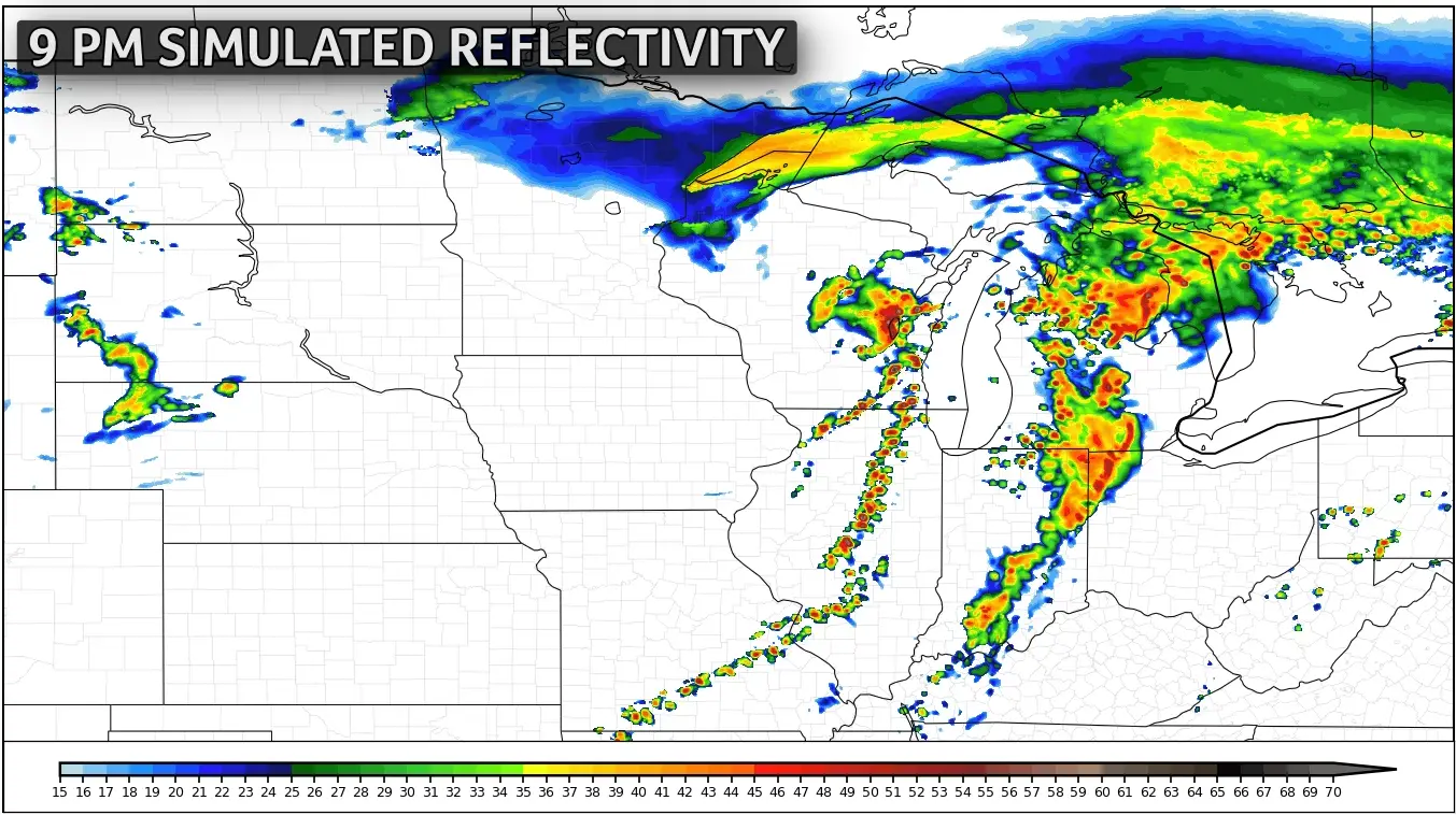
As the evening progresses, storms are likely to organize into lines or clusters, shifting the main threat toward damaging winds, with gusts to 60 to 80 mph possible which is enough to topple trees or power lines. The risk for severe impacts should continue into the early overnight before fading around Midnight.
A renewed risk for severe thunderstorms is expected from the Plains into the Midwest on Friday, with much of the same region under a risk for tornadoes and damaging winds.
