
An active corridor of showers and thunderstorms will stretch along a frontal boundary draped from the Plains and Midwest into the Ohio Valley and Northeast today, with the greatest potential for organized severe weather focused farther east. Morning thunderstorms are expected across portions of the Midwest, Missouri Valley and northwestern Ohio Valley, with areas of clouds and rain that could limit instability later in the day. Even so, additional scattered thunderstorms should redevelop along the advancing cold front and remnant outflow boundaries this afternoon.

The most supportive severe weather environment should develop from the eastern Ohio Valley into portions of the Northeast, where dew points in the upper 60s and 70s combined with some daytime heating will allow moderate instability to develop. At the same time, strengthening winds aloft will provide enough wind shear for storms to become organized. A mixture of storm clusters and a few short-lived supercells will be possible before storms increasingly organize into lines and clusters. Damaging wind gusts will be the primary concern. Hail and tornado potential appear relatively limited, although strengthening low-level winds during the afternoon could support a brief tornado risk with one of the stronger storms.

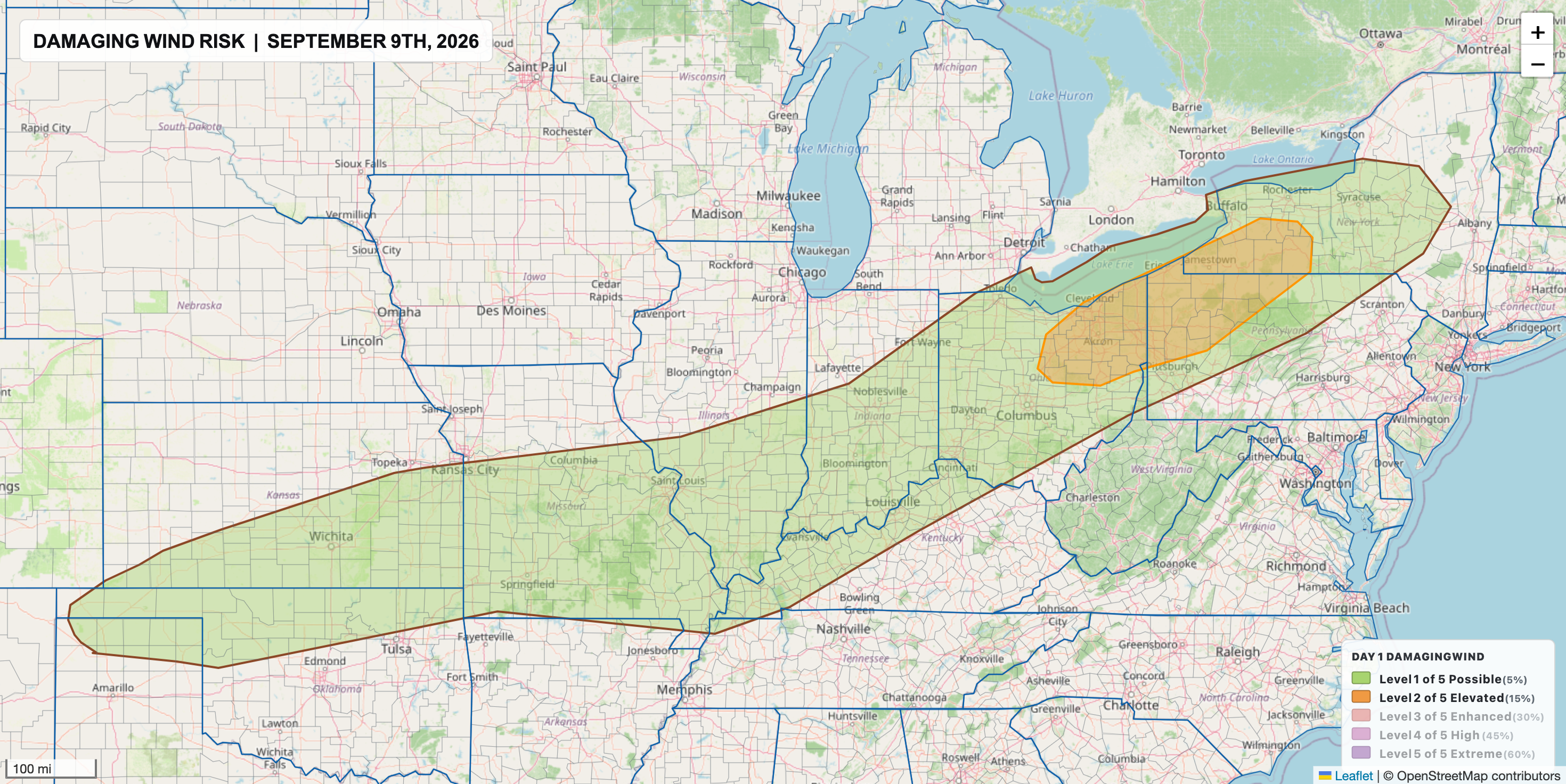
Farther west, scattered afternoon thunderstorms will also be possible from the Midwest and Mid-Mississippi Valley into the central and southern Plains. Wind shear will generally be weaker across this region, favoring disorganized clusters of thunderstorms with a more isolated damaging wind threat. A somewhat better-organized cluster could develop from the Mid-Mississippi Valley into western Kentucky and Tennessee, where stronger winds aloft may help storms maintain their intensity.
Heavy rainfall will be another concern, particularly from the Ohio Valley into the central Appalachians and Mid-Atlantic. A moisture-rich environment will be in place along the slow-moving frontal boundary, with storms capable of producing efficient, heavy rainfall. Storms may repeatedly track across some of the same areas, increasing the potential for localized flooding. The threat could be enhanced along the central Appalachians, where terrain will provide some additional lift.

A broader but lower-end heavy rain threat extends southwest through the lower Ohio and Mississippi valleys and into Oklahoma and northwest Texas. Plenty of moisture will remain available along the front, so locally heavy downpours are likely with thunderstorms. Confidence is lower regarding exactly where storms will repeatedly develop in this corridor, but localized pockets of excessive rainfall and flooding will remain possible.
Rainfall is likely to be highly variable with pockets of heavy rainfall and flash flooding expected to be isolated in nature. Here's a look at the next 36 hours of forecast precipitation from the NAM3 - this is not exactly how precipiation will be distributed, but notice the "splotchy" nature, rather than a broad area of widespread soaking rains.
