
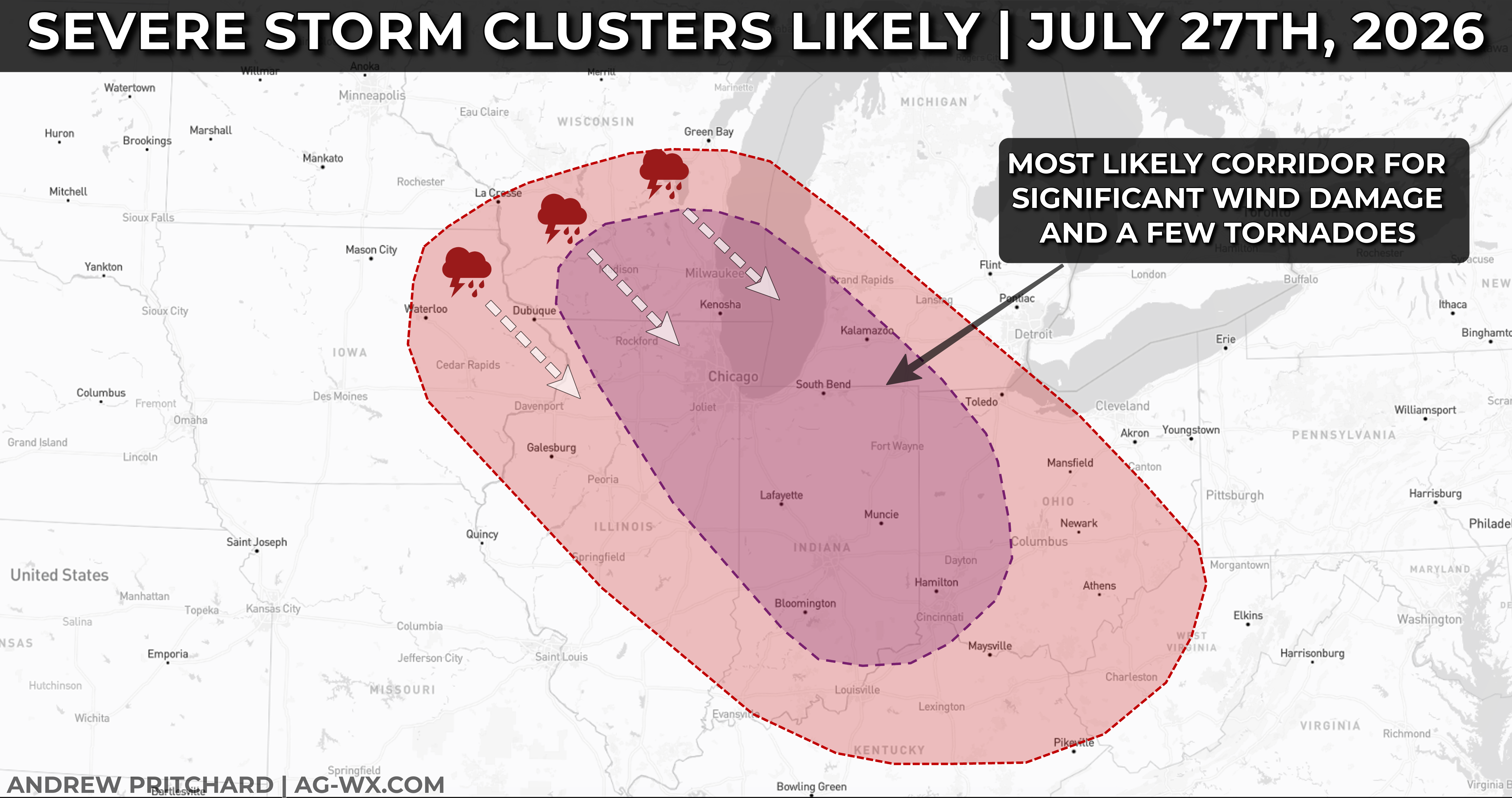
A highly uncertain, potentially high-impact severe weather situation exists today and tonight across portions of the Great Lakes and Midwest.
Building summertime heat and humidity will lead to an extremely unstable air mass in place across portions of southern Wisconsin, eastern Iowa, northern and central Illinois into northern Indiana, southern Michigan, and far northwest Ohio. An approaching storm system will interact with this environment and ignite scattered storm clusters that could produce significant wind damage with gusts over 70 mph, and a few tornadoes possible as they track south-southeast across the risk area today.
Storms are already ongoing across Lake Michigan and lower Michigan, and these storms may continue to increase in intensity as they track south into northern and eventually central Indiana and northwest Ohio. Additional storms may erupt further west where cumulus clouds are already percolating and threatening to developing into thunderstorms across eastern Iowa into southern Wisconsin. This activity would have the potential to produce severe weather impacts across northern and central Illinois into western Indiana.
Ultimately, when/where the worst storms erupt is quite uncertain as of 9 AM CT on Monday morning, but a broad area supports significant severe weather impacts from any storms that do develop through the afternoon, evening, and early overnight hours across the highlighted risk area.
