
We have many of the necessary ingredients coming together for significant severe weather impacts today, including the potential for a few tornadoes, damaging straight-line winds, and hail larger than 2 inches in diameter. The greatest risk is expected across northeast Iowa, southern Wisconsin, and northern Illinois. A more isolated, but still meaningful, severe weather threat may also extend into southern Michigan, northern and central Indiana, and east-central Illinois.

Clusters of thunderstorms developed overnight across Minnesota and Iowa and have since moved through portions of southern Wisconsin and northern Illinois. These storms have left behind an outflow boundary, a dividing line between rain-cooled air to the north and warm, humid air to the south. As sunshine returns through the morning and early afternoon, this stabilized air mass will begin to recover, allowing instability to increase rapidly with renewed storm development expected later in the day.
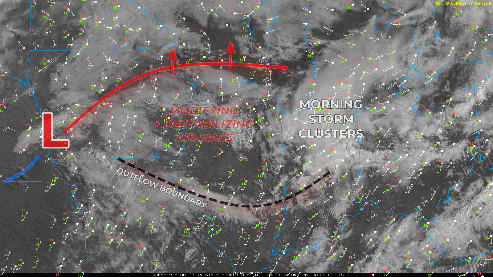
This environment will also become increasingly favorable for organized severe storms. Strong wind shear associated with an approaching upper-level disturbance, combined with localized spin along the outflow boundary and nearby warm front, will support the potential for storms to quickly intensify this afternoon and evening.
A few supercell thunderstorms are likely, capable of producing tornadoes, damaging winds, and large hail exceeding 2 inches in diameter. The most widespread and significant severe weather threat is expected Tuesday evening across northeast Iowa, northern Illinois, and southern Wisconsin.
A secondary area to watch extends along a residual outflow boundary draped from central Indiana westward into central Illinois. Some high-resolution models suggest isolated storm development in this corridor during the afternoon and evening, which could also pose a localized severe weather risk.
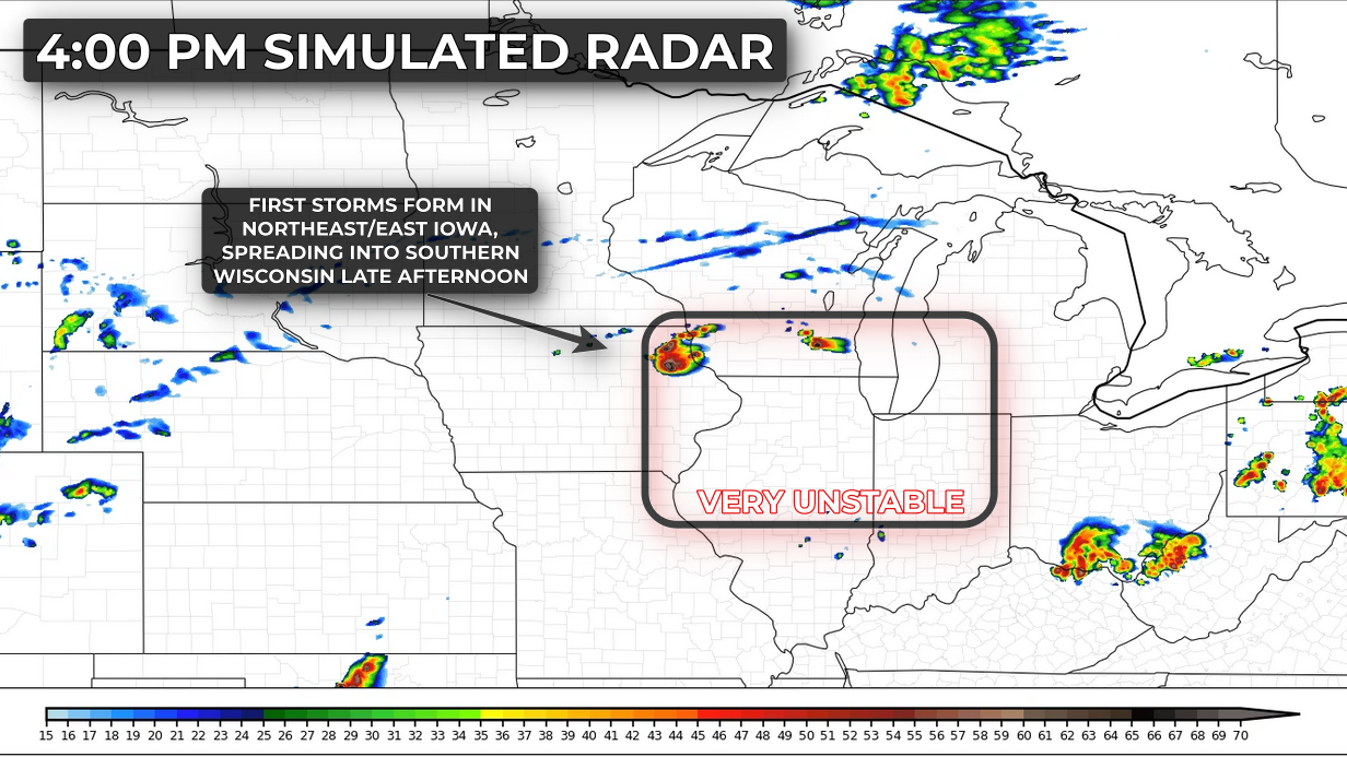
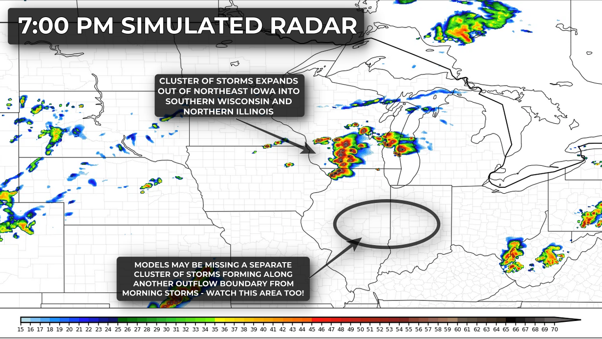
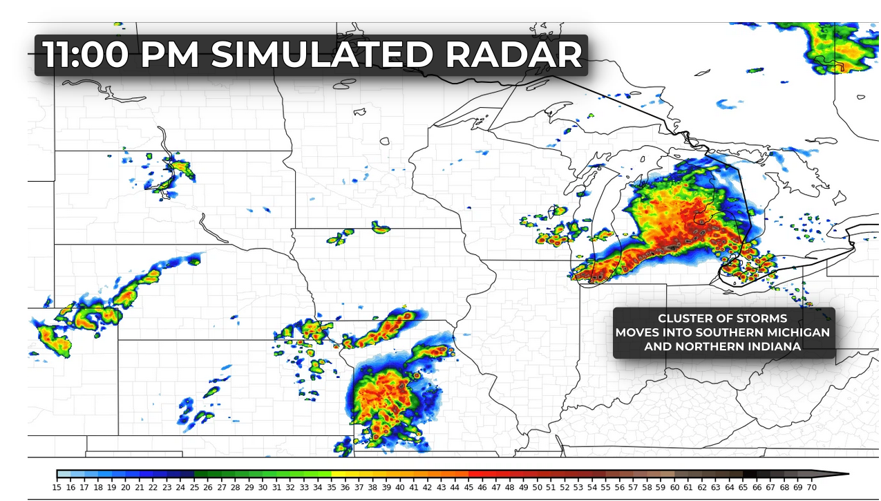
Storms across northern Illinois and southern Wisconsin may organize into a larger cluster and track eastward late this evening into the overnight hours, bringing a continued threat of damaging winds and isolated tornadoes into southern Michigan and northern Indiana.