
The broader weather pattern across North America continues to be dominanted by a persistent ridge of high pressure anchored over the south-central U.S. with deep monsoon moisture and ridge riding storm clusters providing corridors of heavy rainfall around the periphery.

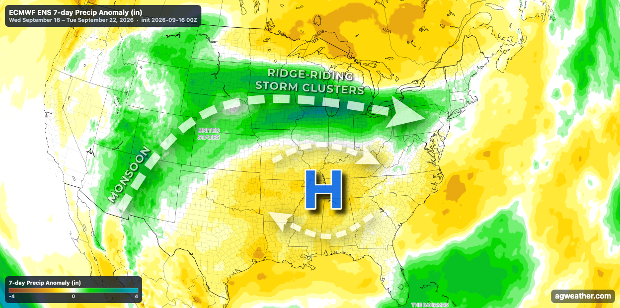
The result will be several more days of excessive heat across much of the Southern U.S. with daily chances for heavy rainfall, flash flooding, and isolated severe weather impacts from the Desert Southwest across the Plains and into the Midwest. The heaviest rain is likely to fall across portions of the Midwest, where another 2-4" of rain is possible across a swath of Iowa-Illinois-Indiana.


This pattern is expected to break down as we head into early next week, with a slow-down in rain chances and a shot of cooler, less humid air filtering into the Central, Southern, and Eastern U.S.