
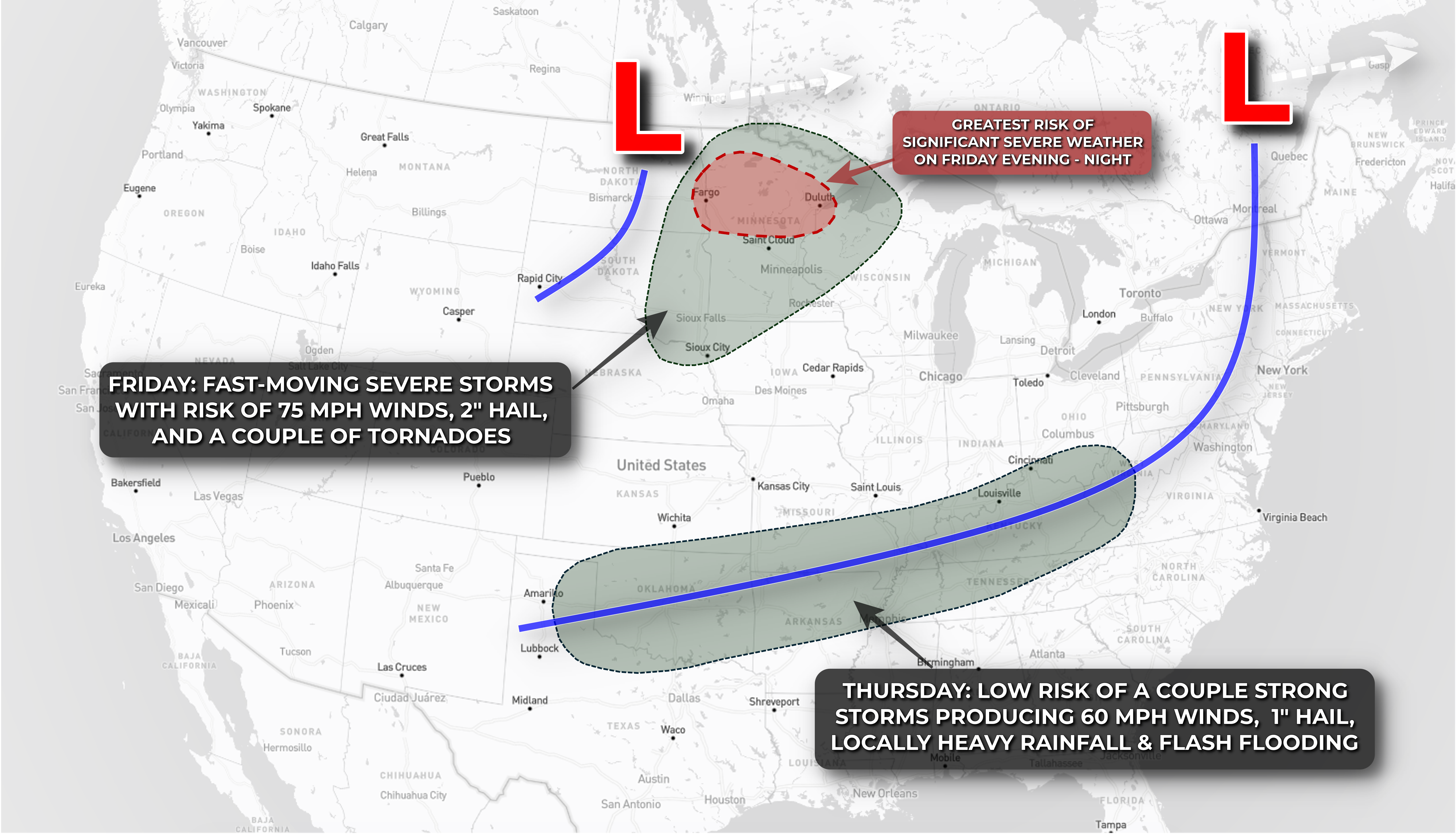
 Big upper-level low pressure systems continue to roll from west to east across Canada and the northern tier of the U.S. with frontal boundaries draped to their south serving as a focal point for thunderstorm activity from the Plains into the Great Lakes and Midwest.
After a several day journey from Minnesota and Iowa southeastward across the Upper and Middle Middissippi Valleys, a frontal boundary will mostly stall out from the Northeast, across the Ohio Valley, back toward the Southern Plains today. There's plenty of moisture along the front, and pockets of moderate instability, but the front has outrun jet stream support so there's not much wind shear to organize thunderstorm activity or promote and big risk for significant severe weather. Instead, expect pockets of gusty storms producing locally heavy rainfall anywhere from Oklahoma and Texas along the front into the Mid-Atlantic.

On Friday, a maturing area of low pressure with plenty of instability and upper-level support will swing out of the Dakotas into the Upper Midwest. This setup looks a little more volatile, with the potential for an organized cluster of storms producing significant severe weather to develop near the border of the Dakotas and Minnesota during the evening and race east into the overnight hours. The greatest risk for 70+ mph wind gusts, 2" hail, and a tornado or two is likely concentrated near the area of low pressure across northern and central Minnesota late Friday evening, but a rowdy severe storm or two is possible down the trailing cold front into northern Nebraska as well.

The pattern reloads over the weekend into early next week with renewed risks for strong to severe storms and locally heavy rainfall across the Plains and Midwest.