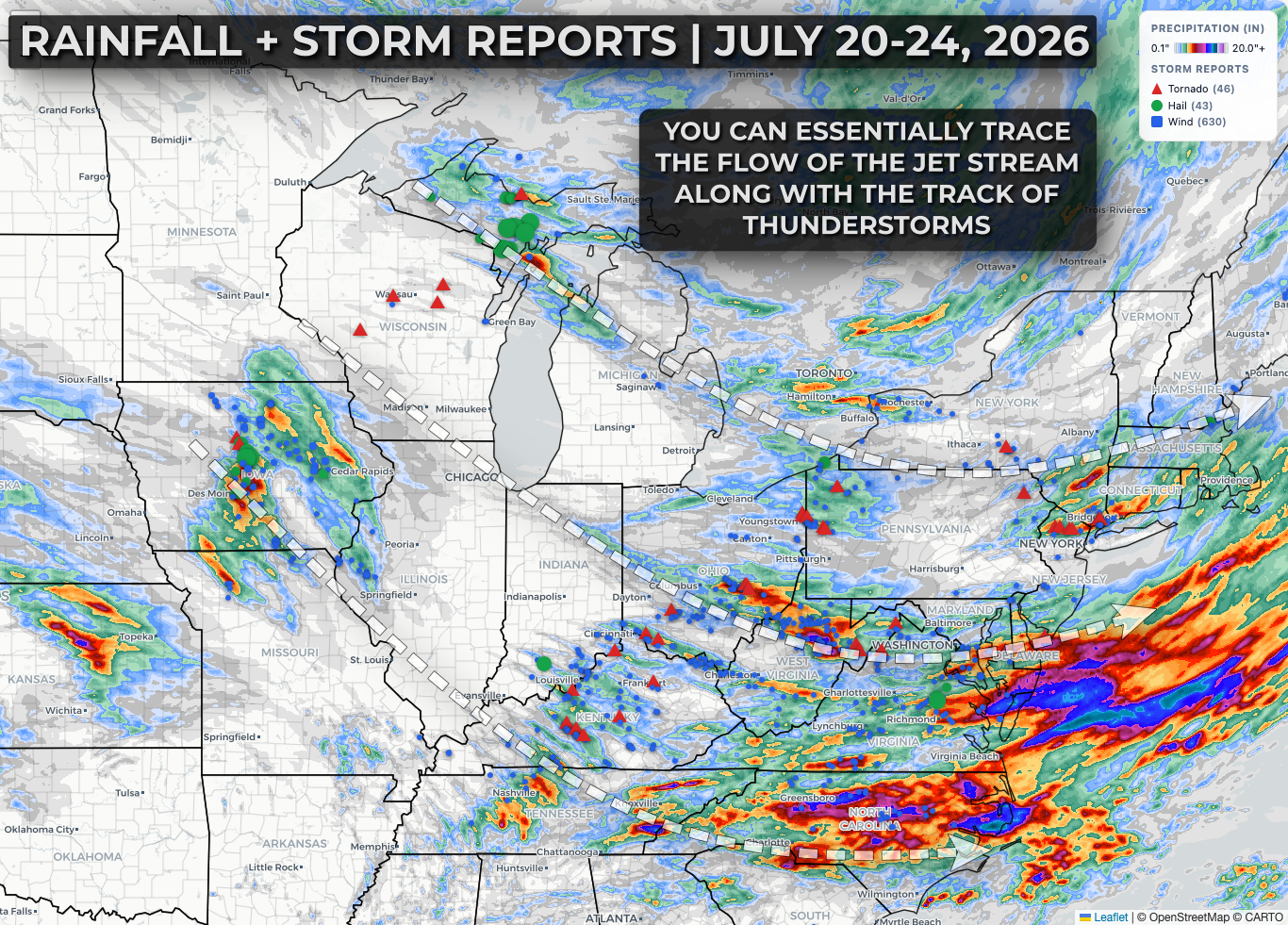
A pocket of stronger jet stream flow across the Upper Midwest and Great Lakes region fueled an active week of thunderstorms and severe weather impacts across the region.

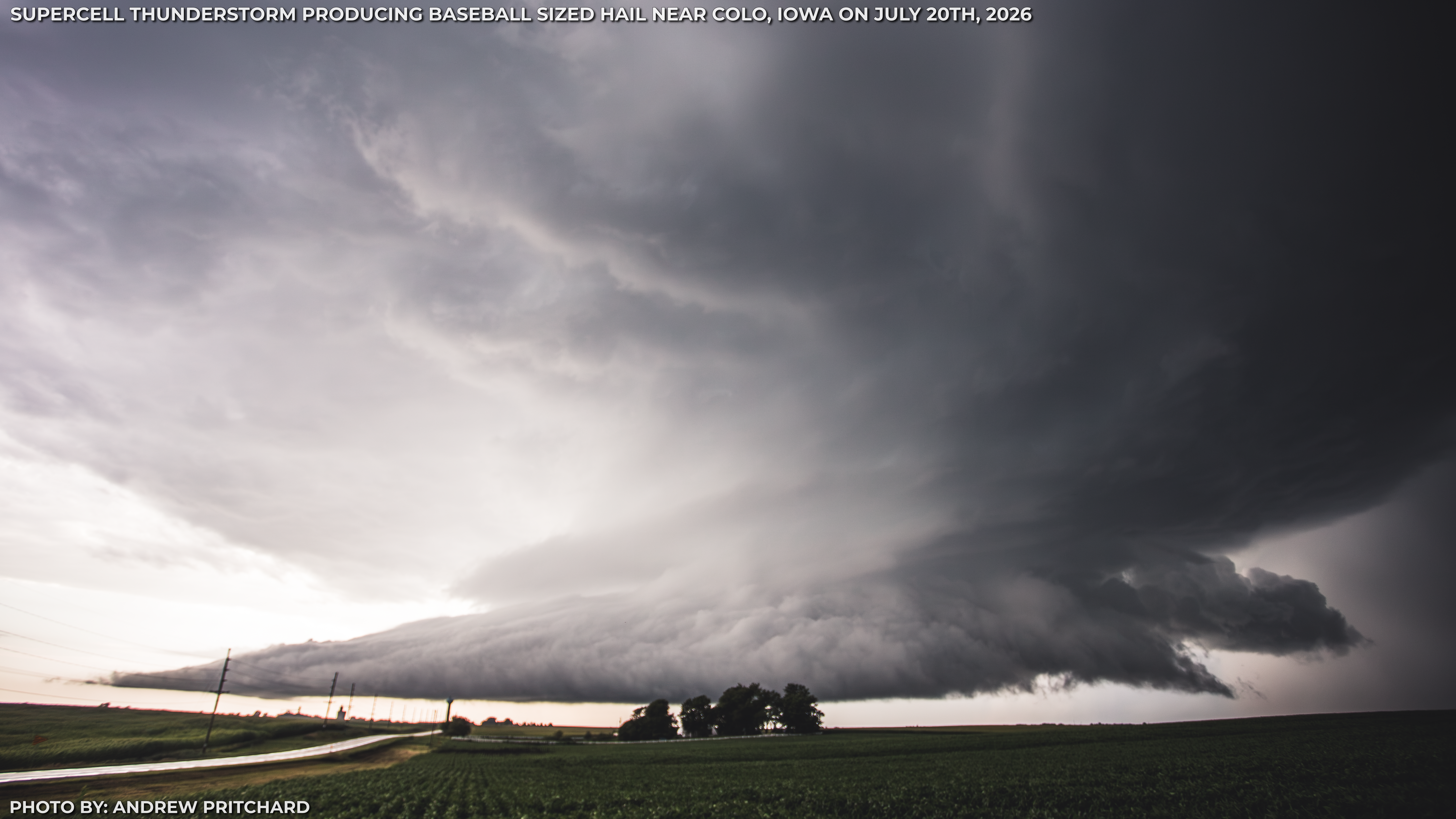
On Monday, July 20th supercell storms erupted from Iowa into Wisconsin and the U.P of Michigan with large hail and a few tornadoes. Repeated rounds of heavy rain and storms on Monday evening led to pockets of flash flooding across central and eastern Iowa as well.


On Tuesday, July 21st a regional outbreak of severe storms broke out across the Ohio Valley and Mid-Atlantic with numerous tornadoes and widespread impacts from damaging wind gusts over 65 mph.
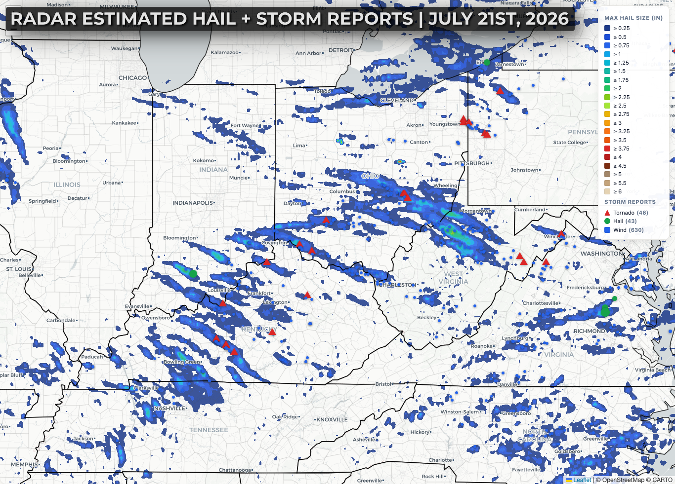
What's interesting is you can essentially trace the flow of the jet stream over the ridge out west and around the trough to the east by following the reports of severe weather reports and swaths of accumulated rainfall / estimated hail.