
After a run of active weather systems brought much-needed drought relief along with severe storms to parts of the Southern Plains and Midwest in late February and early March, the overall pattern across the United States appears to quiet down for the next couple of weeks.
An expansive ridge of high pressure is expected to establish itself across the western United States, placing much of North America in a classic ridge-west, trough-east pattern. This setup typically favors quieter weather across much of the Lower 48. As the ridge strengthens, a period of warmer-than-average temperatures is expected to expand from the western United States into the Plains during the latter half of March. Some locations in the West and central U.S. could approach record warmth, while the Midwest trends toward mild, early-spring conditions.

Forecast models currently show very little support for strong storm systems ejecting across the Rockies in the near term. Instead, the pattern may transition from the western ridge in week one toward a faster, more zonal flow across the northern United States in week two. This could allow a few weak “clipper-type” systems to move across the country. These systems tend to be fast-moving and moisture-limited, so while they may bring occasional chances for showers or thunderstorms, widespread precipitation or high-impact severe weather appears unlikely through most of the March 17–31 timeframe.
There is a chance that one or two cold fronts could move through the central United States during the March 24–31 period as disturbances ride over the top of the western ridge. These fronts could bring scattered rainfall and perhaps a limited severe weather risk in some areas, but confidence in any specific event remains low at this range.
Looking farther ahead, some longer-range signals suggest the pattern could become more active again as we move into early April. One factor forecasters are watching is the Madden-Julian Oscillation (MJO), a maritime atmospheric signal that can influence weather patterns across North America. Current forecasts suggest the MJO may strengthen and move through phases that historically favor a more active storm track across the United States in the 2–3 week timeframe.

Global ensemble guidance is also beginning to hint at a gradual shift toward a wetter pattern from Texas through the Midwest and into the Great Lakes during early April. This would coincide with a potential transition toward a trough developing in the western United States and a ridge building over the East — a configuration that often supports more frequent storm systems across the central part of the country.
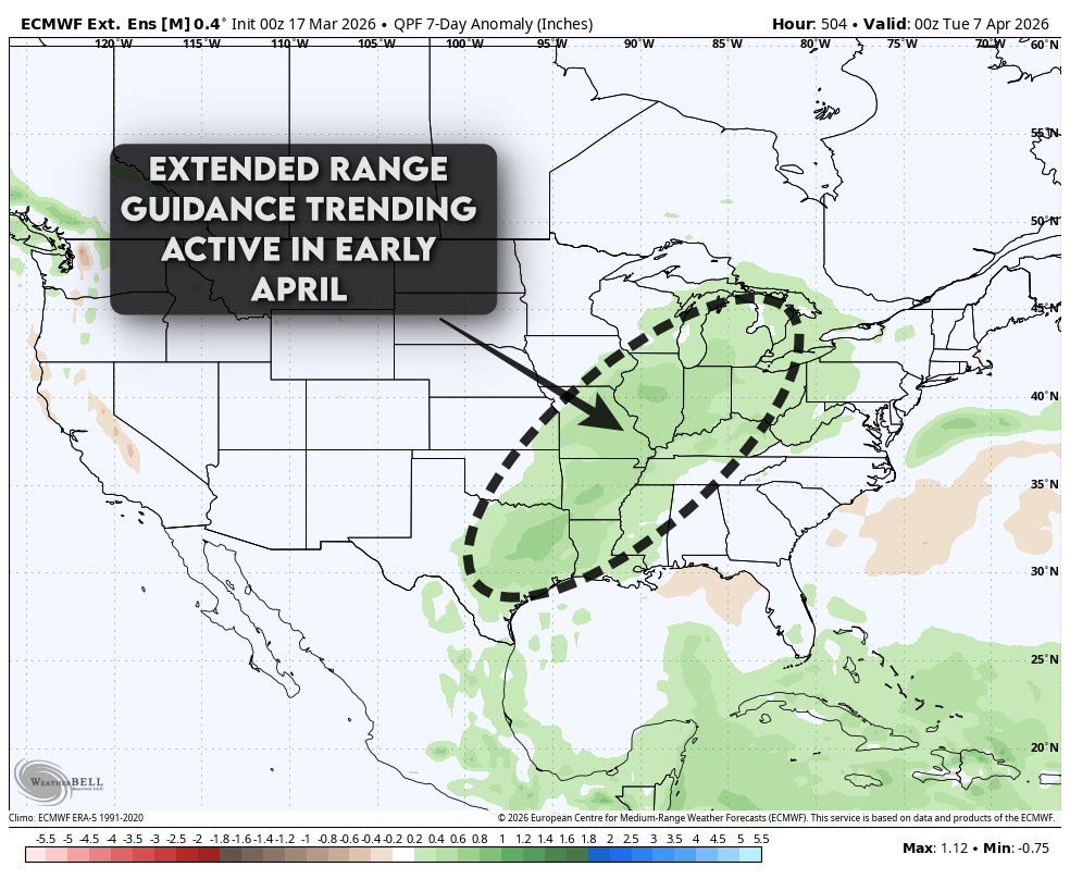
While there are no specific storm systems to highlight at this time, the current quiet pattern expected through late March may give way to a more active period of rainfall and severe weather potential as we move into early April. For now, the next couple of weeks should feature generally mild temperatures and relatively limited storm activity across much of the central United States, offering a brief stretch of calmer early-spring weather before the pattern potentially turns more active again.