
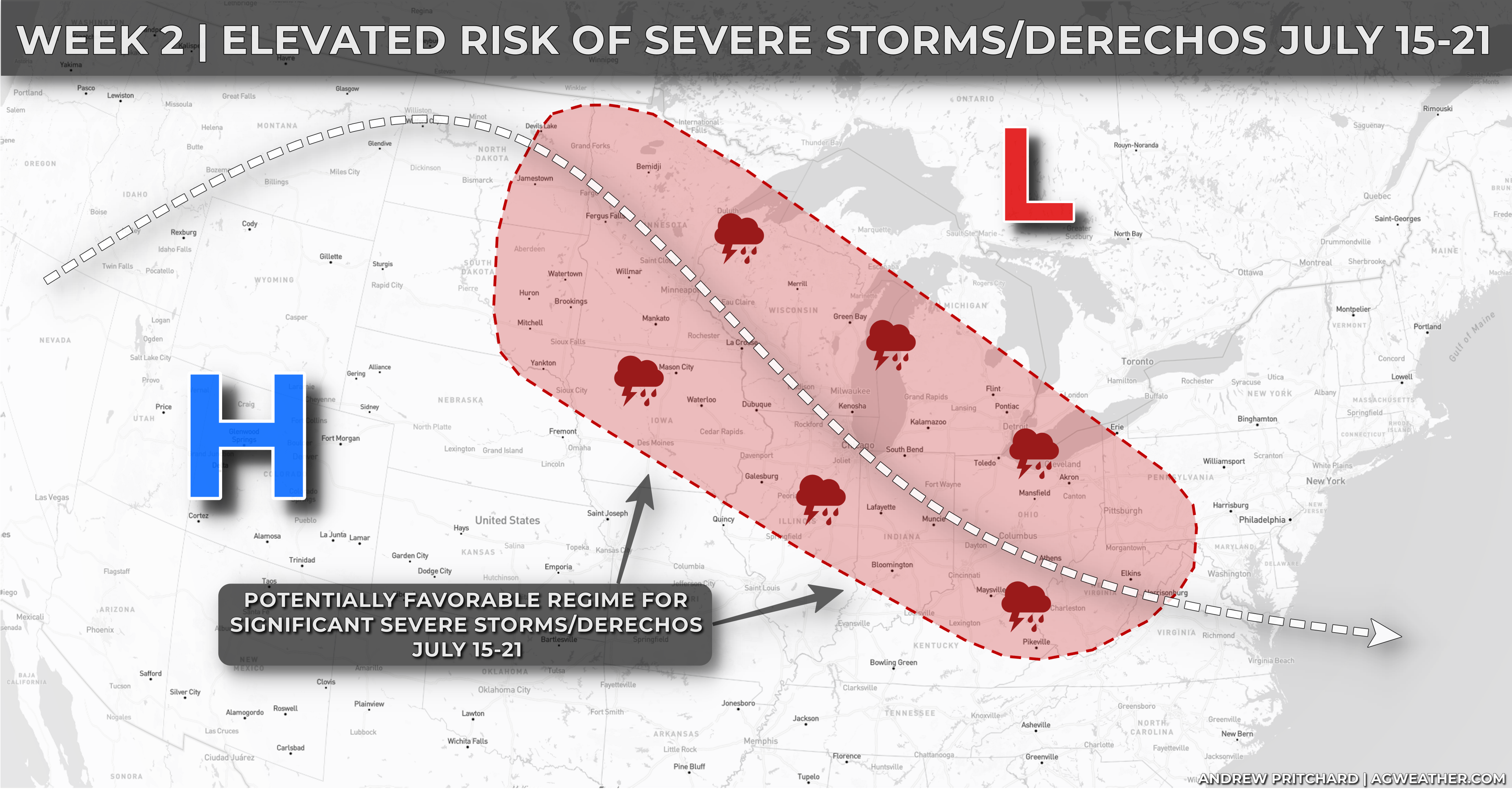
A retrograding ridge of high pressure, combined with a strong surge of jet stream momentum riding over the top of it, may result in a favorable pattern for ridge-riding thunderstorm clusters and potentially significant severe weather.
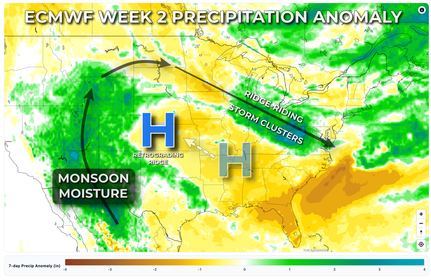
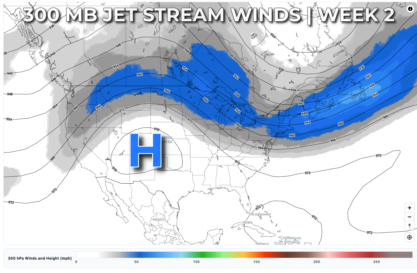
This remains highly speculative for now, as model inconsistency is still quite high when it comes to the details, which is typical at this time of year. That being said, there appears to be growing agreement among the global ensemble guidance that a burst of stronger jet stream flow will develop along the U.S./Canada border, with enhanced northwest flow extending across the Great Lakes. This stronger flow would likely separate an area of intense heat centered over the Central and Southern Plains from cooler air across Ontario, Quebec, and the northeastern United States. Along this thermal gradient, widespread heat and humidity should allow a highly unstable atmosphere to repeatedly reload from the Dakotas into Minnesota and Iowa, then eastward through the Great Lakes and eastern Corn Belt.
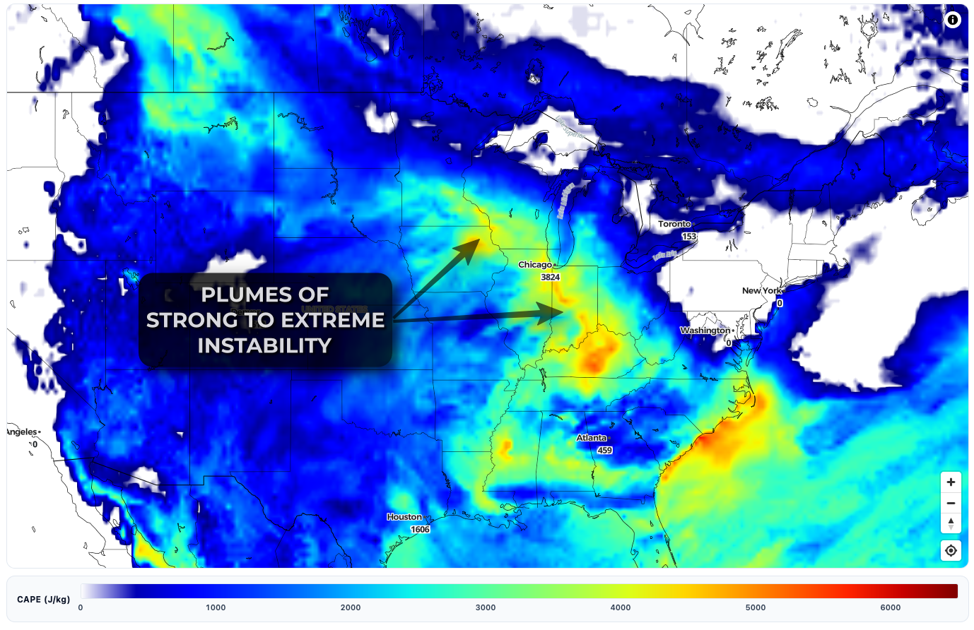
The resulting pattern could support multiple days of severe thunderstorm potential, with hot temperatures, high dew points, and extreme instability residing beneath enhanced northwest flow punctuated by passing shortwave disturbances capable of initiating organized storm clusters. If the timing between an incoming shortwave and peak instability aligns, episodes of significant severe weather would be possible. The most common hazards associated with this type of mid- to late-summer pattern include widespread damaging straight-line winds, isolated tornadoes, and flash flooding. Derechos are notoriously difficult to predict even hours in advance, let alone days, but this is a classic large-scale pattern that deserves close attention for the potential of high-end wind events.
This potential will continue to evolve over the coming days, but at this point the corridor of greatest concern appears to extend from the Dakotas across Minnesota and Iowa into Wisconsin, Illinois, Indiana, and Ohio during the Week 2 period, roughly July 15–21.