
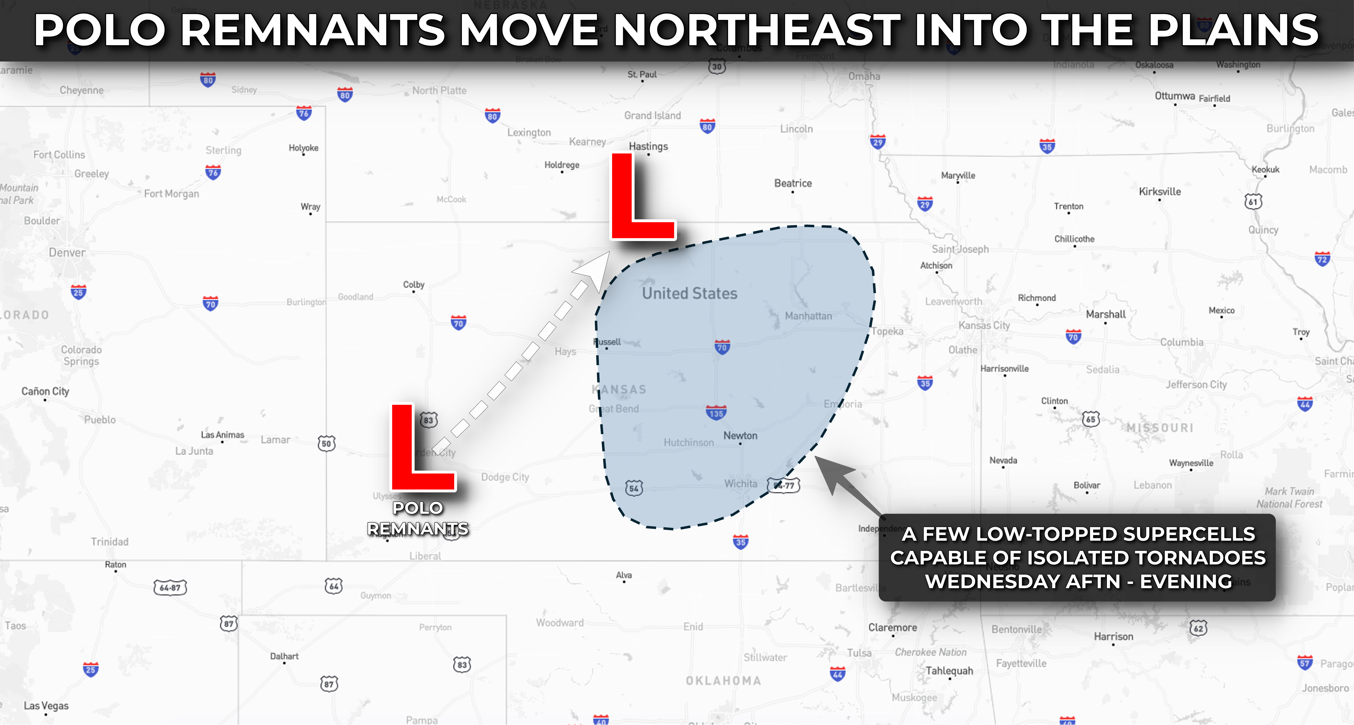
The remnants of Hurricane Polo, in tandem with an upper-level trough overspreading the Plains, will lead to a localized risk for rotating storms and perhaps a few tornadoes across portions of northern, central, and eastern Kansas on Wednesday afternoon and evening.
Limiting the risk today will be rather meager instability, with generally cloudy and cooler conditions prevailing ahead of the approaching surface low and upper-level disturbance. Should a few pockets of sunshine materialize across central Kansas midday Wednesday, a greater risk for a few tornadoes could emerge.


The remnants of Polo's circulation continue to wrap up into a rather tight surface low that will lift into central Kansas early this afternoon. A strong low-level jet will provide sufficient shear in the lower levels of the atmosphere, aiding in storm organization and perhaps fostering some rotation should sustained storms erupt just ahead of the surface low and trailing front across northern and central Kansas. This activity may eventually lift into northeast Kansas this evening.
The overall magnitude of today's severe weather risk will be limited by lower instability, but abundant low-level shear may compensate and lead to a couple of stronger storms capable of producing wind gusts over 60 mph and a few tornadoes.