
The Southern Plains and Midwest remain red hot with severe weather activity as we move into the climatological peak of the season across the United States. Damaging tornadoes touched down in Oklahoma on Thursday evening, produced by a pair of intense supercell thunderstorms that developed along the Interstate 35 corridor.

A series of storm systems will keep severe weather in the forecast through the weekend and into early next week, with additional tornadoes, large hail, and damaging straight-line winds all possible.
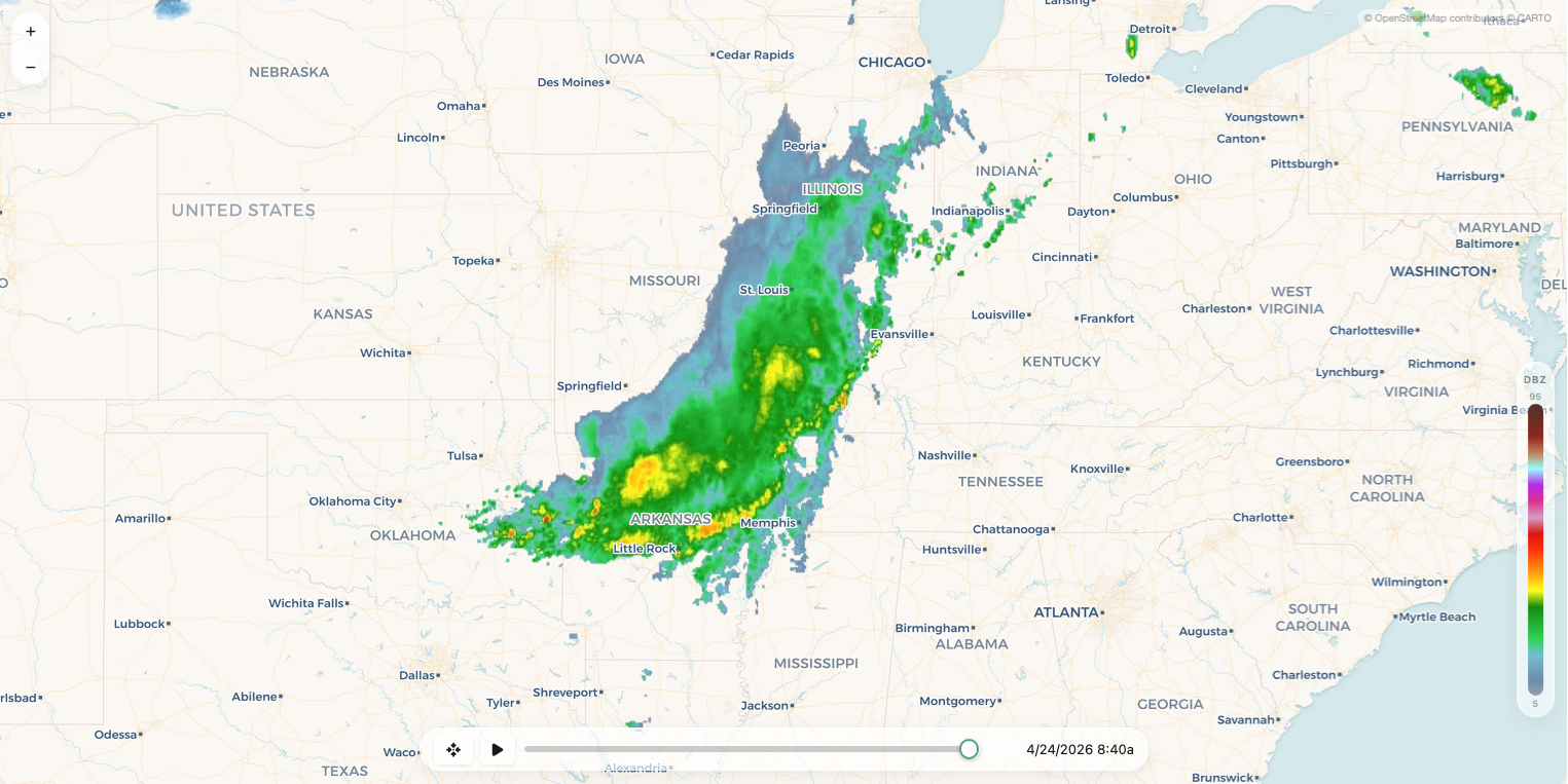
Storms from Thursday evening organized into a large MCS that drifted southeast across the Ozarks overnight. Some areas of northeast Oklahoma and northwest Arkansas picked up 1–2"+ rainfall totals. These storms may continue to pose a low-end severe weather risk as they weaken through midday Friday. Along the boundary between rain-cooled air to the north and untouched air to the south, additional thunderstorms may develop Friday afternoon. Wind shear won’t be particularly strong, but the presence of this outflow boundary and enhanced vorticity along it means any storm that develops could produce an isolated tornado or two.

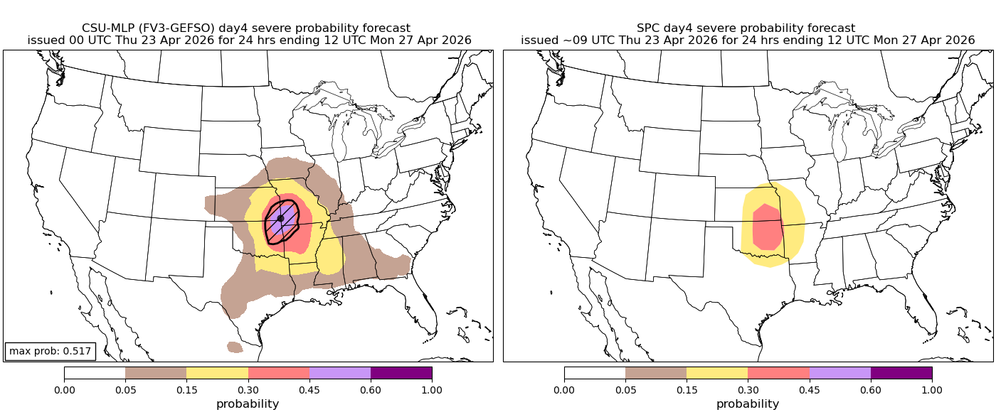
More boom-or-bust potential exists on Saturday and Sunday as the dryline sharpens across portions of Kansas, Oklahoma, and Texas. Increasingly strong jet stream support could lead to isolated or widely scattered supercell thunderstorms capable of producing tornadoes and large hail along the dryline during the evening hours.
Saturday and Sunday severe weather probabilistic forecasts (left) and SPC risk forecast (right):

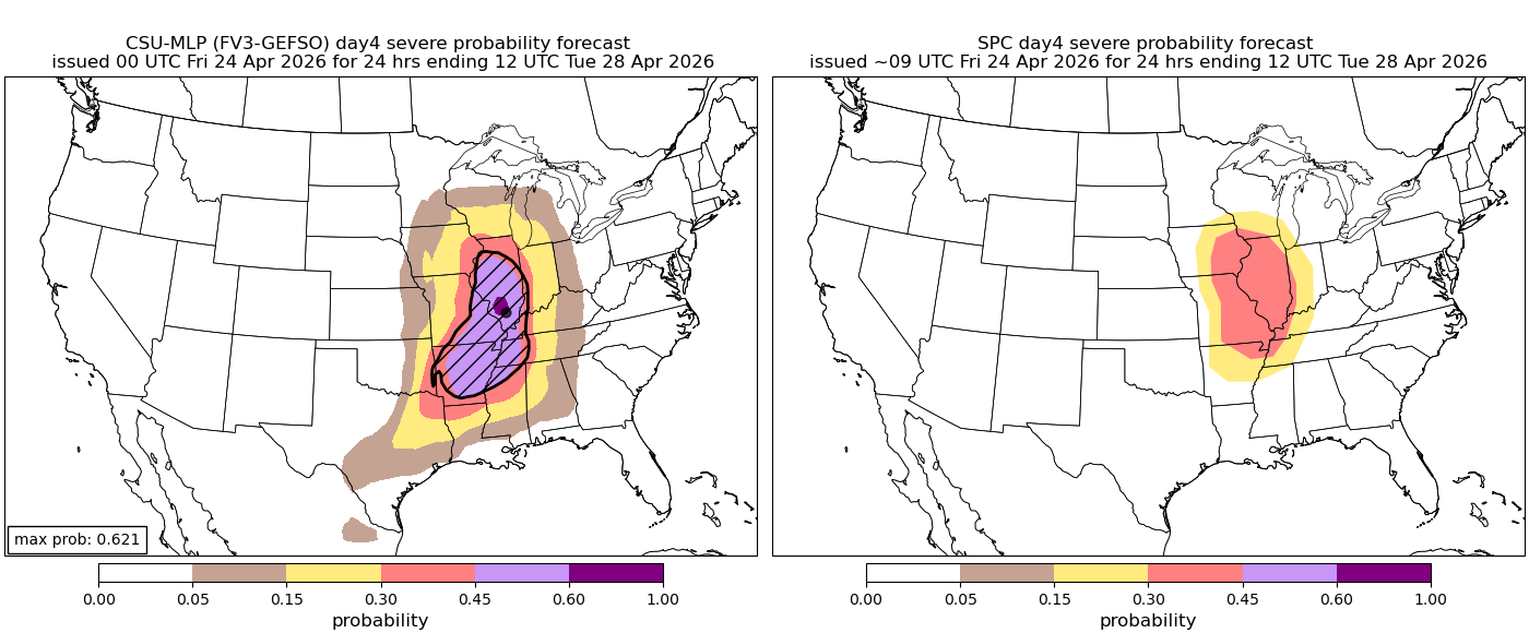
A more significant and widespread severe weather risk appears likely on Monday as a potent storm system lifts into the Midwest. This system will provide sufficient wind shear for organized severe storms while also advecting a pronounced elevated mixed layer (EML) into the region. That combination can create explosive instability while also maintaining a cap, delaying storm development until late in the day when conditions are most favorable. These are classic ingredients for higher-end severe weather events across the central U.S.
Monday severe weather probabilistic forecast (left) and SPC risk forecast (right):
We’ll continue to update this blog through the weekend as these day-to-day severe weather threats evolve across the Plains and Midwest.