
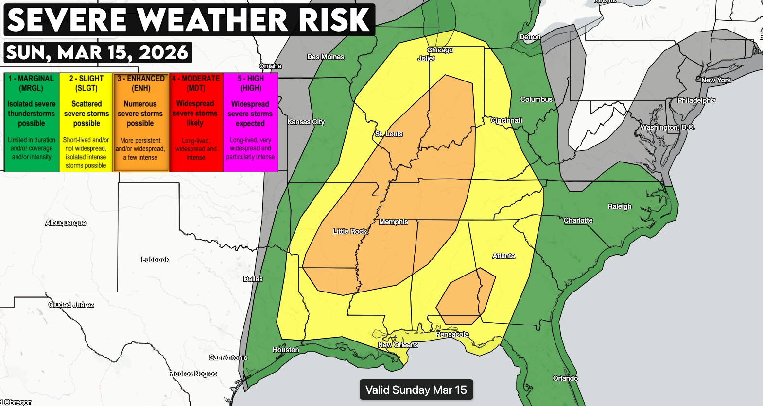
Sunday: A powerful storm system will initiate a high-volume, widespread severe weather threat across much of the central and eastern United States Sunday afternoon through Sunday night. A deepening area of low pressure tracking from Missouri toward the Great Lakes will pull warm, moist air northward while extremely strong winds just above the surface create a favorable environment for organized severe thunderstorms.

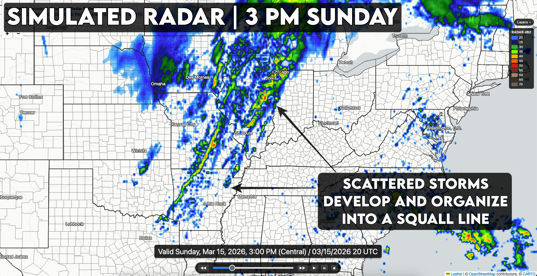
Storms are expected to increase in coverage around midday as a strong cold front moves east across the Mid-South and Midwest with the first storms developing from Missouri into Arkansas and Louisiana. Some storms ahead of the front may briefly become supercells capable of producing tornadoes, though the fast-moving nature of the system should cause storms to organize quickly into a line. Even so, a conditional risk for a few significant tornadoes will exist during the afternoon and early evening where storms can remain more isolated.
As the cold front pushes east, thunderstorms are expected to organize into a fast-moving squall line capable of widespread damaging winds and embedded tornadoes. Very strong winds just above the surface will allow storms to transfer that momentum to the ground, increasing the risk for pockets of significant wind damage. The severe weather threat will likely continue through Sunday evening and overnight as storms sweep eastward from the Ohio and Tennessee Valleys into the Appalachians, Mid-Atlantic, and parts of the Southeast.
Monday: Showers may occur early in the day, but these should lift northward and allow for some breaks of sunshine and gradual destabilization across parts of the Mid-Atlantic and Southeast. As a surface trough deepens and winds near the ground strengthen and turn more southerly, conditions will become increasingly favorable for severe thunderstorms by the afternoon.
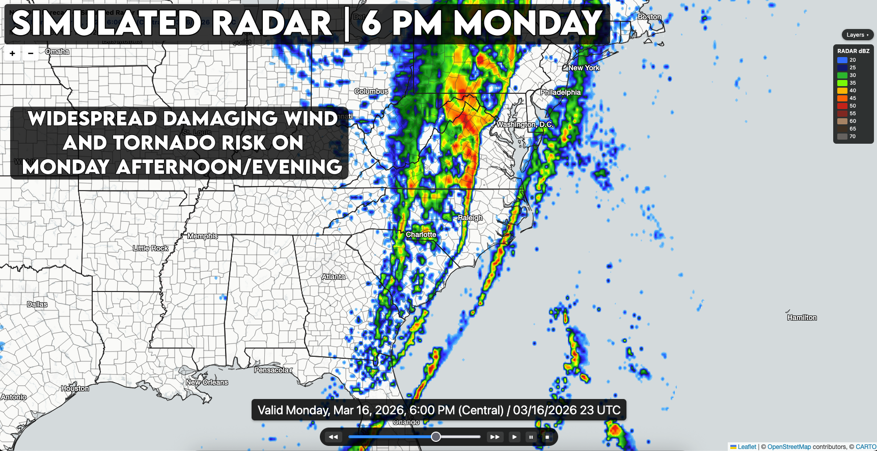
Storms that develop ahead of the advancing cold front may organize into supercells capable of producing tornadoes, particularly from South Carolina into North Carolina and southern Virginia. Very strong wind shear in the lower atmosphere will support rotating storms, and if sufficient instability develops, a few strong, potentially long-track tornadoes will be possible, with storms moving quickly northeast at over 50 mph.
Farther north and later in the day, thunderstorms are expected to consolidate into a well-organized line of storms extending from the Carolinas into parts of the Mid-Atlantic and southern New York. This line will pose a threat for widespread damaging winds and embedded tornadoes, especially across North Carolina, Virginia, Maryland, and southern Pennsylvania during the late afternoon and evening. Storm intensity may gradually weaken closer to the coast later in the evening as storms encounter cooler marine air moving inland from the Atlantic.
](/assets/news/legacy/20260315221021-3-15-9-pm.png)
](/assets/news/legacy/20260315221103-3-16-3-am.png)
](/assets/news/legacy/20260315221127-3-16-12-pm.png)
](/assets/news/legacy/20260315221152-3-16-6-pm.png)