
Another active stretch of organized, potentially damaging severe storms begins today and lasts through much of the coming week as an upper-level trough slowly works east along the U.S. - Canada border.
As stronger jet stream flow begins to emerge over the High Plains and deep Gulf Moisture begins to flow northward on an increasingly strong low-level jet, scattered severe storms are expected to develop this afternoon across portions of Colorado, Nebraska, and Kansas. Additional isolated strong storms are possible across the Midwest and Northern Plains. The risk only ramps up from here.
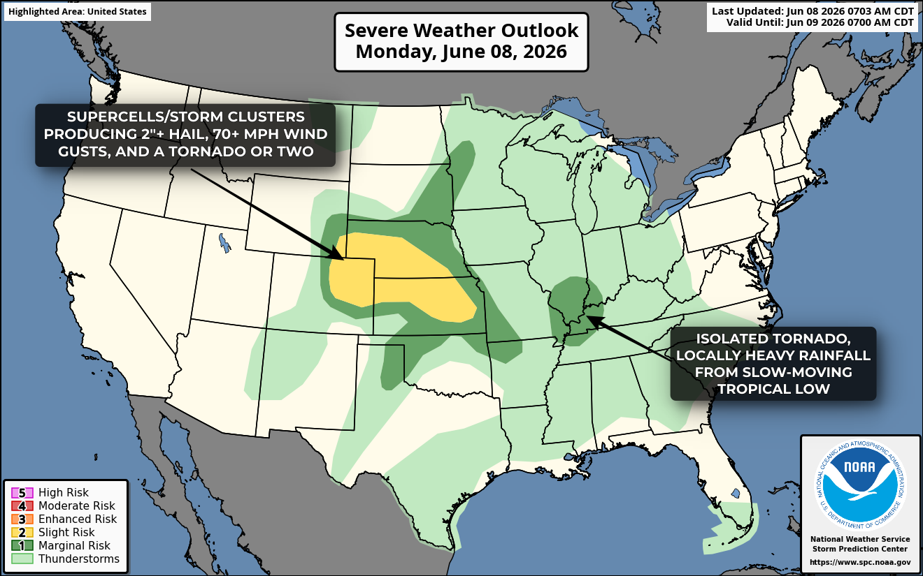
A volatile environment will be in place from the Canadian border southerward into the Dakotas on Tuesday, with numerous severe thunderstorms expected to develop during the afternoon and evenings hours. The risk for tornadoes will be highest with initial supercell storms that develop near the surface low in North Dakota and southern Manitoba, with an eventual upscale growth into a big squall line or bow echo and a transition to a predominantly wind damage risk early Monday night across the central and eastern Dakotas. Isolated severe storms may also develop further south down the dryline into South Dakota and Nebraska, with a risk for hail over 2" in diameter, severe winds, and an isolated tornado.

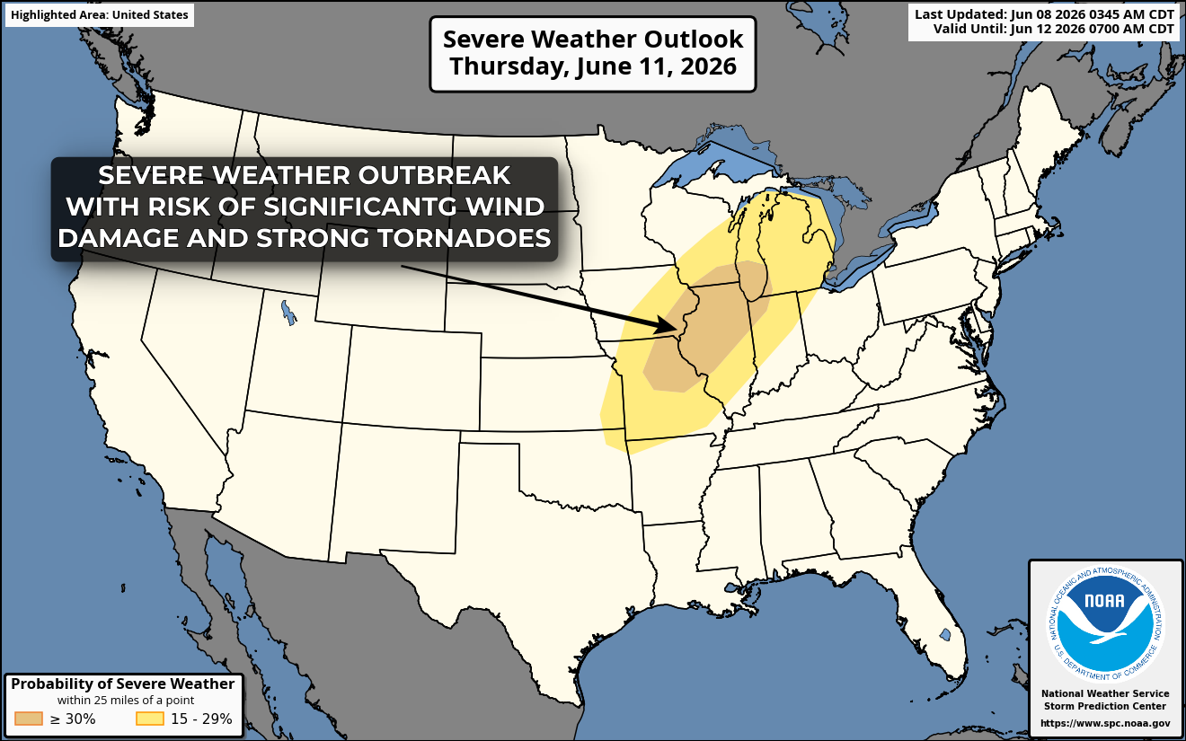
On Wednesday and Thursday the risk shifts east into the Midwest, with two days of extreme instability with seasonally strong jet stream flow aloft leading to a potential two-day severe weather outbreak featuring strong tornadoes and significant wind damage across portions of Iowa, Illinois, Wisconsin, and Minnesota.

More detailed analyses of each day to come!