
A powerful storm system will move out of the Plains into the Upper Midwest on Friday, bringing strong winds aloft and a warm, unstable air mass northward across the region. This combination will support widespread thunderstorm development, some of which will become severe.
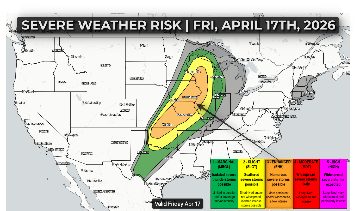
Midday to Early Afternoon (Late Morning – 3 PM): Thunderstorms are expected to develop from far southeastern Nebraska and Kansas into Iowa, southern Minnesota, and perhaps western Wisconsin and northwest Illinois. Initial storms may be more isolated, with the potential to become supercells capable of large hail and tornadoes, especially across Iowa, northern Missouri, northwest Illinois, and western Wisconsin.
Afternoon to Early Evening (3 PM – 7 PM): Storms are expected to rapidly increase in coverage and organize into a line of severe thunderstorms extending from the Wisconsin-Iowa-Illinois border region into Missouri and eastern Kansas. This will be the beginning of a more widespread severe weather threat.
Evening to Overnight (7 PM – Midnight+): The line of storms will move east across the Mississippi River into Illinois, Wisconsin, and eventually toward Michigan and Indiana. During this phase, the primary threat will shift toward damaging straight-line winds, though isolated tornadoes and hail will remain possible.
Main Hazards Damaging Winds: Widespread damaging wind gusts are likely, with the potential for significant swaths of wind damage from gusts over 70 mph. Very Large Hail: Early, more isolated storms may produce hail over 2 inches in diameter, particularly across parts of Nebraska, Kansas, and Iowa. Tornadoes: A corridor from northeast Iowa into central Wisconsin and northern Illinois may see an increased risk for tornadoes, including the potential for a few stronger tornadoes during the afternoon and early evening.
Further south, a more isolated and conditional risk exists Friday evening into the overnight hours across parts of west Texas into western Oklahoma along the dryline. If storms develop in this region, large hail would be the primary concern.
More details on timing/impacts on Friday morning as they become more clear.