
Today’s severe weather setup across the Central and Southern Plains comes with a fair amount of uncertainty, but any severe storms that do develop across today's risk area could be highly impactful with a few tornadoes, hail over 2", and 60 mph wind gusts possible.
We’re watching two primary areas today:

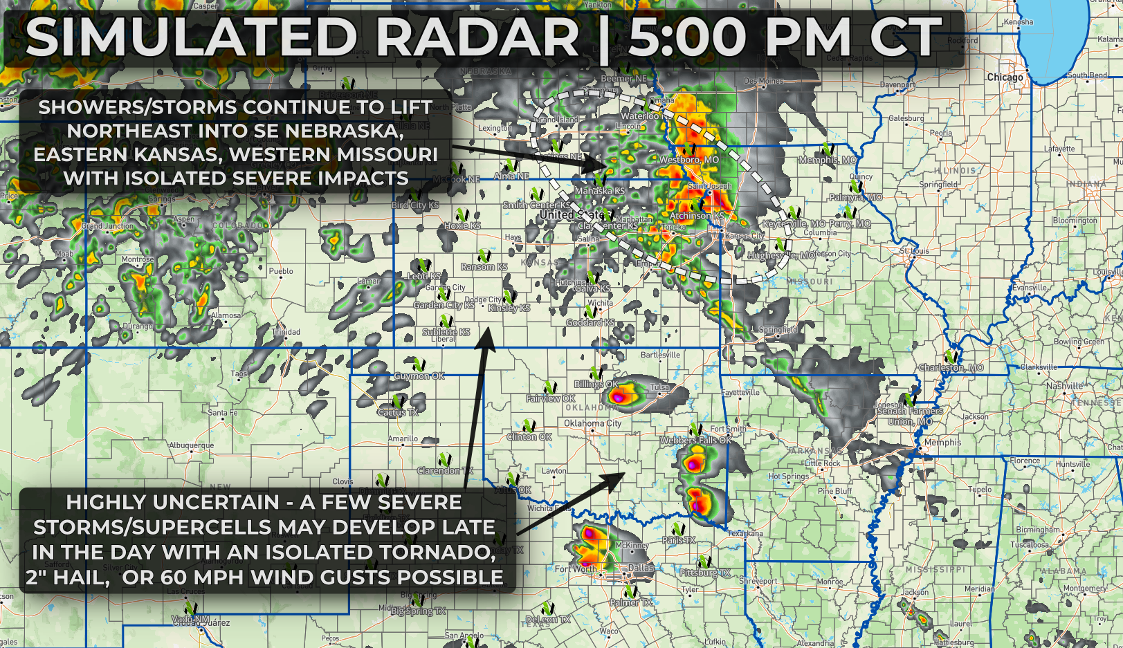
Across eastern Kansas, southeast Nebraska, southwest Iowa, into western Missouri, clusters of showers and thunderstorms are expected to gradually lift northeast through the day and into tonight.
Some of this activity may remain mostly sub-severe for a time, but the environment is supportive of organized storms capable of producing large hail, potentially over 2 inches in diameter. If storms can become better organized (and surface based) later this afternoon or evening, the threat could transition more toward damaging winds, especially as storms try to organize into a cluster moving into Missouri overnight.
A brief tornado can’t be ruled out in this zone, but the primary concern here looks to be hail early, transitioning to wind later.
Farther southwest, from western and central Kansas into northern Oklahoma, the setup becomes more conditional—but also carries a higher ceiling if storms can get going.
Strong instability will be in place along a sharpening dryline, with a developing surface low and strengthening jet stream support arriving into the evening. The challenge is storm initiation and coverage, there’s still some question as to whether storms can break through a lingering cap during peak heating.
If they do, however, a few supercells could quickly become intense, with the potential for very large hail (2–3”+), a couple of tornadoes, and wind gusts over 70 mph.
Low-level wind fields are expected to improve into the evening, which means any storm that can form and hold together may become more efficient at producing tornadoes during the late evening and early overnight.
Storm coverage from this second, later round further west is expected to be rather sparse, meaning most will not see severe weather impacts, but those who do see storms approach should be aware of the higher end severe weather potential.
We’ll continue to monitor trends closely, especially regarding storm development along the dryline, as that will ultimately determine how significant today’s severe weather threat becomes.
Here's an early look at the HRRR and how it handles the evolution of today's storms:

](/assets/news/legacy/20260426184814-4-26-26-9-PM.png)