
Thunderstorms are expected to develop and track along the Gulf Coast today into tonight, bringing a combination of heavy rainfall and a low-end severe weather threat from Texas to Florida. The setup is being driven by a disturbance moving out of northern Mexico interacting with a stalled frontal boundary draped across south Texas and the Gulf Coast, providing a focus for storm development as deep Gulf moisture continues to stream northward into the region.
FRIDAY AM RADAR:

500 MB HEIGH PATTERN:


Storms should develop across south and southeast Texas through the morning and afternoon, particularly along and just north of the front. A few storms in this area could become strong, capable of producing large hail and isolated damaging wind gusts, especially near the middle Texas Coast north of Corpus Christi. The severe threat should gradually diminish later in the day as the most unstable air shifts offshore into the Gulf.
As the system moves east, attention turns to the central and eastern Gulf Coast tonight, including Louisiana, Mississippi, Alabama, and eventually the Florida Panhandle. Thunderstorms are expected to redevelop and increase in coverage through the evening and overnight hours, supported by a very moist and unstable air mass. While the overall severe threat remains somewhat limited, a few stronger storms could still produce gusty winds and small hail. If storms are able to organize into clusters overnight, there is some potential for localized wind damage, particularly near the coast.

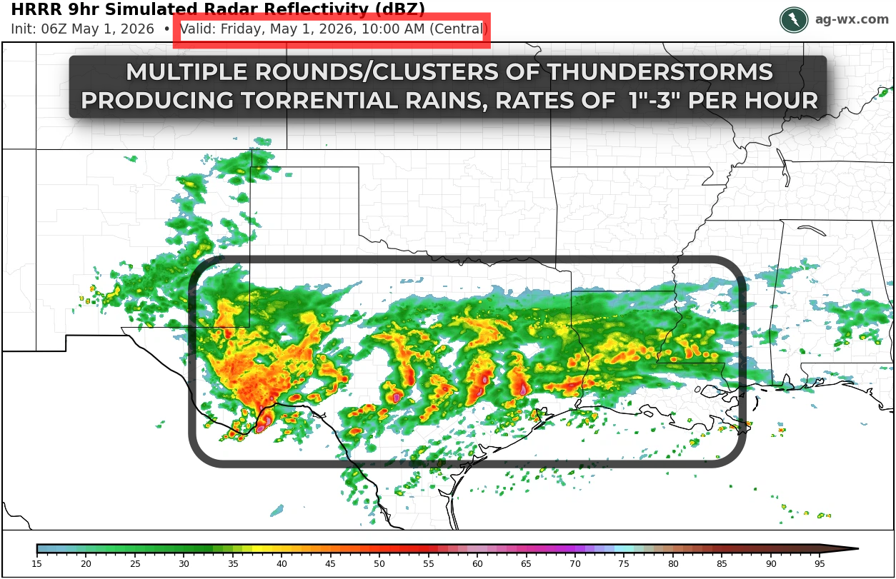

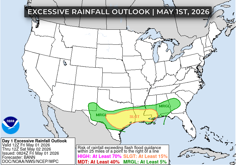
The greater concern with this setup is the potential for heavy rainfall and flash flooding. An axis of deeper moisture and instability is expected to support repeated rounds of thunderstorms from eastern Texas into Louisiana and southern Mississippi, where rainfall rates could reach one to three inches per hour. With some areas already seeing recent rainfall and saturated soils, it will not take much additional rain to produce localized flash flooding, especially in low-lying or poor drainage areas. Farther east, the flood risk is lower but not zero, particularly where storms track over the same locations.
This is a fairly typical Gulf Coast pattern where severe weather is not widespread, but the combination of deep moisture and slow-moving storms can lead to impactful rainfall. Conditions will be favorable for periods of heavy rain through tonight, especially from eastern Texas into Louisiana and southern Mississippi, where the greatest risk for flooding will exist.

