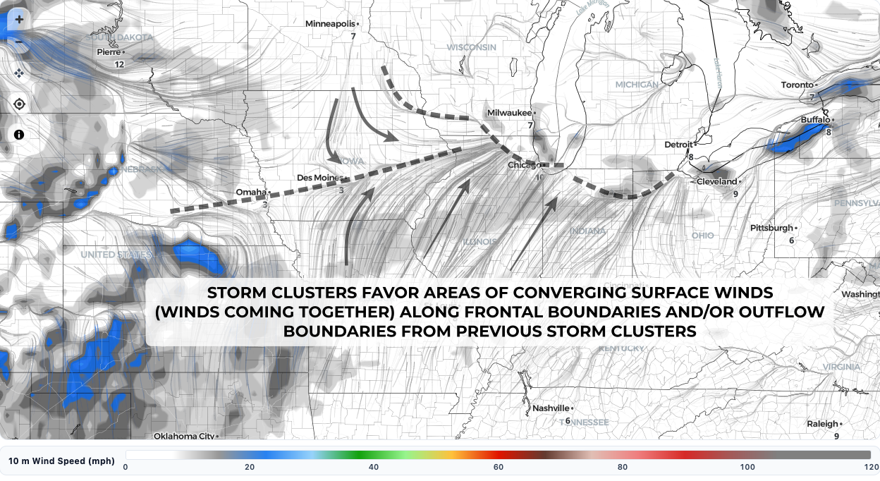
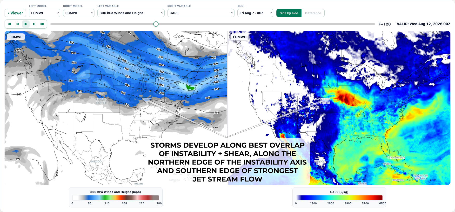
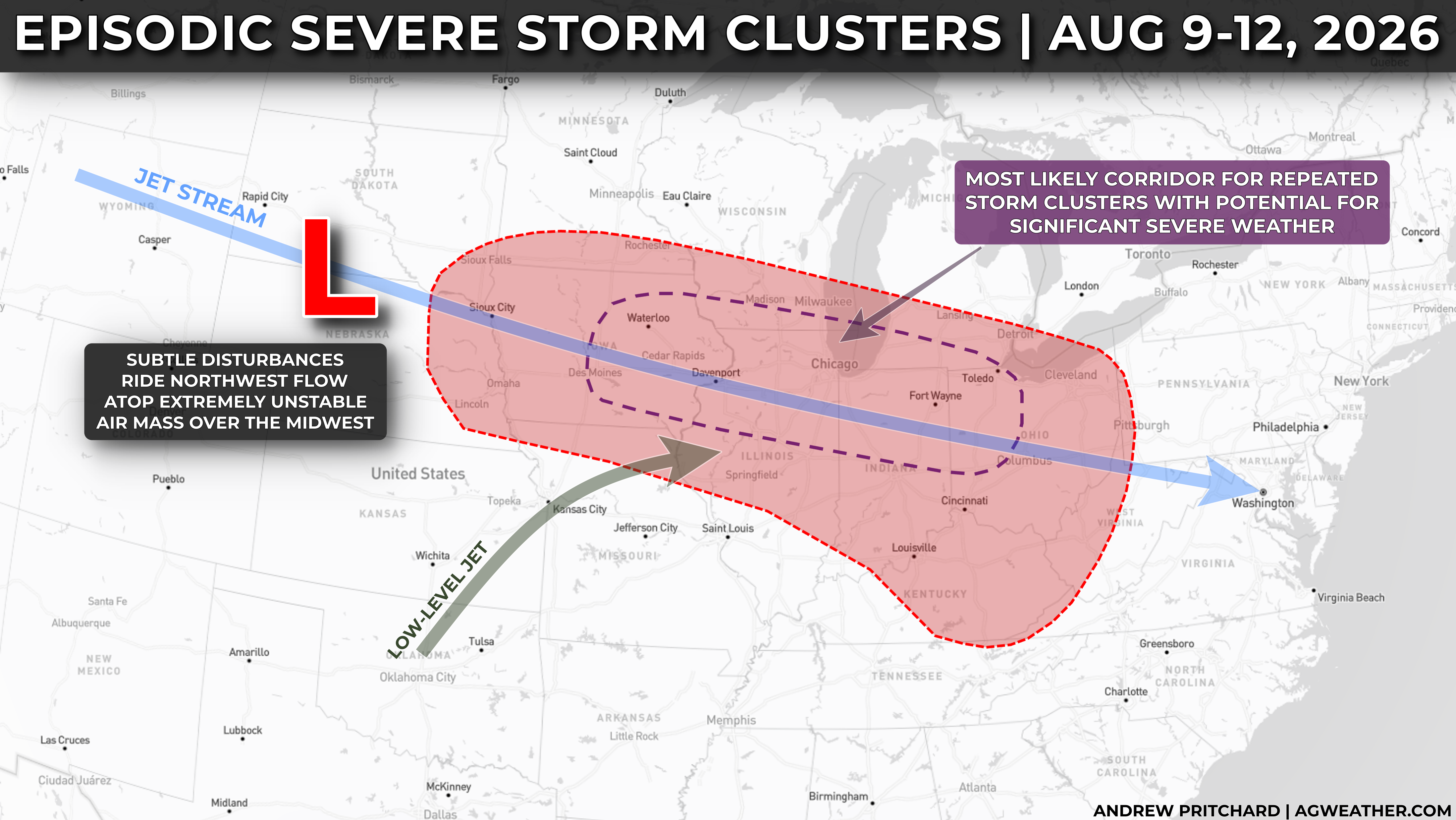
A rather classic pattern for episodic storm clusters, including some significant severe weather risk will establish itself across the Midwest, or portions of the Central and Eastern Cornbelt late this weekend into early next week.
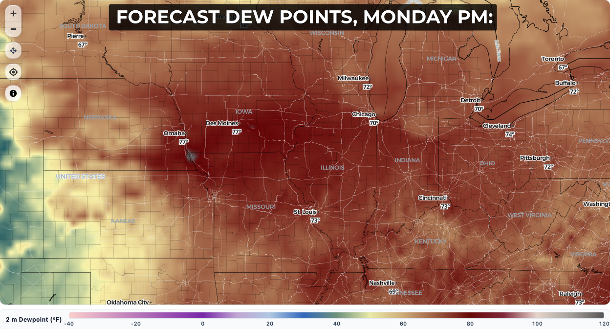
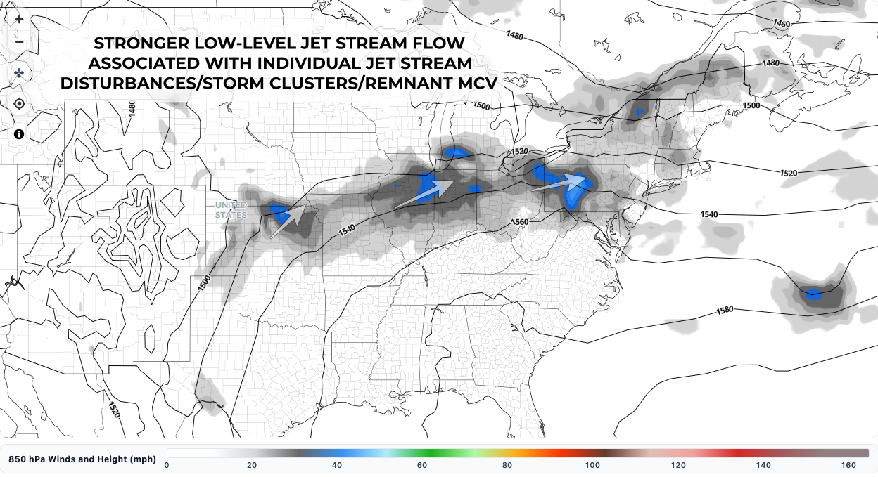
Seasonally high dew points in the middle to upper 70s will aid in creating a very unstable air mass ripe with thunderstorm fuel beneath a favorable alignment of northwest flow and subtle jet stream disturbances riding through this volatile zone.
Day to day variability from forecast guidance will remain high over the next few days with respect to exactly when and where severe weather impacts may focus themselves, but confidence has become fairly high in a 3-4 day period of favorable conditions for organized storm clusters from Sunday - Wednesday, August 9-12 (though isolated severe weather impacts are even possible in the near-term on August 7 and 8 across parts of the Plains and Midwest).
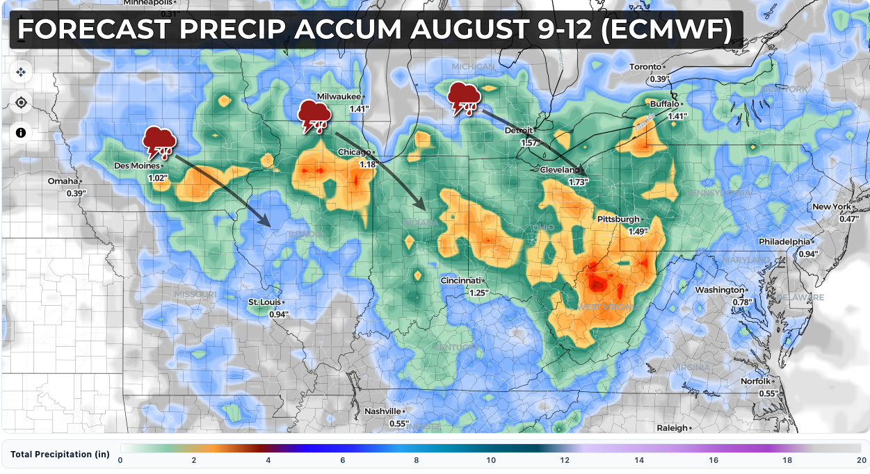
A corridor from central and eastern Iowa into northern and central Illinois and Indiana, northwest Ohio, and southern portions of Wisconsin and Michigan are especially likely to see repeated risks of significant severe weather during this period, including the potential for straight-line wind gusts over 70 mph, locally heavy rainfall, and isolated tornadoes or instances of hail over 1".
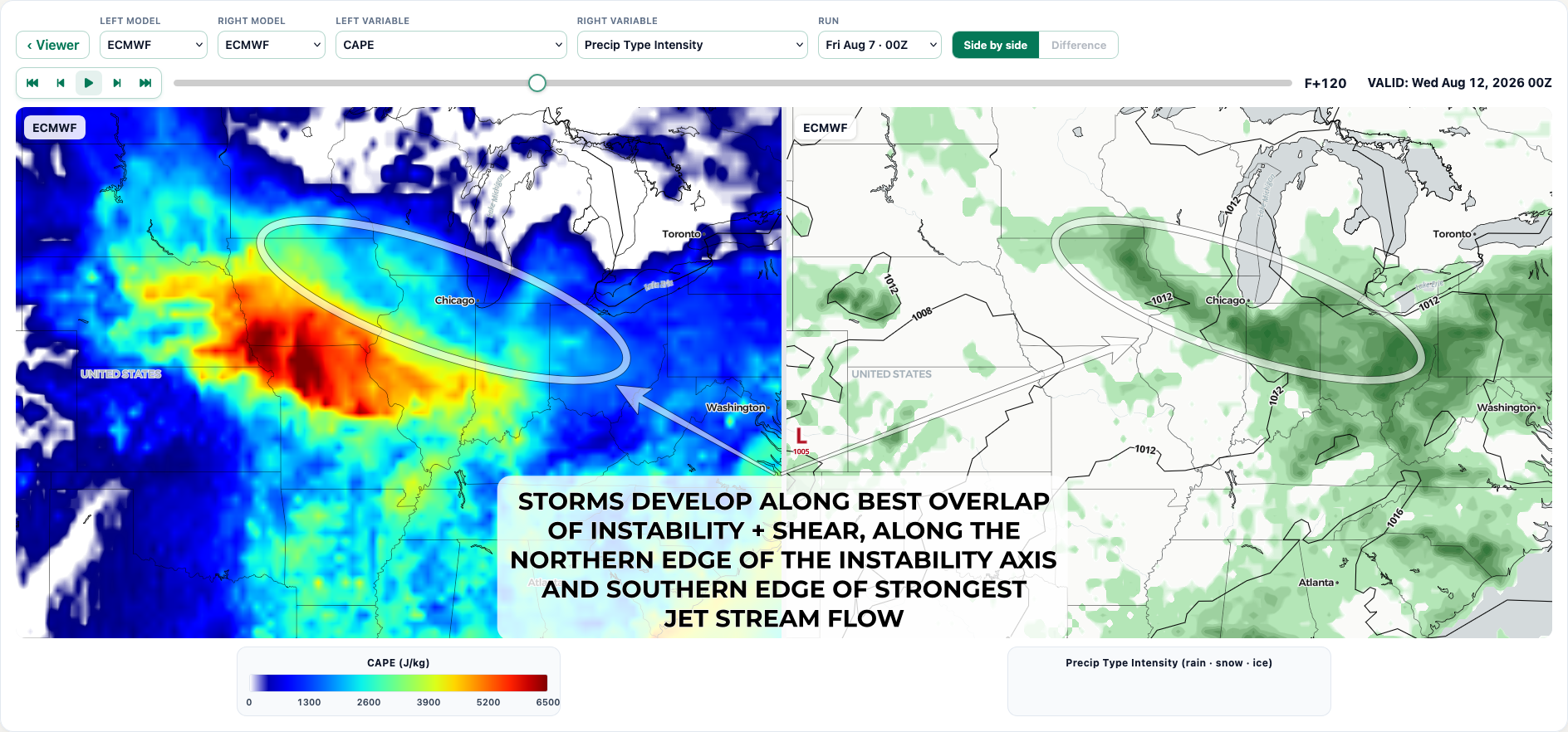
Precipitation forecasts will likely have dramatic swings run-to-run, but recent guidance is honing in on repeated storm clusters/heavy rainfall potential across the Midwest:
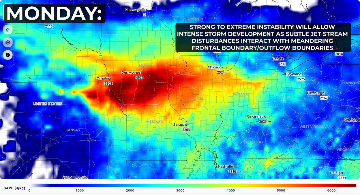
Current ECMWF forecast for instability (thunderstorm fuel!) on Monday afternoon, forecasts appear similar throughout the Sun-Wed time frame):
Seasonally high dew points are expected in the low to middle 70s, perhaps approaching 80 degrees at times across the central and eastern Cornbelt: