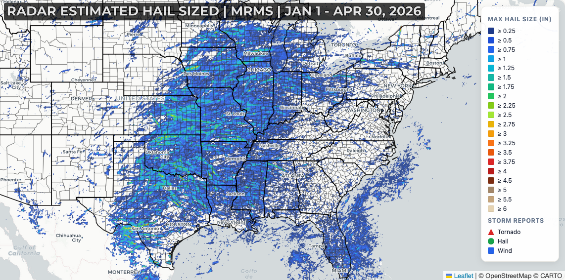
Large hail has been a significant issue in 2026, and it’s not all that surprising given the pattern that set up heading into early spring. Severe drought across the Southern Plains and Southwest, combined with persistent ridging in the western U.S. during late winter and early spring, led to record heat, and dry conditions across that region.
As a period of strong southwesterly jet stream flow and an active storm track developed from Texas to the Great Lakes, these low-pressure systems began pulling that hot, dry air from the Desert Southwest into the Midwest.
This layer of hot, dry air, known as an elevated mixed layer (EML), advected in just above a moist, unstable surface layer. The EML acts as a cap, keeping a lid on thunderstorm development until the atmosphere becomes most volatile during the late afternoon and evening hours.
When storms do develop, they erupt in isolated fashion, tapping into the steep lapse rates provided by the hot, dry, desert air within the EML. Combined with seasonally strong springtime wind shear, these storms can quickly become intense supercells capable of producing significant, damaging hail.
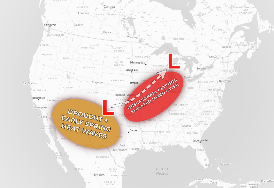
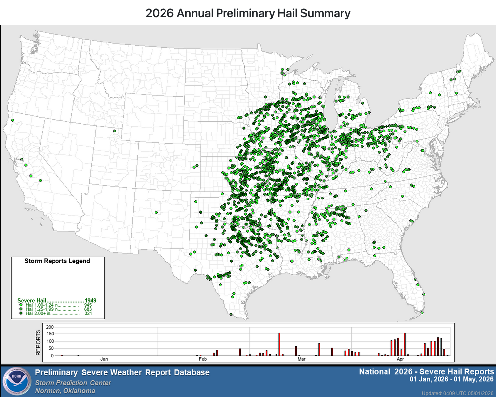
The EML is a common factor in High Plains severe weather setups, geographically closer to the source region of hot, dry desert air. With drought and heat expanding east into the Southern Plains, and a favorable storm track in February-April anomalously favorable conditions for significant hail have repeatedly developed across the Midwest. The CONUS severe hail report count is above average through the end of April 2026, but the more notable impact has been the sheer volume of significant hail events in the Midwest and instances of significant hail impacting Midwestern metropolitan areas

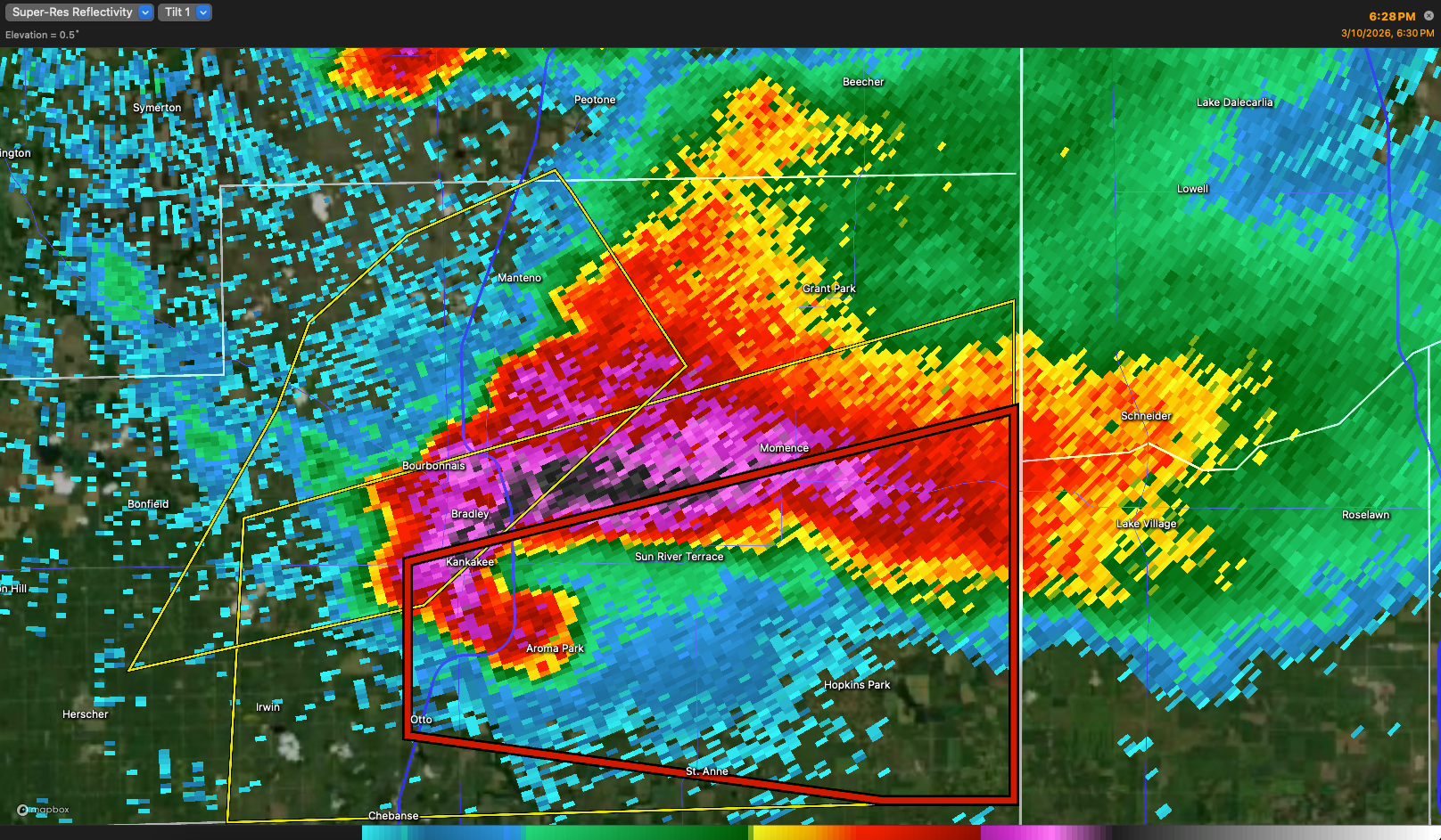
On March 10, an isolated supercell produced several tornadoes along with a long swath of baseball-sized and larger hail from Pontiac to Kankakee in northeast Illinois. At the same time it was producing an EF-3 tornado in Kankakee, the storm dropped a state-record 6.6” hailstone in the city. Widespread damage was reported across Kankakee and surrounding communities through the evening.

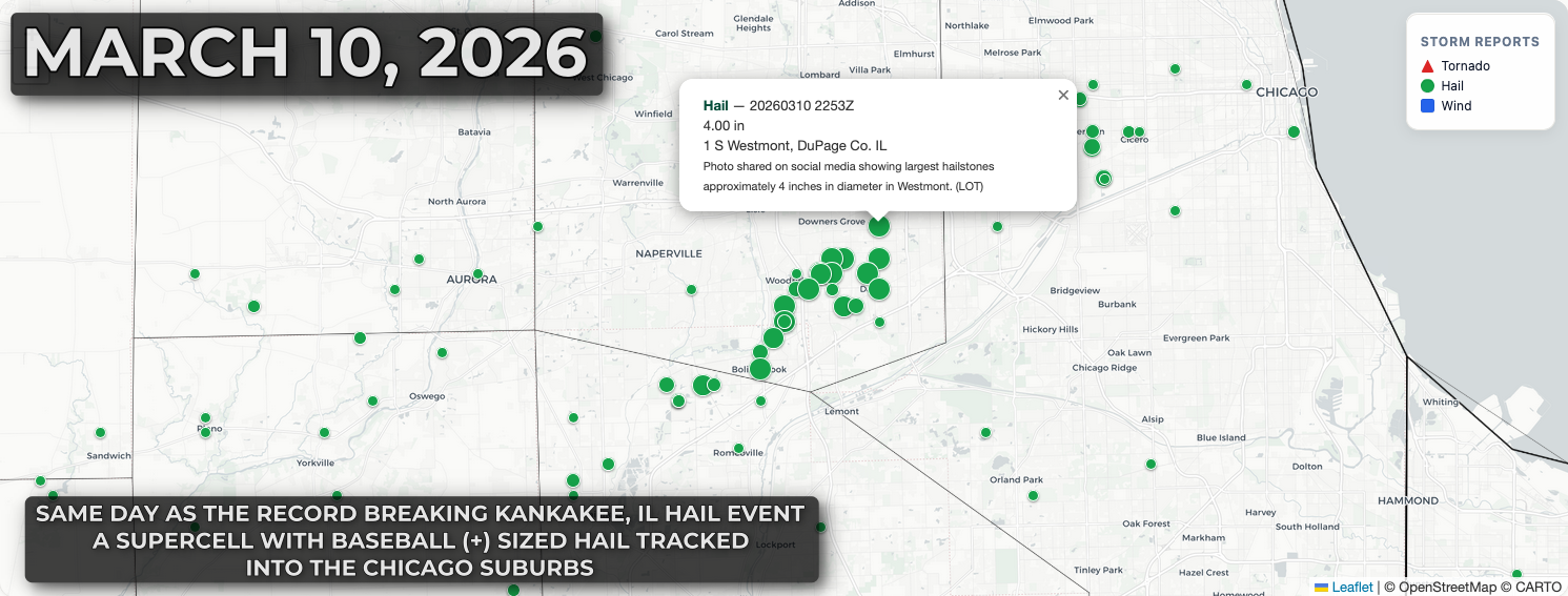
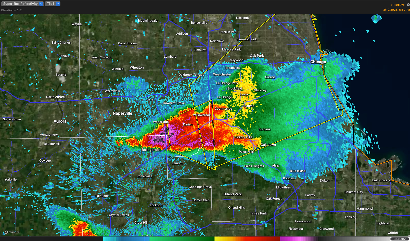
That same evening, another supercell north of the warm front produced baseball-sized hail in the Chicago suburbs.
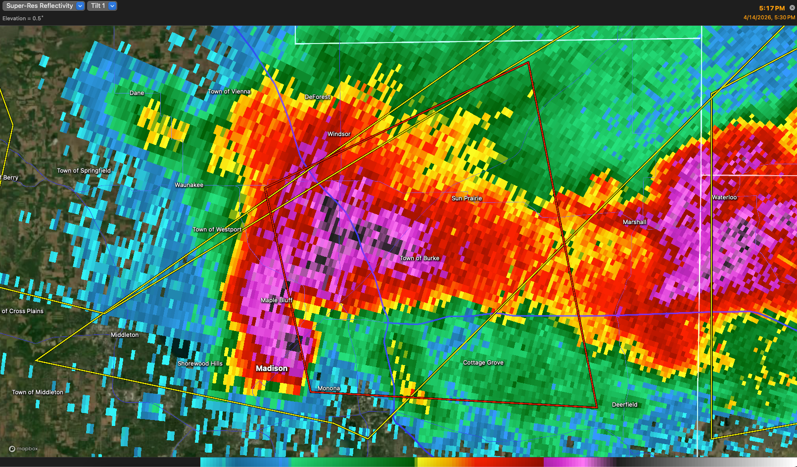
On April 14, widespread severe thunderstorms erupted from the Plains into the Midwest. During the evening rush hour, a tornado-warned supercell dropped baseball-sized hail across the Madison, Wisconsin metro area.


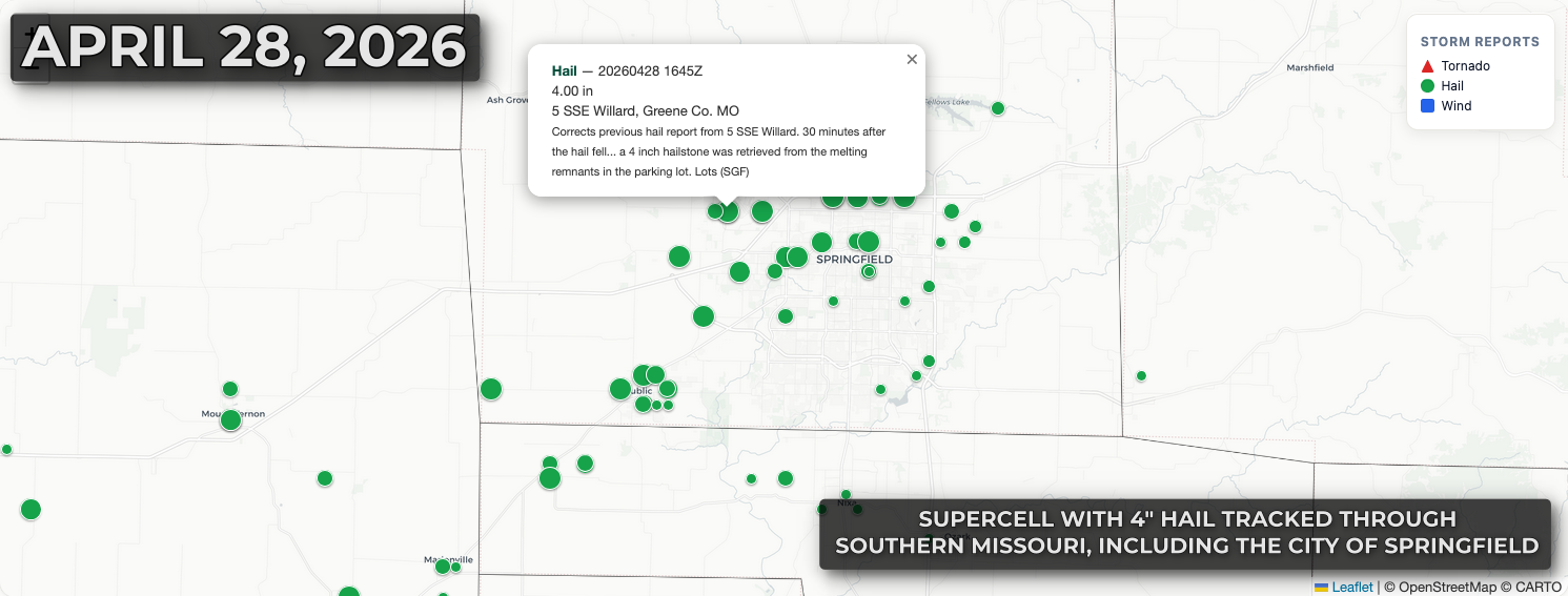
On April 28, two separate destructive hail events occurred from the Ozarks into north Texas. Baseball-sized and larger hail fell across southern Missouri, including the city of Springfield, while the Dallas–Fort Worth Metroplex narrowly avoided a major hail event as damaging hail fell from a cluster of supercells just to the west.

These are just a handful of the more recent significant hail events across the Plains and Midwest this year. You can explore severe hail reports and radar-estimated hail data using the new MRMS Pro tool.