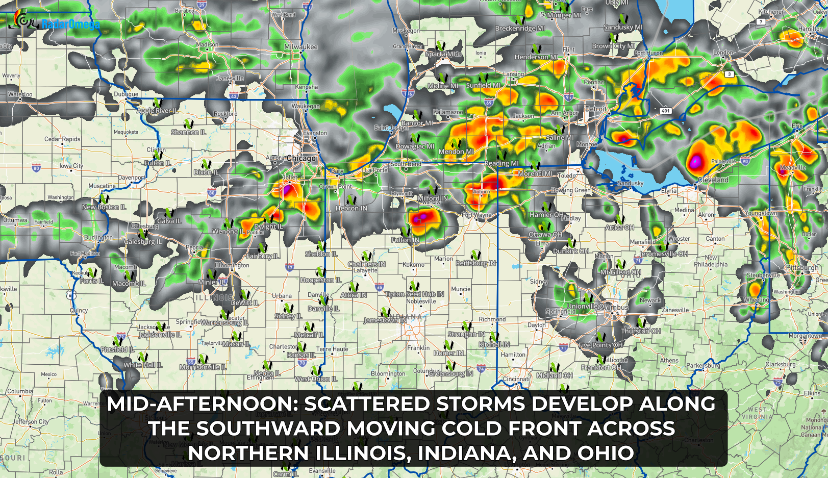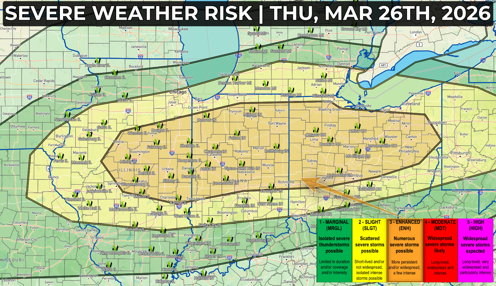
A familiar risk here in the early spring of 2026 as we discuss the potential for large, damaging hail over 2" in diameter across portions of Illinois, Indiana, and Ohio.
Much of today will be warm, windy, and fairly quiet across the region, but that will change quickly by mid to late afternoon as a cold front drops south into the Midwest.
Thunderstorms are expected to develop between 3 PM and 6 PM, initially across central and northern Illinois, then spreading east into Indiana, southern Michigan, and Ohio through the evening. Conditions ahead of the front will feature warm temperatures, increasing instability, and strong winds aloft which will increasingly favor severe thunderstorm development.
Early in the event, a few storms may become supercells capable of producing very large hail over 2 inches in diameter. As the front continues to push southeast, storms are expected to grow into clusters or lines, increasing the threat for widespread damaging winds, with some gusts potentially exceeding 65–75 mph. These winds could lead to downed trees, damage to structures, and scattered power outages.
A few tornadoes are also possible, especially with any storms that can remain more isolated ahead of the main line. While the tornado threat is not the primary concern, it is something to stay aware of through the evening hours.
Storms will be most widespread and impactful between 6 PM and 9 PM, before gradually weakening after 9 PM to midnight as they move farther south east. However, periods of heavy rain and non-severe thunderstorms may linger overnight, and localized flooding could occur where storms repeatedly track over the same areas.